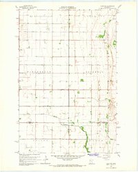
1965 Map of Ulen NW
USGS Topo · Published 1967About this map
Borup sits as the primary settlement in this section of Norman County, where the flat agricultural landscape is meticulously managed by an extensive drainage system. Historically significant features such as County Ditch No 12 and County Ditch No 35 crisscross the townships of Mc Donaldsville, Winchester, and Rockwell, reflecting the mid-century engineering required to sustain Red River Valley farming.
Find a feature on this map
19 named features on this map. Tap any name to fly to it.
Don’t see what you’re looking for? This feature index may not catch every label — zoom into the map to look around manually.
Map Details
Editions of this 1965 Ulen NW Map
This is the sole edition of this map. No revisions or reprints were ever made.
Other maps of this area

1918 · Twin Valley
USGS Topo · 1:62,500

1918 · Ulen
USGS Topo · 1:62,500

1924 · Ada
USGS Topo · 1:62,500

1952 · Grand Forks
USGS Topo · 1:250,000

1956 · Grand Forks
USGS Topo · 1:250,000

1965 · Twin Valley SW
USGS Topo · 1:24,000

1965 · Twin Valley
USGS Topo · 1:24,000

1965 · Syre
USGS Topo · 1:24,000
1965 · Ada
USGS Topo · 1:24,000

1966 · Grand Forks
USGS Topo · 1:250,000