Old Maps of Grand Marais, Minnesota
Explore 18 old maps of Grand Marais, spanning from 1919 to today. These high-resolution historic maps reveal how streets, neighborhoods, landmarks, and natural features evolved over time — perfect for genealogy, metal detecting, research, and local history exploration.
What you can do with these maps:
- See how Grand Marais changed over time: Compare historical maps to modern-day views to trace roads, homesites, rail lines & more.
- View detailed metadata: Each map includes creators, publishers, year, scale, and archive source.
- Overlay maps with satellite & LiDAR: Visualize the past alongside modern tools to explore terrain & human change.
- Trusted historical sources: Maps sourced from the USGS, Library of Congress, and other archives.
- Access maps your way: View online, download high-res files, or order prints for personal or research use.
Start exploring old maps of Grand Marais to uncover forgotten places, hidden landmarks, and the deep history beneath your feet.
Grand Marais, MN maps
(18)- 1919 Map of Grand Marais, 1943 Print
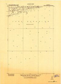 1919 Grand Marais1943 Print · USGSThe North Shore of Lake Superior comes into focus in this early military survey of the Minnesota coast. Genealogists and maritime historians can trace the early layout of Grand Marais and locate coastal features like Good Harbor Bay and Terrace Pt.
 - 1954 Map of Two Harbors, 1964 Print
 1954 Two Harbors1964 Print · USGSThe Minnesota North Shore and Superior National Forest are shown here in the mid-fifties, just as the taconite industry was reshaping the coast. Genealogists and historians can trace the rail lines of the Duluth Missabe and Iron Range or locate remote outposts like Sawbill Landing and Section Thirty.2 unique versions available
 - 1957 Map of Two Harbors
 1957 Two Harbors1957 Print · USGSMinnesota's North Shore and the Arrowhead region are shown here in the mid-fifties as the taconite industry and cold war defense shaped the landscape. Researchers can trace the Duluth Missabe and Iron Range railroad, locate the Split Rock Light, and explore the iron-mining era at Taconite.
 - 1958 Map of Two Harbors
 1958 Two Harbors1958 Print · USGSThe North Shore and Arrowhead region of Minnesota are captured in the 1950s as iron ore shipping and wilderness preservation shaped the land. Researchers can trace the Duluth Missabe and Iron Range RR, find maritime landmarks like Split Rock Light, and locate remote settlements from Babbitt to Grand Marais.
 - 1958 Map of Good Harbor Bay, 1959 Print
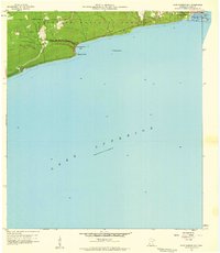 1958 Good Harbor Bay1959 Print · USGSThe North Shore harbor of Grand Marais and the rugged shoreline of Lake Superior are captured here during the late fifties. Genealogists and local historians can locate the Poplar Grove Cem and the Town Hall, or trace the coastline around Terrace Point.4 unique versions available
 - 1960 Map of Grand Marais, 1961 Print
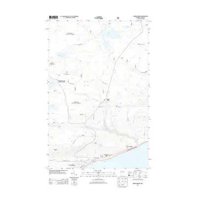
 1960 Grand Marais1961 Print · USGSGrand Marais and the Cook County shoreline are captured here in the early sixties as the harbor town anchored the gateway to the North Woods. Genealogists and local historians can trace the foundations of Chippewa City, the Maple Hill School, and the start of the historic Gunflint Trail.3 unique versions available
 - 1964 Map of Two Harbors
 1964 Two Harbors1964 Print · USGSThe North Shore of Lake Superior is captured here during the mid-1950s, a time of significant industrial mining growth and emerging tourism. Genealogists and historians can trace the rail lines of the Duluth Missabe and Iron Range and locate landmarks like Split Rock Light and the U S Air Force Radar Station.
 - 1977 Map of Grand Marais, 1994 Print
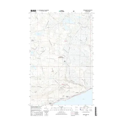
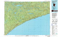 1977 Grand Marais1994 Print · USGSThe North Shore of Lake Superior comes into focus in the mid-1970s, showing a landscape defined by timber, tourism, and lakefront life. Researchers can trace local landmarks like the Grand Marais Lighthouse, the Cathedral of the Pines, and the coastal docks at Taconite Harbor.
 - 2011 Map of Good Harbor Bay OE E, 2011 Print
 2011 Good Harbor Bay OE E2011 Print · USGSCovers Grand Marais, including West Cook, Cook County, and other nearby areas
 - 2011 Map of Grand Marais, 2011 Print
 2011 Grand Marais2011 Print · USGSCovers Grand Marais, including East Cook, Chippewa City, and other nearby areas
 - 2013 Map of Good Harbor Bay OE E, 2013 Print
 2013 Good Harbor Bay OE E2013 Print · USGSCovers Grand Marais, including West Cook, Cook County, and other nearby areas
 - 2013 Map of Grand Marais, 2013 Print
 2013 Grand Marais2013 Print · USGSCovers Grand Marais, including East Cook, Chippewa City, and other nearby areas
 - 2016 Map of Good Harbor Bay OE E, 2016 Print
 2016 Good Harbor Bay OE E2016 Print · USGSCovers Grand Marais, including West Cook, Cook County, and other nearby areas
 - 2016 Map of Grand Marais, 2016 Print
 2016 Grand Marais2016 Print · USGSCovers Grand Marais, including East Cook, Chippewa City, and other nearby areas
 - 2019 Map of Grand Marais, 2019 Print
 2019 Grand Marais2019 Print · USGSCovers Grand Marais, including East Cook, Chippewa City, and other nearby areas
 - 2019 Map of Good Harbor Bay OE E, 2019 Print
 2019 Good Harbor Bay OE E2019 Print · USGSCovers Grand Marais, including West Cook, Cook County, and other nearby areas
 - 2022 Map of Good Harbor Bay OE E, 2022 Print
 2022 Good Harbor Bay OE E2022 Print · USGSThe North Shore coastline near the Canadian border is captured here in the early 2020s, showing the intersection of forest and lake. Researchers can locate Poplar Grove Cem and trace the shoreline developments of Grand Marais and Poplar Grove.
 - 2022 Map of Grand Marais, 2022 Print
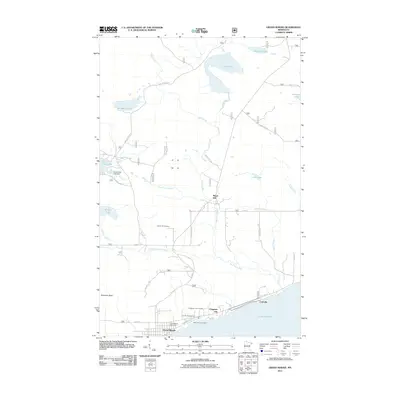
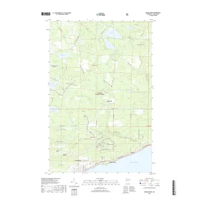
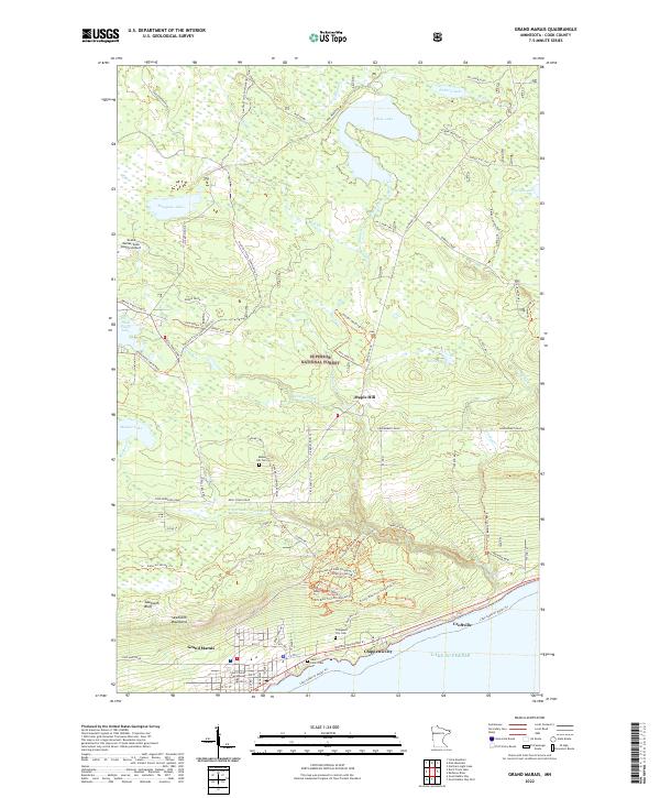 2022 Grand Marais2022 Print · USGSThe Lake Superior shoreline at the north woods edge comes into focus in this recent survey of the Cook County coast. Genealogists and hikers can trace sites like Chippewa City Cem, the historic Gunflint Trail, and the harbor at Grand Marais.
End of results
Showing maps 1-18 of 18
Frequently asked questions
- What are the different types of historical maps available for Grand Marais?
- What is the oldest map of Grand Marais?
- Where can I purchase historical maps of Grand Marais for my home or office?
- Where can I download high-res historical maps of Grand Marais?
- Are there historical topographic maps available for Grand Marais?
- Is there historical aerial imagery available for Grand Marais?
- Where are historical maps of Grand Marais sourced from?