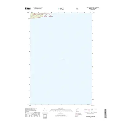
2019 Map of Good Harbor Bay OE E
USGS Topo · Published 2019About this map
The coastal shoreline of Lake Superior dominates this portion of Cook County, revealing the interface between the lake's expanse and the northern forest. The harbor area is defined by East Bay and the edge of the settlement at Grand Marais. This map primarily focuses on the open water and the narrow strip of land within the Superior National Forest. For those tracing local heritage, the inclusion of Poplar Grove Cem provides a specific point of genealogical interest tucked just inland from the coast. The topography transitions quickly from the lake level into the higher elevations of the national forest, marked by the township and range boundary t61n r1e. This document reflects the contemporary state of the North Shore's geographic and administrative landscape.
Find a feature on this map
6 named features on this map. Tap any name to fly to it.
Don’t see what you’re looking for? This feature index may not catch every label — zoom into the map to look around manually.
Map Details
Editions of this 2019 Good Harbor Bay OE E Map
This is the sole edition of this map. No revisions or reprints were ever made.
Other maps of this area

1919 · Grand Marais
USGS Topo · 1:62,500

1954 · Two Harbors
USGS Topo · 1:250,000

1957 · Two Harbors
USGS Topo · 1:250,000

1958 · Two Harbors
USGS Topo · 1:250,000

1958 · Good Harbor Bay
USGS Topo · 1:24,000

1960 · Grand Marais
USGS Topo · 1:24,000
1960 · Kadunce Creek
USGS Topo · 1:24,000
1960 · Devil Track Lake
USGS Topo · 1:24,000

1964 · Two Harbors
USGS Topo · 1:250,000
1977 · Grand Marais
USGS Topo · 1:100,000