
1960 Map of Grand Marais
USGS Topo · Published 1961About this map
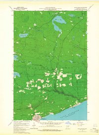
Grand Marais and the North Shore of Lake Superior are depicted here in the early 1960s, showing a transition from the lakeside settlements to the dense interior of the Superior National Forest. The local infrastructure is clearly marked, including the Grand Marais-Devil Track Airport and the iconic Gunflint Trail heading north into the wilderness. Along the shore, smaller communities like Chippewa City and Croftville are visible, while the upland area around Maple Hill features the Maple Hill Sch and a local Cemetery. The landscape is defined by the dramatic Sawteeth Bluff and a complex network of waterways, including the Devil Track River, Binagami Lake, and Elbow Lake. A TV Relay Tower and Radio Tower indicate the era's expanding communications, while scattered Gravel Pits point to the ongoing development and maintenance of this timber and harbor region.
Find a feature on this map
31 named features on this map. Tap any name to fly to it.
Don’t see what you’re looking for? This feature index may not catch every label — zoom into the map to look around manually.
Map Details
Editions of this 1960 Grand Marais Map
3 editions found
Other maps of this area

1919 · Grand Marais
USGS Topo · 1:62,500

1954 · Two Harbors
USGS Topo · 1:250,000

1957 · Two Harbors
USGS Topo · 1:250,000

1958 · Two Harbors
USGS Topo · 1:250,000

1958 · Good Harbor Bay
USGS Topo · 1:24,000

1959 · Northern Light Lake
USGS Topo · 1:24,000

1959 · Pine Mountain
USGS Topo · 1:24,000

1959 · Lima Mountain
USGS Topo · 1:24,000
1960 · Kadunce Creek
USGS Topo · 1:24,000
1960 · Devil Track Lake
USGS Topo · 1:24,000