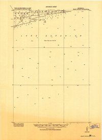
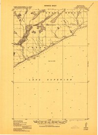
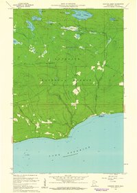
1919 Map of Grand Marais
USGS Topo · Published 1943About this map
Grand Marais and its northern shoreline are the focus of this military advance sheet, compiled at a time when the Lake Superior coast was being systematically charted for defense and navigation. The map highlights the rugged maritime character of Cook County, featuring prominent coastal landmarks like Terrace Pt. and the sheltered waters of Good Harbor Bay. A rare level of bathymetric detail is provided, including depth soundings and notations of the lake floor composition, such as sand and clay, which were vital for mariners approaching the harbor near Rock Island. Interior labels such as Rosebush delineate the early administrative and survey divisions of the North Shore wilderness as it appeared during the era of the First World War.
Find a feature on this map
9 named features on this map. Tap any name to fly to it.
Don’t see what you’re looking for? This feature index may not catch every label — zoom into the map to look around manually.
Map Details
Editions of this 1919 Grand Marais Map
This is the sole edition of this map. No revisions or reprints were ever made.
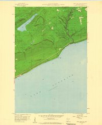
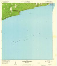
Other maps of this area

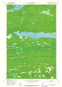
1919 · Brule Lake
USGS Topo · 1:62,500
1919 · Lutsen
USGS Topo · 1:62,500

1954 · Two Harbors
USGS Topo · 1:250,000

1957 · Two Harbors
USGS Topo · 1:250,000

1958 · Two Harbors
USGS Topo · 1:250,000
1958 · Deer Yard Lake
USGS Topo · 1:24,000
1958 · Good Harbor Bay
USGS Topo · 1:24,000

1960 · Grand Marais
USGS Topo · 1:24,000
1960 · Kadunce Creek
USGS Topo · 1:24,000
1960 · Devil Track Lake
USGS Topo · 1:24,000