
1964 Map of Two Harbors
USGS Topo · Published 1964About this map
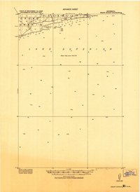
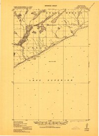
Lake Superior dominates the southeastern quadrant of this mid-century landscape, framing the industrial and recreational corridor of the North Shore. The iron ore economy is evident through the path of the Duluth Missabe and Iron Range and Reserve Mining Co railroads, which connected the inland mines of Babbitt and Ely to shipping hubs at Two Harbors and Silver Bay. The interior is defined by the dense wilderness of the Superior National Forest, characterized by an intricate network of waterways including White Iron Lake, Birch Lake, and the Kawishiwi River. High elevations are marked by the Misquah Hills and Eagle Mountain. Along the rocky coastline, navigation is guided by the Split Rock Light and Two Harbors Light, while the U S Air Force Radar Station near Finland signifies the era's Cold War defensive infrastructure.
Find a feature on this map
98 named features on this map. Tap any name to fly to it.
Don’t see what you’re looking for? This feature index may not catch every label — zoom into the map to look around manually.
Map Details
Editions of this 1964 Two Harbors Map
This is the sole edition of this map. No revisions or reprints were ever made.
Other maps of this area

1895 · Duluth
USGS Topo · 1:62,500

1919 · Brule Lake
USGS Topo · 1:62,500
1919 · Grand Marais
USGS Topo · 1:62,500
1919 · Lutsen
USGS Topo · 1:62,500

1933 · Ely
USGS Topo · 1:62,500

1939 · Ely
USGS Topo · 1:62,500

1941 · Bayfield
USGS Topo · 1:48,000

1943 · Port Wing
USGS Topo · 1:48,000

1944 · Cornucopia
USGS Topo · 1:48,000

1946 · Cornucopia
USGS Topo · 1:48,000