2020s Maps of Windom, Minnesota
Explore 4 historic maps of Windom from the 2020s. These maps offer a rare glimpse into what life looked like during the 2020s — showing old roads, neighborhoods, homes, and landmarks that have changed or disappeared over time.
Whether you're researching your family's past, planning a metal detecting trip, or studying how Windom's landscape evolved across the 2020s, these high-resolution maps are a powerful tool for exploring the history of this region.
- Focus on a specific era: All maps on this page are from the 2020s, giving you a focused view of this time period.
- See what’s changed: Compare century-old streets, trails, and buildings to today's modern landscape using overlays and satellite layers.
- Research with precision: Use these maps for genealogy, historical research, land use analysis, or educational projects.
- View, download, or print: Maps are fully viewable online in high resolution, and can be downloaded or printed for your own records.
Start exploring Windom's history through authentic maps from the 2020s. This is your window into the past.
Windom, MN maps
(4)- 2022 Map of Windom, 2022 Print
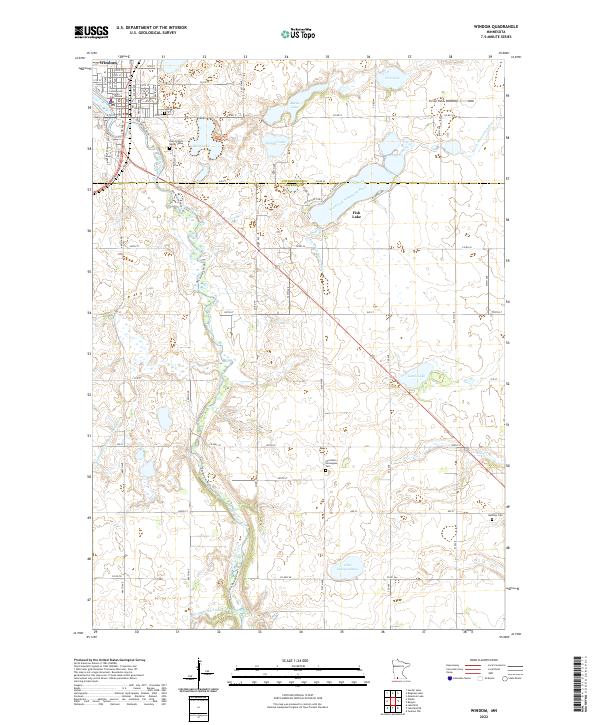 2022 Windom2022 Print · USGSWindom and the surrounding prairie are captured here in the early twenty-first century as the Des Moines River cuts through the Minnesota landscape. Genealogists and local historians can trace family roots at Lakeview Cem or Saint Francis Xavier Cem and locate landmarks like the Cottonwood County Courthouse.
 - 2022 Map of Harder Lake, 2022 Print
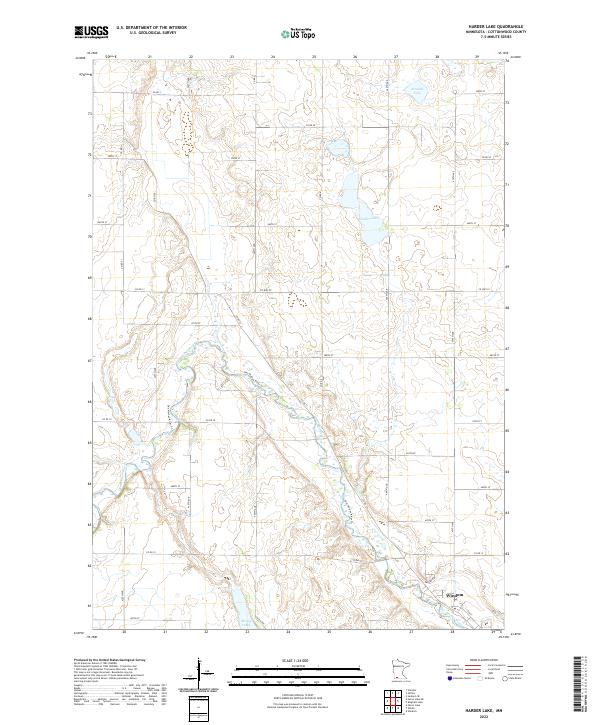 2022 Harder Lake2022 Print · USGSCottonwood County's agricultural heartland is documented here in the early twenty-first century, centered on the river valleys north of Windom. Researchers can trace the path of the Des Moines River and locate family lands near Harder Lake or along Kalash Rd.
 - 2022 Map of Bingham Lake, 2022 Print
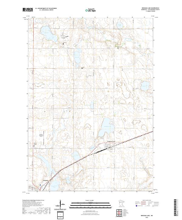 2022 Bingham Lake2022 Print · USGSBingham Lake and the surrounding Cottonwood County townships are shown here in the early twenty-first century as a landscape of prairie lakes and farms. Researchers can trace rural lineages at Delft Cem and Carson Cem or follow the waters of the Watonwan River.
 - 2022 Map of Wilder, 2022 Print
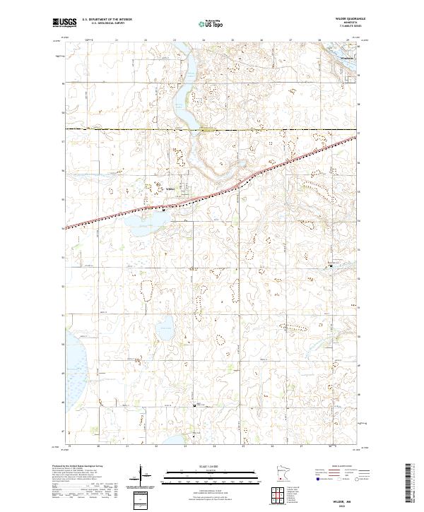 2022 Wilder2022 Print · USGSSouthwestern Minnesota's prairie and wetland landscape is captured here in the early twenty-first century as it spans the Cottonwood and Jackson county line. Genealogists and local historians can locate Wilder Cem, Delafield Cem, and the town of Wilder among the glacial waters of Teal Lake and String Lakes.
End of results
Showing maps 1-4 of 4
Top cities near Windom
- Jackson historical maps
- Mountain Lake historical maps
- Lakefield historical maps
- Heron Lake historical maps
- Jeffers historical maps
- Storden historical maps
See more
Frequently asked questions
- What are the different types of historical maps available for Windom?
- What is the oldest map of Windom?
- Where can I purchase historical maps of Windom for my home or office?
- Where can I download high-res historical maps of Windom?
- Are there historical topographic maps available for Windom?
- Is there historical aerial imagery available for Windom?
- Where are historical maps of Windom sourced from?