Old Maps of Armour Number Two Mine, Crosby for Academic Research
Study the evolution of Armour Number Two Mine with 11 high-resolution historic maps. Whether you're teaching, researching, or modeling changes in land use, these maps provide essential visual documentation of urban, environmental, and geographic change.
- Analyze long-term change: Track patterns in development, transportation, and natural features.
- Ideal for environmental or urban studies: Support academic projects with primary historical map data.
- Use in the classroom or lab: Educators and researchers rely on these maps to bring historical context to life.
These maps are a powerful tool for teaching, research, and visualizing how Armour Number Two Mine has changed over the decades.
Armour Number Two Mine, Crosby maps
(11)- 1912 Map of Deerwood, 1963 Print
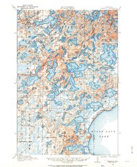 1912 Deerwood1963 Print · USGSIn the decade before the region's full industrialization, this survey captures the lake-country settlements of Deerwood and Crosby just as the Northern Pacific railroad was driving local growth. Genealogists can locate dozens of early district schools and local landmarks like Doris Church and Katrine School.2 unique versions available
 - 1914 Map of Deerwood
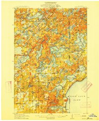 1914 Deerwood1914 Print · USGSCrow Wing and Aitkin counties are captured here just before the First World War, showing the growth of iron range towns and lakeside settlements. Genealogists and researchers can trace early rural life through nearly twenty numbered schoolhouses, the Dorris Church, and railroad stops at Crosby and Ironton.3 unique versions available
 - 1953 Map of Duluth, 1964 Print
 1953 Duluth1964 Print · USGSNortheastern Minnesota and northwestern Wisconsin are shown here during a period of industrial maturity and expanding conservation. Genealogists and historians can trace rail-connected towns like McGrath and Wahkon, or locate heritage sites within the Fond du Lac Indian Reservation.2 unique versions available
 - 1958 Map of Duluth
 1958 Duluth1958 Print · USGSNortheastern Minnesota and the Wisconsin borderlands are shown in detail during the late 1950s, centered on the bustling rail yards and ports of Duluth. You can trace the historic routes of the Soo Line and Duluth Missabe & Iron Range through small towns like McGrath, Bruno, and Wrenshall.
 - 1973 Map of Crosby, 1976 Print
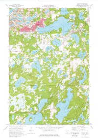 1973 Crosby1976 Print · USGSThe Cuyuna Iron Range comes into sharp focus during the 1970s, showing a landscape defined by industrial iron pits and expansive lakes. Genealogists and historians can trace the mining footprint at the Portsmouth Mine or locate family sites near Irondale Cem and Deerwood Cem.
 - 1985 Map of Mille Lacs Lake
 1985 Mille Lacs Lake1985 Print · USGSMille Lacs Lake and its surrounding settlements are shown in the mid-1980s as a hub of lake-shore recreation and rail commerce. Researchers can trace historic transport lines like the Soo Line and locate communities such as Wahkon and Garrison.2 unique versions available
 - 2010 Map of Crosby, 2010 Print
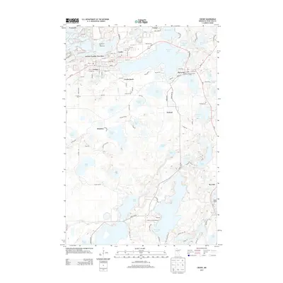
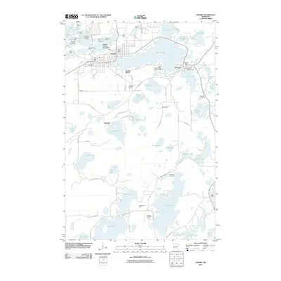 2010 Crosby2010 Print · USGSCovers Armour Number Two Mine, including Crosby, Deerwood, and other nearby areas
 - 2013 Map of Crosby, 2013 Print
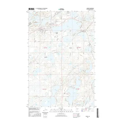
 2013 Crosby2013 Print · USGSCovers Armour Number Two Mine, including Crosby, Deerwood, and other nearby areas
 - 2016 Map of Crosby, 2016 Print
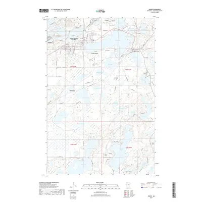
 2016 Crosby2016 Print · USGSCovers Armour Number Two Mine, including Crosby, Deerwood, and other nearby areas
 - 2019 Map of Crosby, 2019 Print
 2019 Crosby2019 Print · USGSCovers Armour Number Two Mine, including Crosby, Deerwood, and other nearby areas
 - 2022 Map of Crosby, 2022 Print
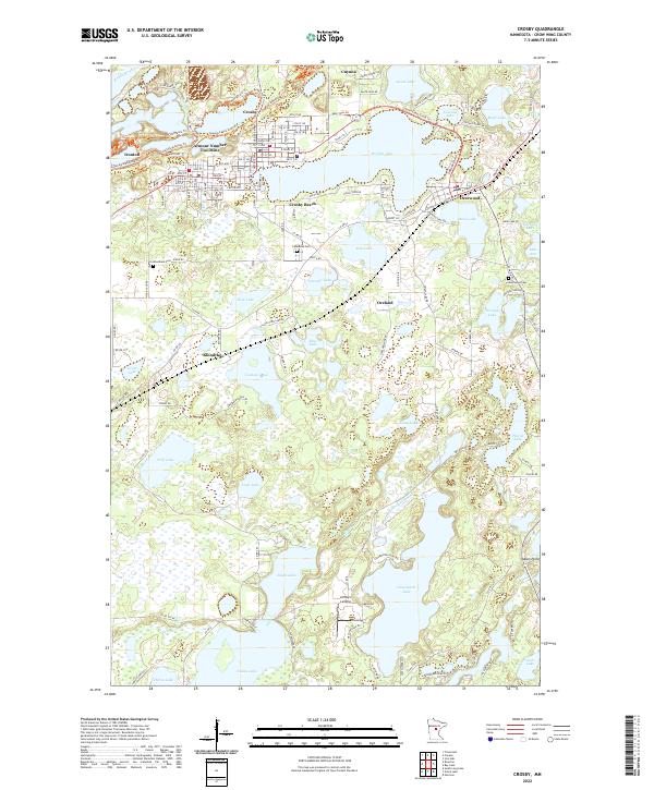 2022 Crosby2022 Print · USGSThe Cuyuna Range lake country is documented here in the early 2020s, showing the intersection of industrial history and modern recreation. Trace the mining heritage of the Armour Number Two Mine and find local landmarks like Lindey's Landing or Lakewood Cem.
End of results
Showing maps 1-11 of 11
Top cities near Armour Number Two Mine
- Brainerd historical maps
- Crosby historical maps
- Breezy Point historical maps
- Bay Lake historical maps
- Mission historical maps
- Deerwood historical maps
See more
Frequently asked questions
- What are the different types of historical maps available for Armour Number Two Mine?
- What is the oldest map of Armour Number Two Mine?
- Where can I purchase historical maps of Armour Number Two Mine for my home or office?
- Where can I download high-res historical maps of Armour Number Two Mine?
- Are there historical topographic maps available for Armour Number Two Mine?
- Is there historical aerial imagery available for Armour Number Two Mine?
- Where are historical maps of Armour Number Two Mine sourced from?