Old Maps of Kensington, Minnesota for Genealogy
Trace your family roots with 10 historic maps of Kensington. These high-res maps reveal old neighborhoods, homesites, landmarks, and streets — helping you uncover where your ancestors lived and how the area evolved over time.
- Explore historic neighborhoods: Identify where your relatives may have lived in the 1800s or 1900s.
- Compare maps over time: Trace the changes in streets, buildings, and landmarks for multi-generational research.
- Perfect for genealogy & ancestry research: Used by family historians and researchers to map out lineage and migration.
These maps are an incredible resource for exploring your personal connection to Kensington's past.
Kensington, MN maps
(10)- 1953 Map of Saint Cloud, 1968 Print
 1953 Saint Cloud1968 Print · USGSCentral Minnesota's lake country and the Mississippi River valley are caught in a period of steady mid-century growth. Researchers can trace historic rail lines, old granite works, and local landmarks like St. Johns University, Camp Ripley, and the shores of Lake Minnewaska.3 unique versions available
 - 1957 Map of Saint Cloud
 1957 Saint Cloud1957 Print · USGSCentral Minnesota's lake country and rail corridors are meticulously detailed in the mid-1950s. Genealogists and researchers can trace the growth of towns like Alexandria, Willmar, and Saint Cloud along the Great Northern railroad line.
 - 1958 Map of Saint Cloud
 1958 Saint Cloud1958 Print · USGSCentral Minnesota in the mid-1950s shows a landscape of growing regional hubs and hundreds of glacial lakes connected by an extensive rail network. Genealogists and historians can trace the early footprints of Saint Cloud, Alexandria, and Willmar along the Great Northern Railway.
 - 1966 Map of Kensington, 1967 Print
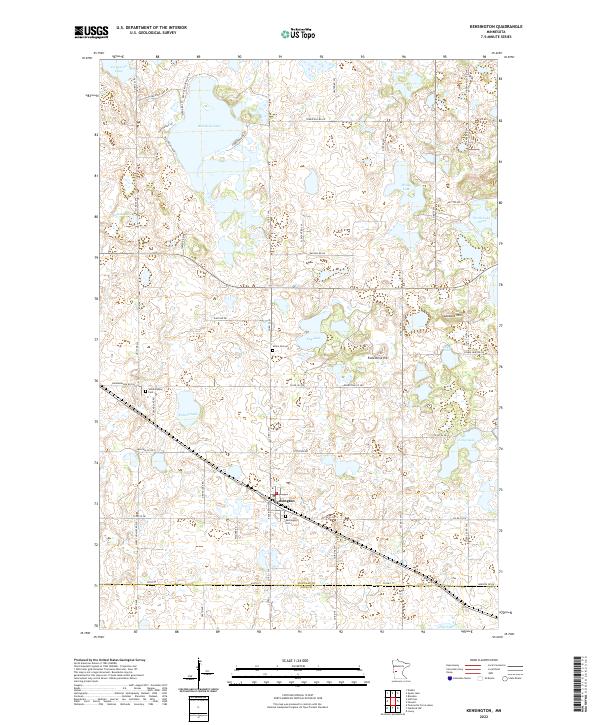
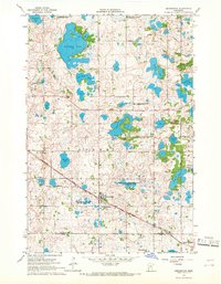 1966 Kensington1967 Print · USGSThe Douglas County prairie is captured here in the mid-sixties, a landscape of glacial lakes and pioneer heritage. Researchers can trace the Soo Line Railroad Grade into Kensington or locate historic sites like Runestone Hill and Solem Ch.2 unique versions available
 - 1986 Map of Lake Minnewaska
 1986 Lake Minnewaska1986 Print · USGSWest-central Minnesota's lake country is captured here in the mid-eighties, showing a landscape of intense glacial activity and growing regional hubs. Genealogists and researchers can trace the rail lines of the Soo Line and Burlington Northern through towns like Glenwood, Starbuck, and Osakis.2 unique versions available
 - 2010 Map of Kensington, 2010 Print
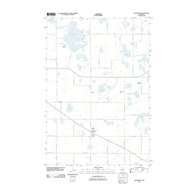 2010 Kensington2010 Print · USGSCovers Kensington, including Douglas County, Pope County, and other nearby areas
 - 2013 Map of Kensington, 2013 Print
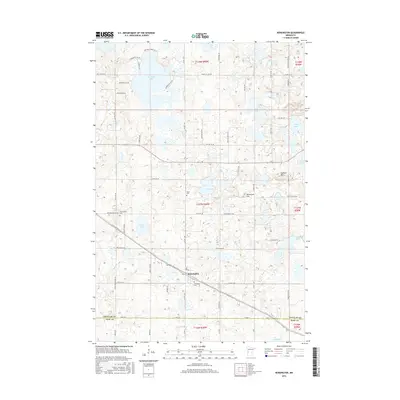
 2013 Kensington2013 Print · USGSCovers Kensington, including Douglas County, Pope County, and other nearby areas
 - 2016 Map of Kensington, 2016 Print
 2016 Kensington2016 Print · USGSCovers Kensington, including Douglas County, Pope County, and other nearby areas
 - 2019 Map of Kensington, 2019 Print
 2019 Kensington2019 Print · USGSCovers Kensington, including Douglas County, Pope County, and other nearby areas
 - 2022 Map of Kensington, 2022 Print
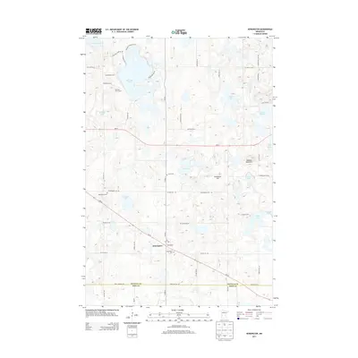
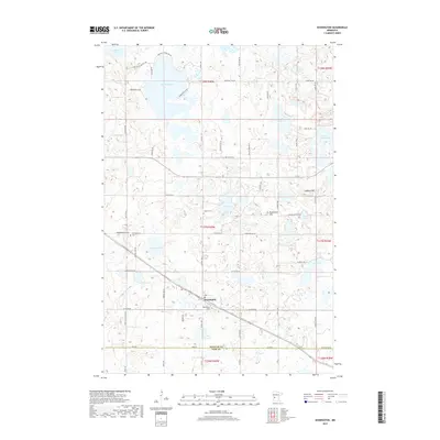
 2022 Kensington2022 Print · USGSKensington and the surrounding glacial lake country are captured in this recent survey. Genealogists and historians can locate legacy sites like Wennersborg Cem and Solem Cem, or trace the landmarks of Runestone Hill and Lookout Mtn.
End of results
Showing maps 1-10 of 10
Top cities near Kensington
- Morris historical maps
- Starbuck historical maps
- Holmes City historical maps
- Hoffman historical maps
- Evansville historical maps
- Brandon historical maps
See more
Frequently asked questions
- What are the different types of historical maps available for Kensington?
- What is the oldest map of Kensington?
- Where can I purchase historical maps of Kensington for my home or office?
- Where can I download high-res historical maps of Kensington?
- Are there historical topographic maps available for Kensington?
- Is there historical aerial imagery available for Kensington?
- Where are historical maps of Kensington sourced from?