2020s Maps of Hollandale, Minnesota
Explore 1 historic maps of Hollandale from the 2020s. These maps offer a rare glimpse into what life looked like during the 2020s — showing old roads, neighborhoods, homes, and landmarks that have changed or disappeared over time.
Whether you're researching your family's past, planning a metal detecting trip, or studying how Hollandale's landscape evolved across the 2020s, these high-resolution maps are a powerful tool for exploring the history of this region.
- Focus on a specific era: All maps on this page are from the 2020s, giving you a focused view of this time period.
- See what’s changed: Compare century-old streets, trails, and buildings to today's modern landscape using overlays and satellite layers.
- Research with precision: Use these maps for genealogy, historical research, land use analysis, or educational projects.
- View, download, or print: Maps are fully viewable online in high resolution, and can be downloaded or printed for your own records.
Start exploring Hollandale's history through authentic maps from the 2020s. This is your window into the past.
Hollandale, MN maps
(1)- 2022 Map of Hollandale, 2022 Print
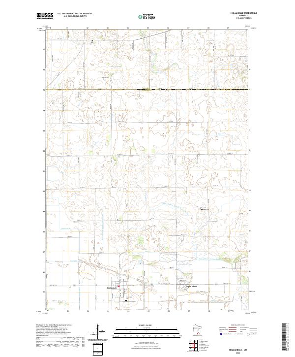 2022 Hollandale2022 Print · USGSFreeborn County farming communities and complex drainage networks are showcased here in the early 2020s. Genealogists can locate family landmarks such as Clark Family Cem and Summit Cem while tracing waterways like Knotvold Br and Mud Cr.
End of results
Showing maps 1-1 of 1
Top cities near Hollandale
- Austin historical maps
- Albert Lea historical maps
- Blooming Prairie historical maps
- Bancroft historical maps
- Clarks Grove historical maps
- Glenville historical maps
See more
Frequently asked questions
- What are the different types of historical maps available for Hollandale?
- What is the oldest map of Hollandale?
- Where can I purchase historical maps of Hollandale for my home or office?
- Where can I download high-res historical maps of Hollandale?
- Are there historical topographic maps available for Hollandale?
- Is there historical aerial imagery available for Hollandale?
- Where are historical maps of Hollandale sourced from?