1980s Maps of Plymouth, Minnesota
Explore 3 historic maps of Plymouth from the 1980s. These maps offer a rare glimpse into what life looked like during the 1980s — showing old roads, neighborhoods, homes, and landmarks that have changed or disappeared over time.
Whether you're researching your family's past, planning a metal detecting trip, or studying how Plymouth's landscape evolved across the 1980s, these high-resolution maps are a powerful tool for exploring the history of this region.
- Focus on a specific era: All maps on this page are from the 1980s, giving you a focused view of this time period.
- See what’s changed: Compare century-old streets, trails, and buildings to today's modern landscape using overlays and satellite layers.
- Research with precision: Use these maps for genealogy, historical research, land use analysis, or educational projects.
- View, download, or print: Maps are fully viewable online in high resolution, and can be downloaded or printed for your own records.
Start exploring Plymouth's history through authentic maps from the 1980s. This is your window into the past.
Plymouth, MN maps
(3)- 1981 Map of Hamel
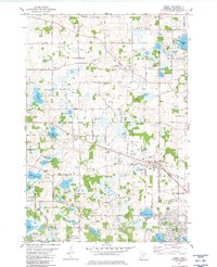 1981 Hamel1981 Print · USGSHennepin County was undergoing significant suburban growth in the early eighties as residential developments moved into the lake country. Genealogists and local researchers can trace early family sites like St James Cem and Old St Thomas Cem near the Soo Line tracks.2 unique versions available
 - 1985 Map of Saint Paul
 1985 Saint Paul1985 Print · USGSThe Twin Cities metropolitan area and its southern suburbs are captured here in the mid-eighties as the urban landscape expanded toward the Minnesota River. Researchers can trace the layout of the Fort Snelling Military Reservation, find local landmarks like St Benedict Church, and study the rail routes of the Soo Line.2 unique versions available
 - 1985 Map of Anoka
 1985 Anoka1985 Print · USGSThe northern Twin Cities suburbs and the Mississippi River valley are captured here in the mid-eighties as suburban growth began to meet rural conservation lands. Trace the expansion of Anoka and Blaine, or locate family landmarks near the Rum River and Buffalo Lake.
End of results
Showing maps 1-3 of 3
Top cities near Plymouth
- Minneapolis historical maps
- Bloomington historical maps
- Brooklyn Park historical maps
- Maple Grove historical maps
- Coon Rapids historical maps
- Eden Prairie historical maps
See more
Top neighborhoods of Plymouth
- Mission Farms historical maps
- Harvest Hills historical maps
- Lake Camelot Estates historical maps
- Camelot Overlook historical maps
- Camelot Villas historical maps
- Taylor Creek historical maps
See more
Frequently asked questions
- What are the different types of historical maps available for Plymouth?
- What is the oldest map of Plymouth?
- Where can I purchase historical maps of Plymouth for my home or office?
- Where can I download high-res historical maps of Plymouth?
- Are there historical topographic maps available for Plymouth?
- Is there historical aerial imagery available for Plymouth?
- Where are historical maps of Plymouth sourced from?