Old Maps of Plymouth, Minnesota
Explore 27 old maps of Plymouth, spanning from 1896 to today. These high-resolution historic maps reveal how streets, neighborhoods, landmarks, and natural features evolved over time — perfect for genealogy, metal detecting, research, and local history exploration.
What you can do with these maps:
- See how Plymouth changed over time: Compare historical maps to modern-day views to trace roads, homesites, rail lines & more.
- View detailed metadata: Each map includes creators, publishers, year, scale, and archive source.
- Overlay maps with satellite & LiDAR: Visualize the past alongside modern tools to explore terrain & human change.
- Trusted historical sources: Maps sourced from the USGS, Library of Congress, and other archives.
- Access maps your way: View online, download high-res files, or order prints for personal or research use.
Start exploring old maps of Plymouth to uncover forgotten places, hidden landmarks, and the deep history beneath your feet.
Plymouth, MN maps
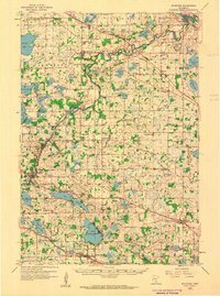
(27)- 1896 Map of Minneapolis
 1896 Minneapolis1896 Print · USGSCovers Plymouth, including Minneapolis, Bloomington, and other nearby areas
 - 1901 Map of Minneapolis
 1901 Minneapolis1901 Print · USGSCovers Plymouth, including Minneapolis, Bloomington, and other nearby areas8 unique versions available
 - 1902 Map of Anoka
 1902 Anoka1902 Print · USGSCovers Plymouth, including Minneapolis, Brooklyn Park, and other nearby areas5 unique versions available
 - 1905 Map of Minnetonka, 1957 Print
 1905 Minnetonka1957 Print · USGSCovers Plymouth, including Eden Prairie, Minnetonka, and other nearby areas
 - 1907 Map of Minnetonka
 1907 Minnetonka1907 Print · USGSCovers Plymouth, including Eden Prairie, Minnetonka, and other nearby areas4 unique versions available
 - 1909 Map of Rockford
 1909 Rockford1909 Print · USGSCovers Plymouth, including Maple Grove, Ramsey, and other nearby areas4 unique versions available
 - 1953 Map of Saint Paul, 1964 Print
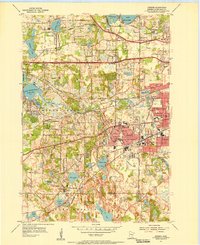
 1953 Saint Paul1964 Print · USGSCovers Plymouth, including Minneapolis, Saint Paul, and other nearby areas4 unique versions available
 - 1953 Map of Stillwater, 1980 Print
 1953 Stillwater1980 Print · USGSCovers Plymouth, including Minneapolis, Brooklyn Park, and other nearby areas
 - 1954 Map of Hopkins, 1956 Print
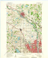
 1954 Hopkins1956 Print · USGSCovers Plymouth, including Eden Prairie, Saint Louis Park, and other nearby areas2 unique versions available
 - 1954 Map of Minneapolis, 1959 Print
 1954 Minneapolis1959 Print · USGSCovers Plymouth, including Minneapolis, Bloomington, and other nearby areas
 - 1955 Map of Osseo, 1956 Print
 1955 Osseo1956 Print · USGSCovers Plymouth, including Brooklyn Park, Maple Grove, and other nearby areas2 unique versions available
 - 1955 Map of Anoka, 1959 Print
 1955 Anoka1959 Print · USGSCovers Plymouth, including Minneapolis, Brooklyn Park, and other nearby areas
 - 1955 Map of Stillwater, 1965 Print
 1955 Stillwater1965 Print · USGSCovers Plymouth, including Minneapolis, Brooklyn Park, and other nearby areas
 - 1958 Map of Stillwater
 1958 Stillwater1958 Print · USGSCovers Plymouth, including Minneapolis, Brooklyn Park, and other nearby areas2 unique versions available
 - 1958 Map of Rockford, 1959 Print
 1958 Rockford1959 Print · USGSCovers Plymouth, including Maple Grove, Ramsey, and other nearby areas2 unique versions available
 - 1958 Map of Lake Minnetonka, 1959 Print
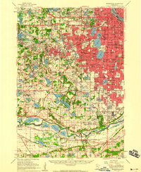
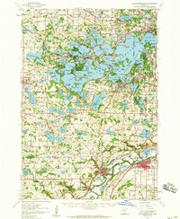 1958 Lake Minnetonka1959 Print · USGSCovers Plymouth, including Eden Prairie, Minnetonka, and other nearby areas2 unique versions available
 - 1958 Map of Excelsior, 1959 Print
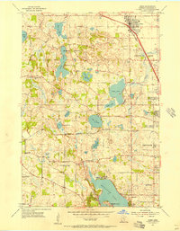
 1958 Excelsior1959 Print · USGSCovers Plymouth, including Eden Prairie, Minnetonka, and other nearby areas5 unique versions available
 - 1959 Map of Saint Paul
 1959 Saint Paul1959 Print · USGSCovers Plymouth, including Minneapolis, Saint Paul, and other nearby areas2 unique versions available
 - 1965 Map of Stillwater
 1965 Stillwater1965 Print · USGSCovers Plymouth, including Minneapolis, Brooklyn Park, and other nearby areas
 - 1967 Map of Hopkins, 1969 Print
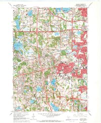 1967 Hopkins1969 Print · USGSCovers Plymouth, including Eden Prairie, Saint Louis Park, and other nearby areas5 unique versions available
 - 1967 Map of Osseo, 1969 Print
 1967 Osseo1969 Print · USGSCovers Plymouth, including Brooklyn Park, Maple Grove, and other nearby areas5 unique versions available
 - 1975 Map of Stillwater
 1975 Stillwater1975 Print · USGSCovers Plymouth, including Minneapolis, Brooklyn Park, and other nearby areas2 unique versions available
 - 1981 Map of Hamel
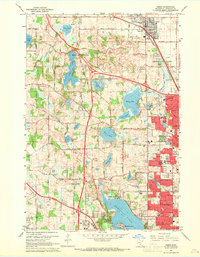
 1981 Hamel1981 Print · USGSCovers Plymouth, including Maple Grove, Orono, and other nearby areas2 unique versions available
 - 1985 Map of Saint Paul
 1985 Saint Paul1985 Print · USGSCovers Plymouth, including Minneapolis, Saint Paul, and other nearby areas2 unique versions available
 - 1985 Map of Anoka
 1985 Anoka1985 Print · USGSCovers Plymouth, including Minneapolis, Brooklyn Park, and other nearby areas
Showing maps 1-25 of 27
Top cities near Plymouth
- Minneapolis historical maps
- Bloomington historical maps
- Brooklyn Park historical maps
- Maple Grove historical maps
- Coon Rapids historical maps
- Eden Prairie historical maps
See more
Top neighborhoods of Plymouth
- Mission Farms historical maps
- Plymouth Preserve historical maps
- Cascades historical maps
- Hampton Hills historical maps
- Arbor Grove historical maps
- Harvest Hills historical maps
See more
Frequently asked questions
- What are the different types of historical maps available for Plymouth?
- What is the oldest map of Plymouth?
- Where can I purchase historical maps of Plymouth for my home or office?
- Where can I download high-res historical maps of Plymouth?
- Are there historical topographic maps available for Plymouth?
- Is there historical aerial imagery available for Plymouth?
- Where are historical maps of Plymouth sourced from?