2020s Maps of Warba, Minnesota
Explore 4 historic maps of Warba from the 2020s. These maps offer a rare glimpse into what life looked like during the 2020s — showing old roads, neighborhoods, homes, and landmarks that have changed or disappeared over time.
Whether you're researching your family's past, planning a metal detecting trip, or studying how Warba's landscape evolved across the 2020s, these high-resolution maps are a powerful tool for exploring the history of this region.
- Focus on a specific era: All maps on this page are from the 2020s, giving you a focused view of this time period.
- See what’s changed: Compare century-old streets, trails, and buildings to today's modern landscape using overlays and satellite layers.
- Research with precision: Use these maps for genealogy, historical research, land use analysis, or educational projects.
- View, download, or print: Maps are fully viewable online in high resolution, and can be downloaded or printed for your own records.
Start exploring Warba's history through authentic maps from the 2020s. This is your window into the past.
Warba, MN maps
(4)- 2022 Map of Warba, 2022 Print
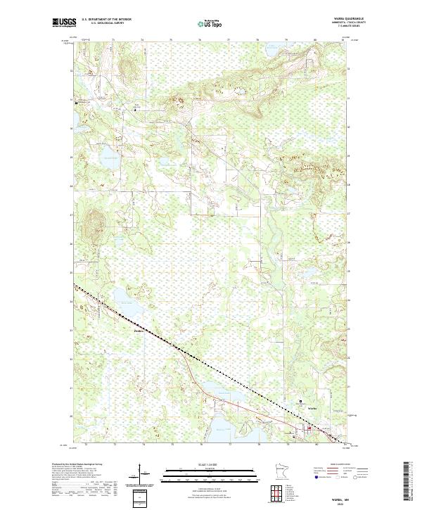 2022 Warba2022 Print · USGSItasca County's watery landscape is documented here in the early twenty-first century, showing the established communities and remote lakefronts. Family historians can locate several burial grounds including Norwegian Cem and New Wabana Cem near the banks of the Swan River.
 - 2022 Map of Swan River, 2022 Print
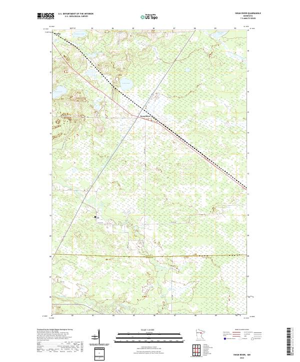 2022 Swan River2022 Print · USGSItasca and Aitkin Counties appear here at the start of the 2020s, showing a landscape defined by glacial lakes and the winding Swan River. Researchers can locate the Sago Cem and trace the drainage of the W-Br Floodwood River near Warba.
 - 2022 Map of Jacobson, 2022 Print
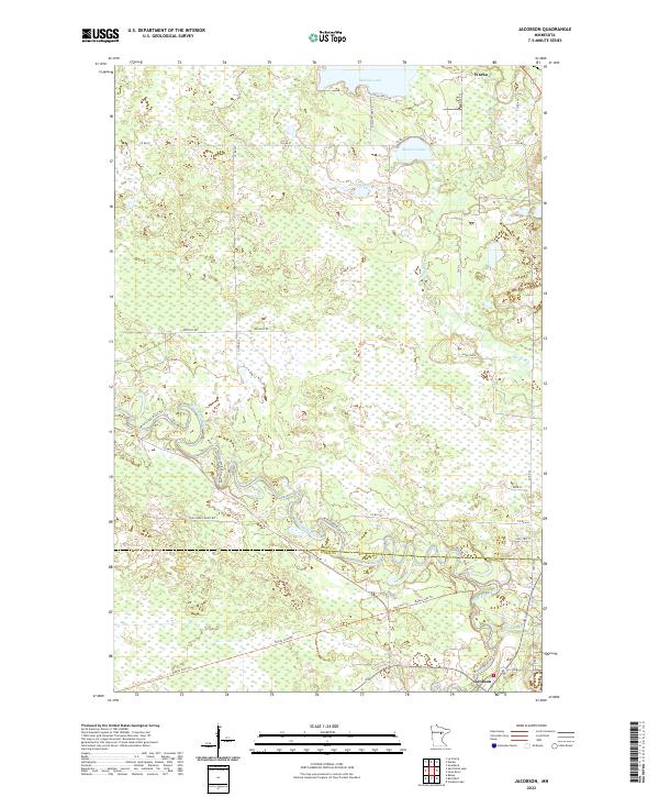 2022 Jacobson2022 Print · USGSItasca County's river-rich landscape comes to life in this modern survey of the upper Mississippi. Historians and outdoor enthusiasts can trace the winding Mississippi River Trl and Swan River while exploring landmarks like Jacobson, Warba, and Shallow Lake.
 - 2022 Map of Goodland, 2022 Print
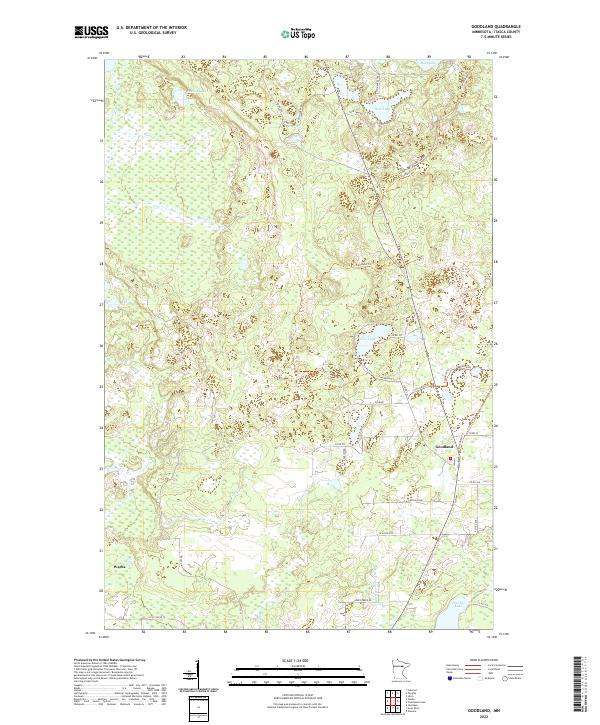 2022 Goodland2022 Print · USGSItasca County's wooded lake country is documented here in the early twenty-first century, centered on the community of Goodland. Researchers can trace local landmarks and family-named roads like Kreklow Rd, Lastovich Rd, and the shores of Pancake Lake.
End of results
Showing maps 1-4 of 4
Top cities near Warba
- Hibbing historical maps
- Grand Rapids historical maps
- Coleraine historical maps
- Nashwauk historical maps
- Blackberry historical maps
- Marble historical maps
See more
Frequently asked questions
- What are the different types of historical maps available for Warba?
- What is the oldest map of Warba?
- Where can I purchase historical maps of Warba for my home or office?
- Where can I download high-res historical maps of Warba?
- Are there historical topographic maps available for Warba?
- Is there historical aerial imagery available for Warba?
- Where are historical maps of Warba sourced from?