Old Maps of Lake County, Minnesota for Academic Research
Study the evolution of Lake County with 158 high-resolution historic maps. Whether you're teaching, researching, or modeling changes in land use, these maps provide essential visual documentation of urban, environmental, and geographic change.
- Analyze long-term change: Track patterns in development, transportation, and natural features.
- Ideal for environmental or urban studies: Support academic projects with primary historical map data.
- Use in the classroom or lab: Educators and researchers rely on these maps to bring historical context to life.
These maps are a powerful tool for teaching, research, and visualizing how Lake County has changed over the decades.
Lake County, MN maps
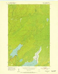
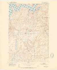
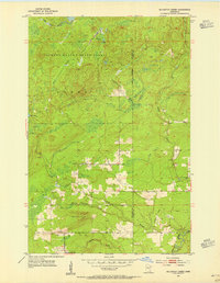
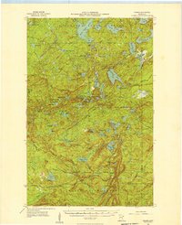
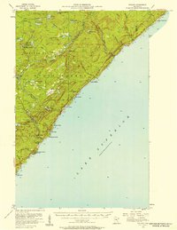
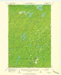
(158)- 1933 Map of Ely, 1961 Print
 1933 Ely1961 Print · USGSCovers Lake County, including Ely, Winton, and other nearby areas
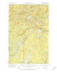
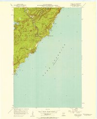
 - 1939 Map of Ely
 1939 Ely1939 Print · USGSCovers Lake County, including Ely, Winton, and other nearby areas3 unique versions available
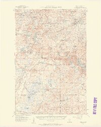
 - 1952 Map of Babbitt SE, 1954 Print
 1952 Babbitt SE1954 Print · USGSCovers Lake County, including Bassett Township, Lake No. 2, and other nearby areas5 unique versions available
 - 1952 Map of Babbitt NE, 1954 Print
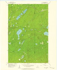
 1952 Babbitt NE1954 Print · USGSCovers Lake County, including Babbitt, Stony River Township, and other nearby areas6 unique versions available
 - 1953 Map of Knife River, 1955 Print
 1953 Knife River1955 Print · USGSCovers Lake County, including Duluth Township, Lake No. 2, and other nearby areas4 unique versions available
 - 1953 Map of Whyte, 1955 Print
 1953 Whyte1955 Print · USGSCovers Lake County, including Silver Creek Township, Stony River Township, and other nearby areas3 unique versions available
 - 1953 Map of Ashland, 1964 Print
 1953 Ashland1964 Print · USGSCovers Lake County, including Duluth, Superior, and other nearby areas3 unique versions available
 - 1954 Map of Mc Carthy Creek, 1955 Print
 1954 Mc Carthy Creek1955 Print · USGSCovers Lake County, including Pequaywan Township, Alden Township, and other nearby areas3 unique versions available
 - 1954 Map of Greenwood Lake, 1956 Print
 1954 Greenwood Lake1956 Print · USGSCovers Lake County, including Stony River Township, Lake No. 2, and other nearby areas2 unique versions available
 - 1954 Map of Silver Bay, 1956 Print
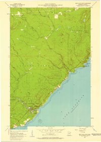
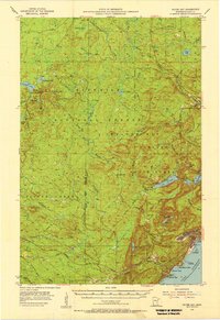 1954 Silver Bay1956 Print · USGSCovers Lake County, including Silver Bay, Beaver Bay, and other nearby areas3 unique versions available
 - 1954 Map of Two Harbors, 1964 Print
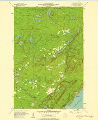
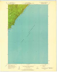
 1954 Two Harbors1964 Print · USGSCovers Lake County, including Two Harbors, Ely, and other nearby areas2 unique versions available
 - 1955 Map of Isabella, 1957 Print
 1955 Isabella1957 Print · USGSCovers Lake County, including Stony River Township, Wheeler Landing, and other nearby areas4 unique versions available
 - 1955 Map of Cramer, 1957 Print
 1955 Cramer1957 Print · USGSCovers Lake County, including Lake No. 1, Schroeder Township, and other nearby areas3 unique versions available
 - 1956 Map of Split Rock Point, 1958 Print
 1956 Split Rock Point1958 Print · USGSCovers Lake County, including Silver Creek Township, Beaver Bay Township, and other nearby areas3 unique versions available
 - 1956 Map of Little Marais, 1958 Print
 1956 Little Marais1958 Print · USGSCovers Lake County, including Lake No. 1, Schroeder Township, and other nearby areas3 unique versions available
 - 1956 Map of Finland, 1958 Print
 1956 Finland1958 Print · USGSCovers Lake County, including Lake No. 1, Little Marais Postoffice, and other nearby areas3 unique versions available
 - 1956 Map of King Lake, 1958 Print
 1956 King Lake1958 Print · USGSCovers Lake County, including Ault Township, Pequaywan Township, and other nearby areas3 unique versions available
 - 1956 Map of Finland, 1958 Print
 1956 Finland1958 Print · USGSCovers Lake County, including Silver Bay, Lake No. 1, and other nearby areas2 unique versions available
 - 1956 Map of Illgen City, 1958 Print
 1956 Illgen City1958 Print · USGSCovers Lake County, including Silver Bay, Illgen City, and other nearby areas3 unique versions available
 - 1956 Map of Split Rock Point, 1958 Print
 1956 Split Rock Point1958 Print · USGSCovers Lake County, including Beaver Bay, Silver Creek Township, and other nearby areas2 unique versions available
 - 1956 Map of Split Rock Point NE, 1958 Print
 1956 Split Rock Point NE1958 Print · USGSCovers Lake County, including Beaver Bay, Beaver Bay Township, and other nearby areas2 unique versions available
 - 1957 Map of Two Harbors
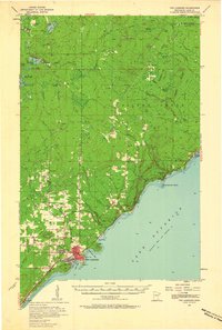
 1957 Two Harbors1957 Print · USGSCovers Lake County, including Two Harbors, Ely, and other nearby areas
 - 1957 Map of Two Harbors, 1958 Print
 1957 Two Harbors1958 Print · USGSCovers Lake County, including Two Harbors, Silver Creek, and other nearby areas2 unique versions available
 - 1957 Map of Two Harbors, 1958 Print
 1957 Two Harbors1958 Print · USGSCovers Lake County, including Two Harbors, Silver Creek Township, and other nearby areas2 unique versions available
 - 1957 Map of Brimson, 1958 Print
 1957 Brimson1958 Print · USGSCovers Lake County, including Fairbanks, Bassett, and other nearby areas3 unique versions available
Showing maps 1-25 of 158
Top cities of Lake County
Frequently asked questions
- What are the different types of historical maps available for Lake County?
- What is the oldest map of Lake County?
- Where can I purchase historical maps of Lake County for my home or office?
- Where can I download high-res historical maps of Lake County?
- Are there historical topographic maps available for Lake County?
- Is there historical aerial imagery available for Lake County?
- Where are historical maps of Lake County sourced from?