Old Maps of Lake County, Minnesota for Hiking & Exploration
Hike through history with 410 historic maps of Lake County. Explore old trails, ghost towns, and forgotten backroads — perfect for outdoor adventurers and local explorers.
- Rediscover forgotten places: Map out old mining camps, roads, and footpaths that no longer exist on modern maps.
- Layer with modern tools: Combine with LiDAR or satellite views to plan hikes through historical terrain.
- Made for exploration: Popular among hikers, overlanders, and local history lovers.
Use these maps to find adventure and explore the hidden past of Lake County.
Lake County, MN maps
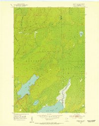
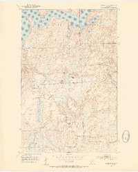
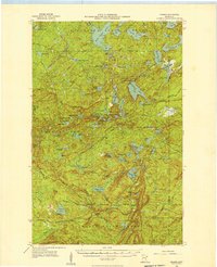
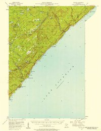
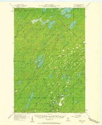
(410)- 1933 Map of Ely, 1961 Print
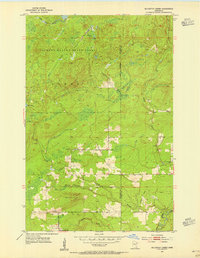
 1933 Ely1961 Print · USGSThe iron-rich Vermilion Range comes alive in the early 1930s, showing the intersection of heavy industry and the Northwoods wilderness. Genealogists and historians can trace the foundations of Ely and Winton, including the Pioneer Mines and the Halfway CCC Camp.
 - 1939 Map of Ely
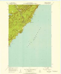
 1939 Ely1939 Print · USGSEly and the surrounding Iron Range were dominated by heavy industry and woodland conservation in the years before the war. Genealogists and historians can locate specific sites like Pioneer Mines, the Halfway CCC Camp, and the White Iron Sch.3 unique versions available
 - 1952 Map of Babbitt SE, 1954 Print
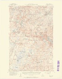
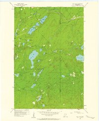
 1952 Babbitt SE1954 Print · USGSThe Arrowhead Region of Minnesota is shown here just after the war as industrial infrastructure began to pierce the wilderness. You can trace the path of the Reserve Mining Company Railroad and locate the Boy Scout Camp near Seven Beaver Lake.5 unique versions available
 - 1952 Map of Babbitt NE, 1954 Print
 1952 Babbitt NE1954 Print · USGSThe northern Minnesota wilderness of the early fifties is defined by the expansive waters of Birch Lake and the surrounding national forests. Trace the remnants of former outposts like Tomahawk Camp and an Old Landing Field near the Dunka River.6 unique versions available
 - 1953 Map of Knife River, 1955 Print
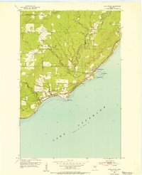 1953 Knife River1955 Print · USGSThe Lake Superior shoreline comes alive in the mid-fifties as the railroad and old highway wind through coastal settlements. Researchers can trace the industrial corridor of the Duluth Missabe and Iron Range Railroad and locate local sites like Lake View Cem and Palmers.4 unique versions available
 - 1953 Map of Whyte, 1955 Print
 1953 Whyte1955 Print · USGSThe Superior National Forest was a hub of rail-driven industry in the early fifties, crisscrossed by specialized ore and logging lines. Researchers can trace the junctions of the Duluth Missabe and Iron Range Railroad near Whyte and McNair, or locate landmarks like the Lookout Tower on Mt Weber.3 unique versions available
 - 1953 Map of Ashland, 1964 Print
 1953 Ashland1964 Print · USGSNorthern Wisconsin's lakefront and timberlands are seen here in the mid-1950s, showing the intersection of industrial rail lines and vast wilderness. Genealogists and historians can trace the Soo Line through rail towns like Mellen or locate family roots in the Apostle Islands and Bad River Indian Reservation.3 unique versions available
 - 1954 Map of Mc Carthy Creek, 1955 Print
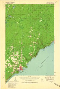
 1954 Mc Carthy Creek1955 Print · USGSSt. Louis County was a landscape of dense state forests and timber transit in the mid-fifties. Genealogists and historians can trace local landmarks like Clover Valley Sch, the Molde Lookout Tower, and an Old Railroad Grade.3 unique versions available
 - 1954 Map of Greenwood Lake, 1956 Print
 1954 Greenwood Lake1956 Print · USGSLake County’s timber and iron country is captured here in the mid-fifties as industrial rail lines were expanding through the wilderness. Researchers can trace the routes of the Erie Mining Company Railroad and find landmarks like Jack Pine Mountain and Slate Lake.2 unique versions available
 - 1954 Map of Silver Bay, 1956 Print
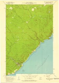
 1954 Silver Bay1956 Print · USGSThe North Shore was undergoing industrial expansion in the mid-1950s as mining and maritime logistics converged on the Lake Superior coast. Researchers can trace the early infrastructure of Silver Bay, the operations at the Mining site, and old logging routes like the Old Company Railroad.3 unique versions available
 - 1954 Map of Two Harbors, 1964 Print
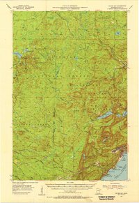
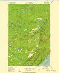
 1954 Two Harbors1964 Print · USGSThe Minnesota North Shore and Superior National Forest are shown here in the mid-fifties, just as the taconite industry was reshaping the coast. Genealogists and historians can trace the rail lines of the Duluth Missabe and Iron Range or locate remote outposts like Sawbill Landing and Section Thirty.2 unique versions available
 - 1955 Map of Isabella, 1957 Print
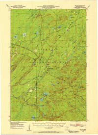
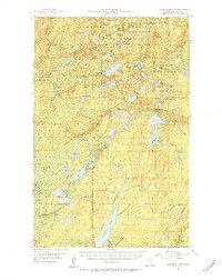
 1955 Isabella1957 Print · USGSThe Lake County timberlands of the mid-1950s are captured here as a network of rail lines and forest landings. Researchers can trace the legacy of logging and settlement at the Isabella Sch (Abandoned), Manitou Junction, and Murphy City.4 unique versions available
 - 1955 Map of Cramer, 1957 Print
 1955 Cramer1957 Print · USGSThe North Shore backcountry of Lake and Cook counties is shown here in the mid-fifties, dominated by dense state and national forests. Researchers can trace the Minnesota and Northern Railroad line to Cramer or locate high-ground landmarks like the Wanless Lookout Tower.3 unique versions available
 - 1956 Map of Split Rock Point, 1958 Print
 1956 Split Rock Point1958 Print · USGSThe Lake Superior shoreline comes alive in the mid-fifties, capturing the rugged North Shore before modern expansion. Trace the Old Railroad Grade and explore early coastal landmarks like Little Two Harbors, Castle Danger, and the falls of Gooseberry Falls State Park.3 unique versions available
 - 1956 Map of Little Marais, 1958 Print
 1956 Little Marais1958 Print · USGSThe North Shore's rugged transition from forest to lake is captured here in the mid-fifties, just as coastal infrastructure was modernizing. Trace the path of a highway Under Construction past Little Marais and the landmark Caribou Falls.3 unique versions available
 - 1956 Map of Finland, 1958 Print
 1956 Finland1958 Print · USGSThe North Shore highlands in the mid-fifties reveal a landscape of forestry and Cold War infrastructure. Researchers can locate the Finland Air Force Station, trace the Baptism River, or find family roots at the Finland Cem and Little Marais PO.3 unique versions available
 - 1956 Map of King Lake, 1958 Print
 1956 King Lake1958 Print · USGSThe northern Minnesota wilderness in the 1950s was a landscape of industrial rail lines and vast timber stands. Geologists and local historians can trace the Duluth Missabe and Iron Range tracks or locate remote sites like the Paquaywan Lookout Tower and King Lake.3 unique versions available
 - 1956 Map of Finland, 1958 Print
 1956 Finland1958 Print · USGSThe North Shore of Lake Superior is captured here in the mid-fifties, showing the rugged intersection of the Crystal Bay Finland State Forest and the lake. Researchers can trace the era's military footprint at the Finland Air Force Station or locate family roots near the Finland Cem and Cramer Homestead Lake.2 unique versions available
 - 1956 Map of Illgen City, 1958 Print
 1956 Illgen City1958 Print · USGSThe North Shore of Lake Superior comes to life in the mid-1950s, showing the early infrastructure and protected forests of Lake County. Researchers can trace the development of Illgen City and locate landmarks like Illgen Falls and the Radio Tower atop Palisade Head.3 unique versions available
 - 1956 Map of Split Rock Point, 1958 Print
 1956 Split Rock Point1958 Print · USGSThe North Shore of Lake Superior during the mid-fifties is captured here, showing the era's balance of industry and tourism. Trace the Old RR Grade and maritime landmarks like the Split Rock Lighthouse and Castle Danger.2 unique versions available
 - 1956 Map of Split Rock Point NE, 1958 Print
 1956 Split Rock Point NE1958 Print · USGSThe North Shore of Lake County comes into focus in the mid-fifties, capturing the rugged coastline near the township of Beaver Bay. Researchers can trace the maritime landscape around the iconic Split Rock Lighthouse and explore small inlets like Little Two Harbors and Islet Bay.2 unique versions available
 - 1957 Map of Two Harbors
 1957 Two Harbors1957 Print · USGSMinnesota's North Shore and the Arrowhead region are shown here in the mid-fifties as the taconite industry and cold war defense shaped the landscape. Researchers can trace the Duluth Missabe and Iron Range railroad, locate the Split Rock Light, and explore the iron-mining era at Taconite.
 - 1957 Map of Two Harbors, 1958 Print
 1957 Two Harbors1958 Print · USGSThe North Shore harbor of Two Harbors and its iron-ore rail connections are captured here during the mid-fifties. Genealogists and historians can trace coastal life from the Lighthouse at Agate Bay to inland settlements like Waldo, Alger, and the Johnson School.2 unique versions available
 - 1957 Map of Two Harbors, 1958 Print
 1957 Two Harbors1958 Print · USGSThe Lake Superior shoreline at Two Harbors is captured here in the late fifties, dominated by the vital iron-ore shipping works. Researchers can trace the massive Duluth Missabe and Iron Range Railroad yards, locate the Lighthouse, or find old schools like Johnson Sch.2 unique versions available
 - 1957 Map of Brimson, 1958 Print
 1957 Brimson1958 Print · USGSNortheast Minnesota’s iron range and timber country are captured here in the late fifties, showing a landscape defined by rail and water. Genealogists and historians can trace old community sites like Toimi, Brimson, and Fairbanks alongside the Skibo Mill and Old Railroad Grade.3 unique versions available
Showing maps 1-25 of 410
Top cities of Lake County
Frequently asked questions
- What are the different types of historical maps available for Lake County?
- What is the oldest map of Lake County?
- Where can I purchase historical maps of Lake County for my home or office?
- Where can I download high-res historical maps of Lake County?
- Are there historical topographic maps available for Lake County?
- Is there historical aerial imagery available for Lake County?
- Where are historical maps of Lake County sourced from?