Old Maps of Two Harbors, Minnesota for Hiking & Exploration
Hike through history with 13 historic maps of Two Harbors. Explore old trails, ghost towns, and forgotten backroads — perfect for outdoor adventurers and local explorers.
- Rediscover forgotten places: Map out old mining camps, roads, and footpaths that no longer exist on modern maps.
- Layer with modern tools: Combine with LiDAR or satellite views to plan hikes through historical terrain.
- Made for exploration: Popular among hikers, overlanders, and local history lovers.
Use these maps to find adventure and explore the hidden past of Two Harbors.
Two Harbors, MN maps
(13)- 1954 Map of Two Harbors, 1964 Print
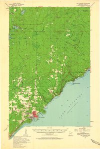
 1954 Two Harbors1964 Print · USGSThe Minnesota North Shore and Superior National Forest are shown here in the mid-fifties, just as the taconite industry was reshaping the coast. Genealogists and historians can trace the rail lines of the Duluth Missabe and Iron Range or locate remote outposts like Sawbill Landing and Section Thirty.2 unique versions available
 - 1957 Map of Two Harbors
 1957 Two Harbors1957 Print · USGSMinnesota's North Shore and the Arrowhead region are shown here in the mid-fifties as the taconite industry and cold war defense shaped the landscape. Researchers can trace the Duluth Missabe and Iron Range railroad, locate the Split Rock Light, and explore the iron-mining era at Taconite.
 - 1957 Map of Two Harbors, 1958 Print
 1957 Two Harbors1958 Print · USGSThe North Shore harbor of Two Harbors and its iron-ore rail connections are captured here during the mid-fifties. Genealogists and historians can trace coastal life from the Lighthouse at Agate Bay to inland settlements like Waldo, Alger, and the Johnson School.2 unique versions available
 - 1957 Map of Two Harbors, 1958 Print
 1957 Two Harbors1958 Print · USGSThe Lake Superior shoreline at Two Harbors is captured here in the late fifties, dominated by the vital iron-ore shipping works. Researchers can trace the massive Duluth Missabe and Iron Range Railroad yards, locate the Lighthouse, or find old schools like Johnson Sch.2 unique versions available
 - 1958 Map of Two Harbors
 1958 Two Harbors1958 Print · USGSThe North Shore and Arrowhead region of Minnesota are captured in the 1950s as iron ore shipping and wilderness preservation shaped the land. Researchers can trace the Duluth Missabe and Iron Range RR, find maritime landmarks like Split Rock Light, and locate remote settlements from Babbitt to Grand Marais.
 - 1964 Map of Two Harbors
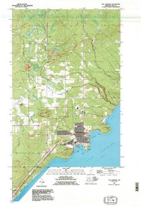
 1964 Two Harbors1964 Print · USGSThe North Shore of Lake Superior is captured here during the mid-1950s, a time of significant industrial mining growth and emerging tourism. Genealogists and historians can trace the rail lines of the Duluth Missabe and Iron Range and locate landmarks like Split Rock Light and the U S Air Force Radar Station.
 - 1976 Map of Two Harbors, 1994 Print
 1976 Two Harbors1994 Print · USGSThe North Shore of Lake Superior comes alive in this mid-seventies survey of the Minnesota timber and iron country. Trace the Duluth Missabe and Iron Range RR from Two Harbors past Split Rock Lighthouse State Park to the industrial port at Silver Bay.
 - 1992 Map of Two Harbors, 1995 Print
 1992 Two Harbors1995 Print · USGSThe Lake Superior shoreline at the start of the 1990s showcases the shipping and rail infrastructure of Two Harbors. Genealogists and local historians can trace the developments at Larsmont, find family plots at the Cem, or locate landmarks like the Lighthouse and Pork City Hill.
 - 2010 Map of Two Harbors, 2010 Print
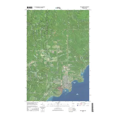
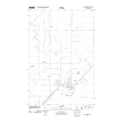 2010 Two Harbors2010 Print · USGSCovers Two Harbors, including Silver Creek Township, Lake No. 2, and other nearby areas
 - 2013 Map of Two Harbors, 2013 Print
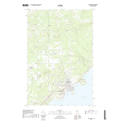
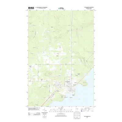 2013 Two Harbors2013 Print · USGSCovers Two Harbors, including Silver Creek Township, Lake No. 2, and other nearby areas
 - 2016 Map of Two Harbors, 2016 Print
 2016 Two Harbors2016 Print · USGSCovers Two Harbors, including Silver Creek Township, Lake No. 2, and other nearby areas
 - 2019 Map of Two Harbors, 2019 Print
 2019 Two Harbors2019 Print · USGSCovers Two Harbors, including Silver Creek Township, Lake No. 2, and other nearby areas
 - 2022 Map of Two Harbors, 2022 Print
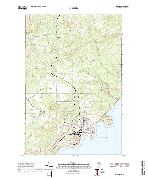 2022 Two Harbors2022 Print · USGSThe North Shore of Lake Superior comes into focus in this contemporary survey of the Iron Range's coastal gateway. Genealogists and researchers can trace the streets of Two Harbors, locate family plots at Lakeview Cem, or explore the rural reaches of Stewart and Waldo.
End of results
Showing maps 1-13 of 13
Top cities near Two Harbors
Frequently asked questions
- What are the different types of historical maps available for Two Harbors?
- What is the oldest map of Two Harbors?
- Where can I purchase historical maps of Two Harbors for my home or office?
- Where can I download high-res historical maps of Two Harbors?
- Are there historical topographic maps available for Two Harbors?
- Is there historical aerial imagery available for Two Harbors?
- Where are historical maps of Two Harbors sourced from?