Old Maps of Arnesén, Minnesota for Hiking & Exploration
Hike through history with 12 historic maps of Arnesén. Explore old trails, ghost towns, and forgotten backroads — perfect for outdoor adventurers and local explorers.
- Rediscover forgotten places: Map out old mining camps, roads, and footpaths that no longer exist on modern maps.
- Layer with modern tools: Combine with LiDAR or satellite views to plan hikes through historical terrain.
- Made for exploration: Popular among hikers, overlanders, and local history lovers.
Use these maps to find adventure and explore the hidden past of Arnesén.
Arnesén, MN maps
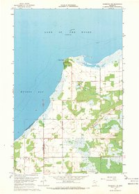
(12)- 1918 Map of Roosevelt
 1918 Roosevelt1918 Print · USGSNorthern Minnesota's wooded frontier is captured here at the end of the Great War, as the railway transformed the lake country. Genealogists and historians can trace early school sites and track the Canadian Northern rail line through Roosevelt and Swift.
 - 1943 Map of Roosevelt
 1943 Roosevelt1943 Print · USGSNear the international boundary in the 1940s, this area shows the early development of Roseau and Beltrami Counties around the Canadian Northern line. Researchers can trace the layout of Roosevelt, Arnesen, and Swift alongside the timbered landscapes of Laona.
 - 1954 Map of Roseau, 1969 Print
 1954 Roseau1969 Print · USGSNorthern Minnesota's borderlands come alive in the 1950s, showing a landscape defined by timber, water, and rail. Trace family roots through old schools and cemeteries near Roseau, Warroad, and the expansive Red Lake Indian Reservation.2 unique versions available
 - 1957 Map of Roseau
 1957 Roseau1957 Print · USGSThe international border and tribal lands define Northern Minnesota in the mid-fifties, from the shores of Lake of the Woods to the Red Lake Indian Reservation. Researchers can trace the path of the Great Northern railroad and locate isolated outposts like the U S Custom House and Ponemah.
 - 1958 Map of Roseau
 1958 Roseau1958 Print · USGSNorthern Minnesota's borderlands and vast lake country are captured here in the late fifties. Researchers can trace the Canadian National rail line through Warroad or find family history in frontier settlements like Baudette, Waskish, and Shotley.
 - 1967 Map of Roosevelt NE, 1969 Print
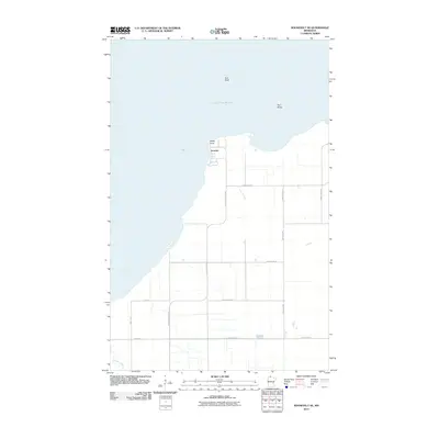
 1967 Roosevelt NE1969 Print · USGSThe northern shoreline of Minnesota at Lake of the Woods comes into focus during the late sixties. Trace local history through the lakeside settlement of Arnesen, the church at Mt Carmel Ch, and navigation markers like Gull Rock Light.2 unique versions available
 - 1976 Map of Roseau, 1994 Print
 1976 Roseau1994 Print · USGSThe Minnesota-Manitoba borderlands come into focus in the mid-seventies, showing the intersection of lake-shore life and the prairie's edge. Genealogists and historians can trace rail sidings and small settlements from Warroad to Roseau, or locate family landmarks near the Red Lake Indian Reservation and Arnesen.
 - 2010 Map of Roosevelt NE, 2010 Print
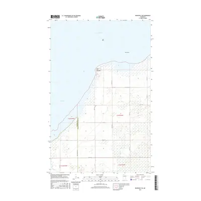
 2010 Roosevelt NE2010 Print · USGSCovers Arnesén, including Roseau County, Lake of the Woods County, and other nearby areas
 - 2013 Map of Roosevelt NE, 2013 Print
 2013 Roosevelt NE2013 Print · USGSCovers Arnesén, including Roseau County, Lake of the Woods County, and other nearby areas
 - 2016 Map of Roosevelt NE, 2016 Print
 2016 Roosevelt NE2016 Print · USGSCovers Arnesén, including Roseau County, Lake of the Woods County, and other nearby areas
 - 2019 Map of Roosevelt NE, 2019 Print
 2019 Roosevelt NE2019 Print · USGSCovers Arnesén, including Roseau County, Lake of the Woods County, and other nearby areas
 - 2022 Map of Roosevelt NE, 2022 Print
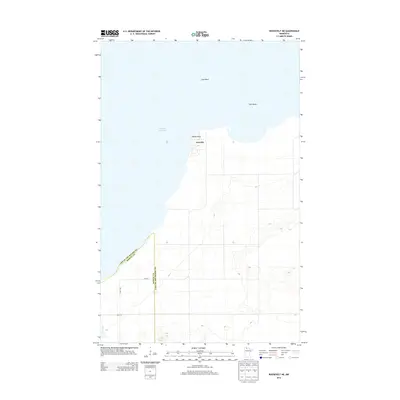
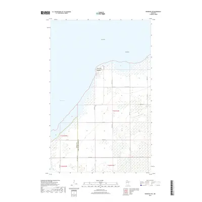
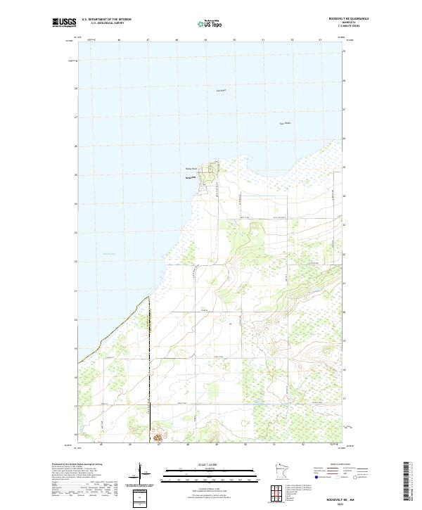 2022 Roosevelt NE2022 Print · USGSThe southern reach of Lake of the Woods comes into focus in this contemporary survey of the Minnesota shoreline. Trace the coastal geography from the settlement of Arnesén to offshore landmarks like Gull Rock and the marshy edges of Muskeg Bay.
End of results
Showing maps 1-12 of 12
Top cities near Arnesén
Frequently asked questions
- What are the different types of historical maps available for Arnesén?
- What is the oldest map of Arnesén?
- Where can I purchase historical maps of Arnesén for my home or office?
- Where can I download high-res historical maps of Arnesén?
- Are there historical topographic maps available for Arnesén?
- Is there historical aerial imagery available for Arnesén?
- Where are historical maps of Arnesén sourced from?