1960s Maps of Waltham, Minnesota
Explore 2 historic maps of Waltham from the 1960s. These maps offer a rare glimpse into what life looked like during the 1960s — showing old roads, neighborhoods, homes, and landmarks that have changed or disappeared over time.
Whether you're researching your family's past, planning a metal detecting trip, or studying how Waltham's landscape evolved across the 1960s, these high-resolution maps are a powerful tool for exploring the history of this region.
- Focus on a specific era: All maps on this page are from the 1960s, giving you a focused view of this time period.
- See what’s changed: Compare century-old streets, trails, and buildings to today's modern landscape using overlays and satellite layers.
- Research with precision: Use these maps for genealogy, historical research, land use analysis, or educational projects.
- View, download, or print: Maps are fully viewable online in high resolution, and can be downloaded or printed for your own records.
Start exploring Waltham's history through authentic maps from the 1960s. This is your window into the past.
Waltham, MN maps
(2)- 1966 Map of Waltham, 1967 Print
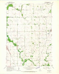 1966 Waltham1967 Print · USGSSouthern Minnesota's agricultural heartland is documented here during the mid-1960s, showing the vital rail links and small townships of Mower and Dodge Counties. Researchers can trace local genealogy and land use through landmarks like St Michaels Ch, the village of Waltham, and the Chicago Great Western tracks.
 - 1966 Map of Sargeant, 1967 Print
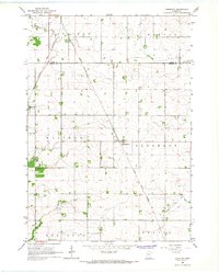 1966 Sargeant1967 Print · USGSSoutheastern Minnesota farmland near the Dodge and Mower county line is captured here in the mid-sixties. Genealogists and local historians can trace the Chicago Great Western rail line and locate community landmarks like St Johns Ch and the Waltham Cem.
End of results
Showing maps 1-2 of 2
Top cities near Waltham
- Austin historical maps
- Kasson historical maps
- Byron historical maps
- Dodge Center historical maps
- Blooming Prairie historical maps
- Hayfield historical maps
See more
Frequently asked questions
- What are the different types of historical maps available for Waltham?
- What is the oldest map of Waltham?
- Where can I purchase historical maps of Waltham for my home or office?
- Where can I download high-res historical maps of Waltham?
- Are there historical topographic maps available for Waltham?
- Is there historical aerial imagery available for Waltham?
- Where are historical maps of Waltham sourced from?