1960s Maps of Otter Tail County, Minnesota
Explore 24 historic maps of Otter Tail County from the 1960s. These maps offer a rare glimpse into what life looked like during the 1960s — showing old roads, neighborhoods, homes, and landmarks that have changed or disappeared over time.
Whether you're researching your family's past, planning a metal detecting trip, or studying how Otter Tail County's landscape evolved across the 1960s, these high-resolution maps are a powerful tool for exploring the history of this region.
- Focus on a specific era: All maps on this page are from the 1960s, giving you a focused view of this time period.
- See what’s changed: Compare century-old streets, trails, and buildings to today's modern landscape using overlays and satellite layers.
- Research with precision: Use these maps for genealogy, historical research, land use analysis, or educational projects.
- View, download, or print: Maps are fully viewable online in high resolution, and can be downloaded or printed for your own records.
Start exploring Otter Tail County's history through authentic maps from the 1960s. This is your window into the past.
Otter Tail County, MN maps
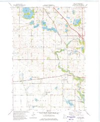
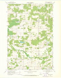
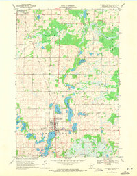
(24)- 1965 Map of Brainerd
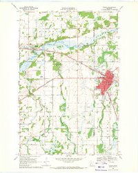
 1965 Brainerd1965 Print · USGSNorth-central Minnesota in the mid-fifties presents a complex landscape of sprawling lake systems and established rail corridors. Genealogists and historians can trace the growth of timber towns along the Northern Pacific RR and explore early borders of the White Earth Indian Reservation or Tamarac National Wildlife Refuge.
 - 1966 Map of Carlisle, 1975 Print
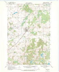
 1966 Carlisle1975 Print · USGSOtter Tail County in the early 1970s shows a landscape where prairie agriculture and waterfowl conservation meet. Researchers can trace local landmarks like the Carlisle settlement, the Burlington Northern line, and the Otter Tail River.
 - 1969 Map of Lake Miltona West, 1971 Print
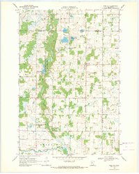
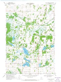
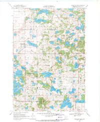
 1969 Lake Miltona West1971 Print · USGSDouglas County’s sprawling lake country comes into focus in the late sixties, highlighting the intricate shorelines and early communities of the region. Genealogists and local researchers can trace family landmarks like Leaf Valley, St James Ch, and the many docks along Lake Miltona.
 - 1969 Map of Lake Miltona East, 1971 Print
 1969 Lake Miltona East1971 Print · USGSDouglas County’s lake country is captured here in the late sixties as the area balanced recreation with local industry and conservation. Genealogists and historians can locate the Miltona settlement, St Pauls Ch, and family sites near Lake Irene.
 - 1969 Map of Henning, 1971 Print
 1969 Henning1971 Print · USGSHenning and its surrounding townships are shown in the late sixties as a vital crossroads for the Soo Line and Burlington Northern railroads. Genealogists and local historians can locate Grace Cem, the Henning Municipal Airport, and numerous gravel pits across the landscape.
 - 1969 Map of Sebeka SW, 1971 Print
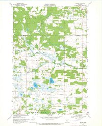
 1969 Sebeka SW1971 Print · USGSOtter Tail County remains a landscape of wetlands and watercourses in the late sixties. Researchers can find family history sites like Hay Creek Cem and Pioneer Cem alongside the winding Leaf River.
 - 1969 Map of Eagle Lake, 1971 Print
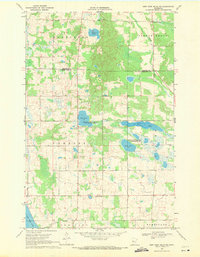
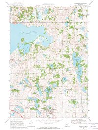
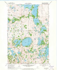 1969 Eagle Lake1971 Print · USGSOtter Tail County’s glacial lake country is meticulously detailed here in the late sixties. Genealogists and local historians can trace the locations of School No 1418, the Trefoldighed Menighed Ch, and the Evander Cem.2 unique versions available
 - 1969 Map of New York Mills NW, 1971 Print
 1969 New York Mills NW1971 Print · USGSOtter Tail and Becker counties meet in this 1960s survey of Minnesota lake country, where state wildlife areas preserve significant wetland habitats. Researchers can locate rural landmarks like St Johns Ch, Townhall, and the Spruce Grove Cem.
 - 1969 Map of Parkers Prairie NW, 1971 Print
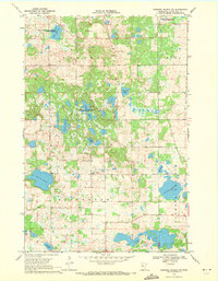 1969 Parkers Prairie NW1971 Print · USGSOtter Tail County’s glaciated terrain is preserved here as it appeared in the late sixties, showing a landscape defined by conservation and rural community hubs. Genealogists can locate Folden Ch, North Effington Ch, and the local Cem among the sprawling waters of Block Lake and Nelson Lake.
 - 1969 Map of Henning SE, 1971 Print
 1969 Henning SE1971 Print · USGSSoutheastern Otter Tail County in the late sixties is a landscape of glacial wetlands, wildlife management areas, and intersecting rail lines. Researchers can trace old family plots at Inman Cem or Trinity Cem and locate landmarks like the Northern Pacific railroad and Wing River Lake.
 - 1969 Map of Millerville, 1971 Print
 1969 Millerville1971 Print · USGSMillerville and the high ridges of the Leaf Mountains are captured here in the late sixties as the region’s landscape balanced agriculture with conservation. Local historians can trace family-named sites and landmarks like Trinity Ch, the Cem near Lake Moses, and the rural village of Urbank.
 - 1969 Map of Sebeka NW, 1971 Print
 1969 Sebeka NW1971 Print · USGSThe tri-county borderlands of Minnesota are preserved here in the late sixties, showing a landscape of small townships and drainage networks. Genealogists can locate family-named landmarks and rural institutions like Runeberg Ch, White Oak Sch, and Grace Cem.
 - 1969 Map of Heinola, 1971 Print
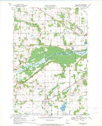
 1969 Heinola1971 Print · USGSOtter Tail County's glacial landscape is seen here in the late sixties, showcasing the interconnected waters of the Leaf Lakes. Local historians can locate specific landmarks like School No 135, Leaf Lake Ch, and the rural settlement of Heinola.
 - 1969 Map of Rose City, 1971 Print
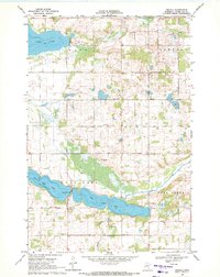
 1969 Rose City1971 Print · USGSIn the late sixties, this portion of Douglas County was a landscape of managed wildlife areas and small rural settlements. Researchers can locate the Rose City community and trace historical burials at the Esther Ch Cemetery or the Scribner Cemetery.
 - 1969 Map of New York Mills West, 1971 Print
 1969 New York Mills West1971 Print · USGSOtter Tail County in the late sixties reveals a landscape shaped by the Burlington Northern rail line and the vast Big Pine Lake. Genealogists and local historians can trace the foundations of Richdale, the outskirts of New York Mills, and burials at Greenwood Cem.
 - 1969 Map of Wrightstown, 1971 Print
 1969 Wrightstown1971 Print · USGSWrightstown and the surrounding prairies of Otter Tail County are captured here in the late sixties during a period of steady rural life. Genealogists and local researchers can pinpoint the Oak Ridge Cemetery, Union Corner Church, and the winding course of South Bluff Creek.
 - 1969 Map of Wadena, 1971 Print
 1969 Wadena1971 Print · USGSThe Leaf River valley and the growing hub of Wadena are captured here in the late sixties as the region transitioned through the mid-century. Genealogists and local historians can trace the foundations of the community through sites like the Alliance Ch, Compton Cem, and the Burlington Northern rail corridor.
 - 1969 Map of Eagle Bend NW, 1971 Print
 1969 Eagle Bend NW1971 Print · USGSThe lake-strewn borderlands of Otter Tail and Todd counties are recorded here in the late sixties. Researchers can trace rural landmarks like the local Townhall and cemetery alongside the extensive Eastern Township State Wildlife Management Area.
 - 1969 Map of Deer Creek, 1971 Print
 1969 Deer Creek1971 Print · USGSDeer Creek and its surrounding townships are captured in the late sixties as the village functioned as a quiet rail and agricultural center. Researchers can trace family sites at Oak Hill Cem or Fairview Cem and follow the path of the Burlington Northern line.
 - 1969 Map of New York Mills East, 1971 Print
 1969 New York Mills East1971 Print · USGSOtter Tail County is captured here in the late sixties as the rail corridor and local townships were maturing. Genealogists can trace family lands across Homestead and Newton, or locate early sites like the settlement of Davies and New York Mills.
 - 1969 Map of Parkers Prairie, 1971 Print
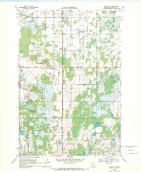
 1969 Parkers Prairie1971 Print · USGSOtter Tail County in the late sixties shows a landscape of glacial lakes and prairie settlements organized around the rail line. Genealogists and local historians can locate family plots at St Williams Cem or Swedish Cem and trace the Soo Line through Parkers Prairie.
 - 1969 Map of Inspiration Peak, 1971 Print
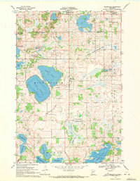
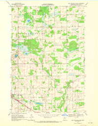
 1969 Inspiration Peak1971 Print · USGSThe glacial hills of Otter Tail County are mapped here in the late sixties, showing a landscape defined by water and high ridges. Researchers can locate family landmarks like the Leaf Mountain Ch, Mission Covenant Cem, and Inspiration Peak.
 - 1969 Map of Evansville, 1971 Print
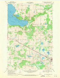
 1969 Evansville1971 Print · USGSThe glacial lake country of Douglas County is captured here in the late sixties as the rail lines were transitioning. Researchers can locate the Christina Lake Ch and Christina Lake Cem or trace the Old Railroad Grade near Evansville.
 - 1969 Map of Butler, 1971 Print
 1969 Butler1971 Print · USGSThe borderlands of Becker and Otter Tail Counties are shown here in the late sixties, where small rural communities like Butler and Hillview remain central to local life. Genealogists can trace family roots at Paddock-Bethel Cem or Holy Cross Ch along the Redeye River.
End of results
Showing maps 1-24 of 24
Top cities of Otter Tail County
- Fergus Falls historical maps
- Perham historical maps
- Pelican Rapids historical maps
- New York Mills historical maps
- Parkers Prairie historical maps
- Battle Lake historical maps
See more
Frequently asked questions
- What are the different types of historical maps available for Otter Tail County?
- What is the oldest map of Otter Tail County?
- Where can I purchase historical maps of Otter Tail County for my home or office?
- Where can I download high-res historical maps of Otter Tail County?
- Are there historical topographic maps available for Otter Tail County?
- Is there historical aerial imagery available for Otter Tail County?
- Where are historical maps of Otter Tail County sourced from?