1900s (20th Century) Maps of Eastern Township, Minnesota
Explore 9 historic maps of Eastern Township from the 1900s (20th Century). These maps offer a rare glimpse into what life looked like during the 1900s — showing old roads, neighborhoods, homes, and landmarks that have changed or disappeared over time.
Whether you're researching your family's past, planning a metal detecting trip, or studying how Eastern Township's landscape evolved across the 1900s, these high-resolution maps are a powerful tool for exploring the history of this region.
- Focus on a specific era: All maps on this page are from the 1900s, giving you a focused view of this time period.
- See what’s changed: Compare century-old streets, trails, and buildings to today's modern landscape using overlays and satellite layers.
- Research with precision: Use these maps for genealogy, historical research, land use analysis, or educational projects.
- View, download, or print: Maps are fully viewable online in high resolution, and can be downloaded or printed for your own records.
Start exploring Eastern Township's history through authentic maps from the 1900s. This is your window into the past.
Eastern Township, MN maps
(9)- 1953 Map of Brainerd, 1966 Print
 1953 Brainerd1966 Print · USGSCentral Minnesota's lake country and iron ranges are detailed in the mid-fifties, showing the intersection of industry and wilderness. Researchers can locate specific local landmarks like the Crow Wing County Courthouse or trace the early paths of the Soo Line Railroad and the Cuyuna Range Iron Mines.3 unique versions available
 - 1957 Map of Brainerd
 1957 Brainerd1957 Print · USGSNorth-central Minnesota's lake-rich landscape is captured in the mid-1950s as a crossroads of rail, river, and forest. Genealogists and historians can trace the paths of the Great Northern and Soo Line railroads through hubs like Brainerd, Wadena, and Detroit Lakes.
 - 1958 Map of Brainerd
 1958 Brainerd1958 Print · USGSCentral Minnesota in the late fifties is a landscape of dense lake chains, rail hubs, and sprawling state forests. Genealogists and local historians can trace old property alignments near the Mississippi River or locate family sites in Brainerd, Little Falls, and Detroit Lakes.
 - 1965 Map of Brainerd
 1965 Brainerd1965 Print · USGSNorth-central Minnesota in the mid-fifties presents a complex landscape of sprawling lake systems and established rail corridors. Genealogists and historians can trace the growth of timber towns along the Northern Pacific RR and explore early borders of the White Earth Indian Reservation or Tamarac National Wildlife Refuge.
 - 1969 Map of Lake Miltona East, 1971 Print
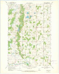
 1969 Lake Miltona East1971 Print · USGSDouglas County’s lake country is captured here in the late sixties as the area balanced recreation with local industry and conservation. Genealogists and historians can locate the Miltona settlement, St Pauls Ch, and family sites near Lake Irene.
 - 1969 Map of Rose City, 1971 Print
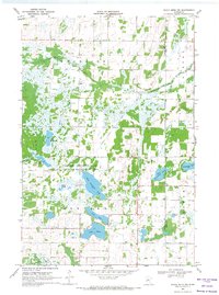
 1969 Rose City1971 Print · USGSIn the late sixties, this portion of Douglas County was a landscape of managed wildlife areas and small rural settlements. Researchers can locate the Rose City community and trace historical burials at the Esther Ch Cemetery or the Scribner Cemetery.
 - 1969 Map of Eagle Bend NW, 1971 Print
 1969 Eagle Bend NW1971 Print · USGSThe lake-strewn borderlands of Otter Tail and Todd counties are recorded here in the late sixties. Researchers can trace rural landmarks like the local Townhall and cemetery alongside the extensive Eastern Township State Wildlife Management Area.
 - 1969 Map of Parkers Prairie, 1971 Print
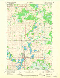 1969 Parkers Prairie1971 Print · USGSOtter Tail County in the late sixties shows a landscape of glacial lakes and prairie settlements organized around the rail line. Genealogists and local historians can locate family plots at St Williams Cem or Swedish Cem and trace the Soo Line through Parkers Prairie.
 - 1986 Map of Battle Lake
 1986 Battle Lake1986 Print · USGSMinnesota's lake-rich glacial heartland is captured in the mid-1980s, showcasing a landscape defined by water and rail. Genealogists and collectors can trace the rural sections around Battle Lake and Parkers Prairie or locate family sites near Otter Tail Lake and Clitherall.2 unique versions available
End of results
Showing maps 1-9 of 9
Top cities near Eastern Township
- Alexandria historical maps
- Parkers Prairie historical maps
- Henning historical maps
- Eagle Bend historical maps
- Belle River historical maps
- Bertha historical maps
See more
Frequently asked questions
- What are the different types of historical maps available for Eastern Township?
- What is the oldest map of Eastern Township?
- Where can I purchase historical maps of Eastern Township for my home or office?
- Where can I download high-res historical maps of Eastern Township?
- Are there historical topographic maps available for Eastern Township?
- Is there historical aerial imagery available for Eastern Township?
- Where are historical maps of Eastern Township sourced from?