2020s Maps of Elizabeth, Minnesota
Explore 2 historic maps of Elizabeth from the 2020s. These maps offer a rare glimpse into what life looked like during the 2020s — showing old roads, neighborhoods, homes, and landmarks that have changed or disappeared over time.
Whether you're researching your family's past, planning a metal detecting trip, or studying how Elizabeth's landscape evolved across the 2020s, these high-resolution maps are a powerful tool for exploring the history of this region.
- Focus on a specific era: All maps on this page are from the 2020s, giving you a focused view of this time period.
- See what’s changed: Compare century-old streets, trails, and buildings to today's modern landscape using overlays and satellite layers.
- Research with precision: Use these maps for genealogy, historical research, land use analysis, or educational projects.
- View, download, or print: Maps are fully viewable online in high resolution, and can be downloaded or printed for your own records.
Start exploring Elizabeth's history through authentic maps from the 2020s. This is your window into the past.
Elizabeth, MN maps
(2)- 2022 Map of Erhard, 2022 Print
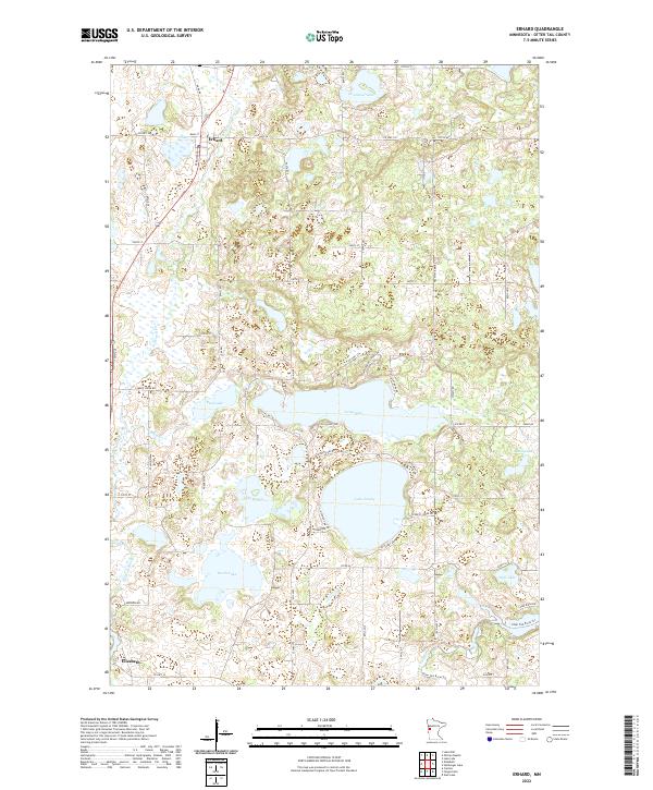 2022 Erhard2022 Print · USGSOtter Tail County's lake-strewn landscape is captured here in the early 2020s, showing the settlements of Erhard and Elizabeth. Genealogists and locals can trace the rural road networks surrounding Lake Jewett, Grandrud Lake, and the winding Pelican River.
 - 2022 Map of Elizabeth, 2022 Print
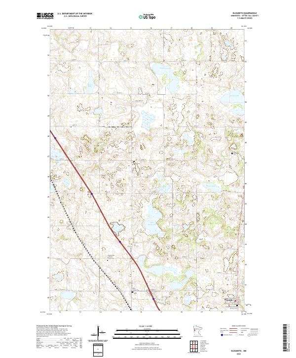 2022 Elizabeth2022 Print · USGSOtter Tail County's lake country and its deep Scandinavian roots are on display in this contemporary survey of the area around Elizabeth. Genealogists and local historians can locate several rural parish sites, including Old Friborg Cem and Hedemarken Lutheran Church Cem.
End of results
Showing maps 1-2 of 2
Top cities near Elizabeth
- Fergus Falls historical maps
- Pelican Rapids historical maps
- Rothsay historical maps
- Dalton historical maps
- Carlisle historical maps
- Erhard historical maps
See more
Frequently asked questions
- What are the different types of historical maps available for Elizabeth?
- What is the oldest map of Elizabeth?
- Where can I purchase historical maps of Elizabeth for my home or office?
- Where can I download high-res historical maps of Elizabeth?
- Are there historical topographic maps available for Elizabeth?
- Is there historical aerial imagery available for Elizabeth?
- Where are historical maps of Elizabeth sourced from?