2020s Maps of Everts Township, Minnesota
Explore 2 historic maps of Everts Township from the 2020s. These maps offer a rare glimpse into what life looked like during the 2020s — showing old roads, neighborhoods, homes, and landmarks that have changed or disappeared over time.
Whether you're researching your family's past, planning a metal detecting trip, or studying how Everts Township's landscape evolved across the 2020s, these high-resolution maps are a powerful tool for exploring the history of this region.
- Focus on a specific era: All maps on this page are from the 2020s, giving you a focused view of this time period.
- See what’s changed: Compare century-old streets, trails, and buildings to today's modern landscape using overlays and satellite layers.
- Research with precision: Use these maps for genealogy, historical research, land use analysis, or educational projects.
- View, download, or print: Maps are fully viewable online in high resolution, and can be downloaded or printed for your own records.
Start exploring Everts Township's history through authentic maps from the 2020s. This is your window into the past.
Everts Township, MN maps
(2)- 2022 Map of Underwood, 2022 Print
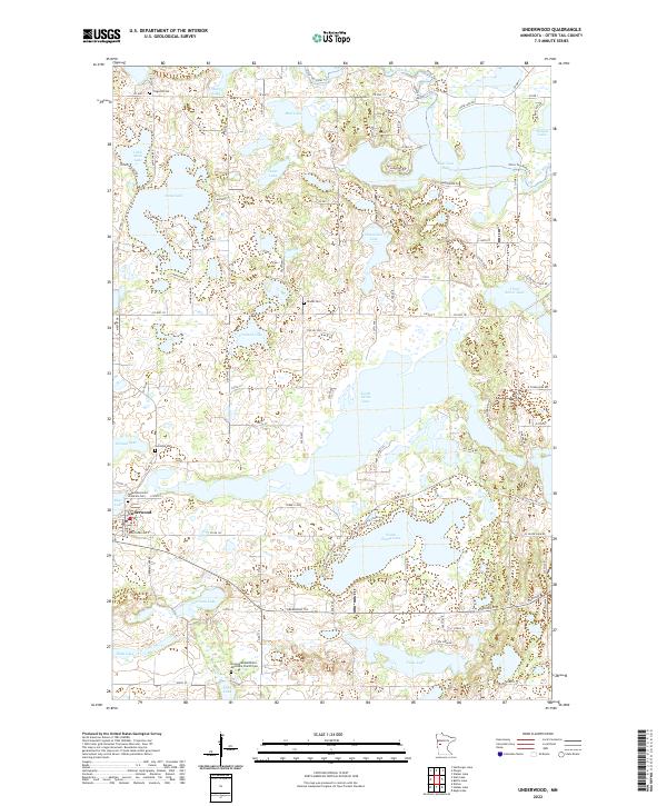 2022 Underwood2022 Print · USGSThe lakeside community of Underwood and the surrounding township lands are documented here in the early 2020s. Researchers can locate several historical burial sites including Sverdrup Cem and the Norwegian Methodist Episcopal Church Cem near Long Lake.
 - 2022 Map of Battle Lake, 2022 Print
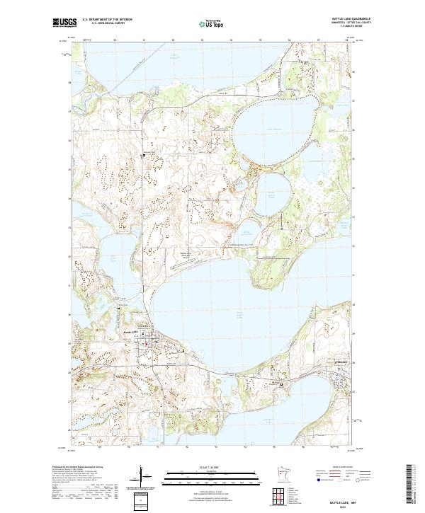 2022 Battle Lake2022 Print · USGSThe lakeside communities of Otter Tail County are mapped here in the early 2020s, showing a landscape defined by seasonal homes and rural tradition. Researchers can trace local lineage at Lakewood Cem or locate the historic First Evangelical Lutheran Church near the shores of West Battle Lake.
End of results
Showing maps 1-2 of 2
Top cities near Everts Township
- Battle Lake historical maps
- Maine historical maps
- Ottertail historical maps
- Amor historical maps
- Underwood historical maps
- Dalton historical maps
See more
Frequently asked questions
- What are the different types of historical maps available for Everts Township?
- What is the oldest map of Everts Township?
- Where can I purchase historical maps of Everts Township for my home or office?
- Where can I download high-res historical maps of Everts Township?
- Are there historical topographic maps available for Everts Township?
- Is there historical aerial imagery available for Everts Township?
- Where are historical maps of Everts Township sourced from?