2020s Maps of Wilma Township, Minnesota
Explore 4 historic maps of Wilma Township from the 2020s. These maps offer a rare glimpse into what life looked like during the 2020s — showing old roads, neighborhoods, homes, and landmarks that have changed or disappeared over time.
Whether you're researching your family's past, planning a metal detecting trip, or studying how Wilma Township's landscape evolved across the 2020s, these high-resolution maps are a powerful tool for exploring the history of this region.
- Focus on a specific era: All maps on this page are from the 2020s, giving you a focused view of this time period.
- See what’s changed: Compare century-old streets, trails, and buildings to today's modern landscape using overlays and satellite layers.
- Research with precision: Use these maps for genealogy, historical research, land use analysis, or educational projects.
- View, download, or print: Maps are fully viewable online in high resolution, and can be downloaded or printed for your own records.
Start exploring Wilma Township's history through authentic maps from the 2020s. This is your window into the past.
Wilma Township, MN maps
(4)- 2022 Map of Danbury West, 2022 Print
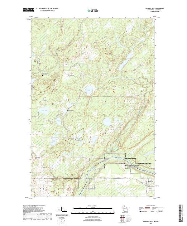 2022 Danbury West2022 Print · USGSThe St. Croix river valley is preserved here in the early twenty-first century as it forms the state line. Genealogists can locate the Native American Burial Grounds, Lena Lake Cem, and Saint Croix Landing.
 - 2022 Map of Ox Creek, 2022 Print
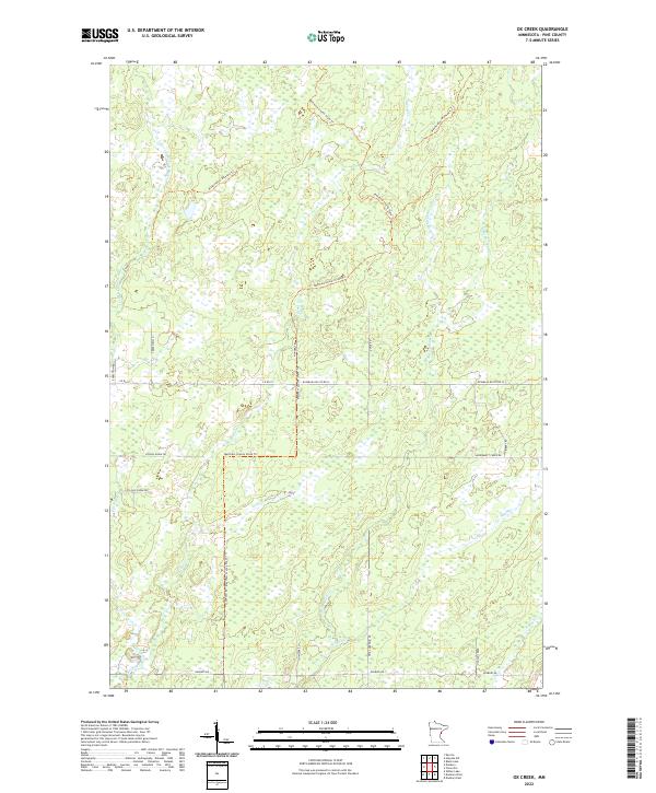 2022 Ox Creek2022 Print · USGSPine County’s wetland and trail networks are meticulously detailed in this recent survey of the Ox Creek area. Researchers can trace historical routes and local drainage along Matthew Lourey State Trl, Ox Cr, and School House Dr.
 - 2022 Map of Wilbur Lake, 2022 Print
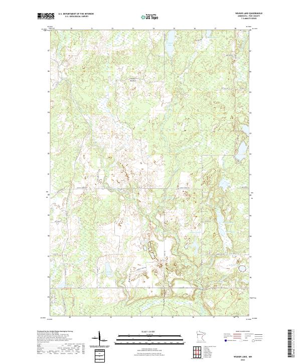 2022 Wilbur Lake2022 Print · USGSPine County’s wetland interior is showcased here as it appeared in recent years, dominated by a vast network of creeks and small lakes. Researchers can trace local names and trails through the marshes, from Wilbur Lake and Lake Five to the Thunder Meadow region.
 - 2022 Map of Duxbury, 2022 Print
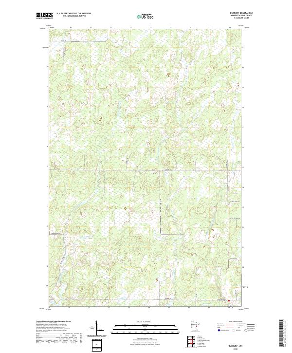 2022 Duxbury2022 Print · USGSDuxbury and the surrounding Pine County wetlands are documented here in the early 21st century. Researchers can trace rural family-named routes like Monette Rd and the drainage of the Lower Tamarack River near the settlement of Duxbury.
End of results
Showing maps 1-4 of 4
Top cities near Wilma Township
- Webster historical maps
- Dairyland historical maps
- Bruno historical maps
- Kerrick historical maps
- Kingsdale historical maps
Top neighborhoods of Wilma Township
Frequently asked questions
- What are the different types of historical maps available for Wilma Township?
- What is the oldest map of Wilma Township?
- Where can I purchase historical maps of Wilma Township for my home or office?
- Where can I download high-res historical maps of Wilma Township?
- Are there historical topographic maps available for Wilma Township?
- Is there historical aerial imagery available for Wilma Township?
- Where are historical maps of Wilma Township sourced from?