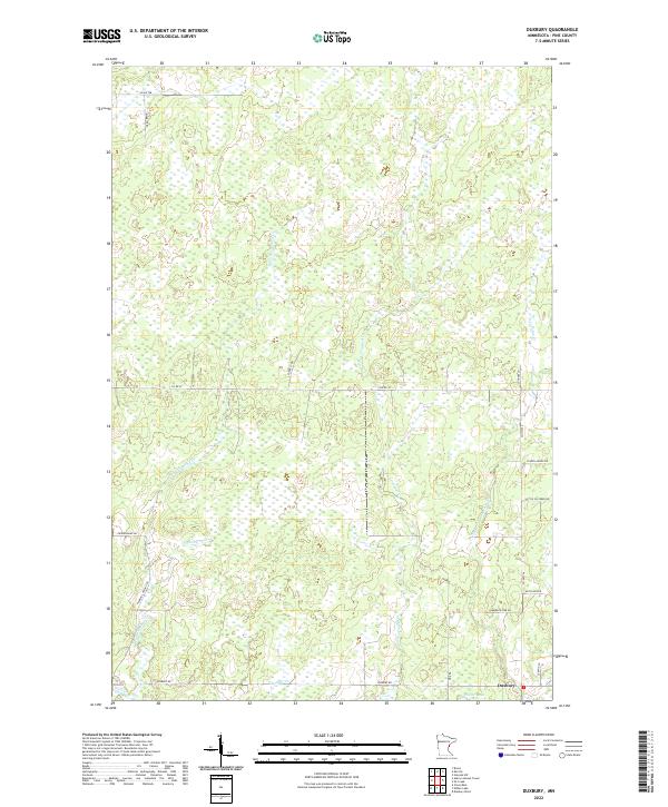
2022 Map of Duxbury
USGS Topo · Published 2022About this map
Duxbury anchors the southeast corner of this northern Minnesota landscape, where the Lower Tamarack River and Thunder Cr converge amidst a dense network of wetlands and small tributaries. The drainage patterns of the W Fork Crooked Cr and E Fork Crooked Cr dominate the central terrain, illustrating the hydrologic character of Pine County. This survey reveals a landscape defined by its waterways and logging history, with numerous forest roads and tracks such as Fleming Logging Rd and Forrest Rd cutting through the township lines. Small basins like Dollar Lake sit near the settlement, while family-named routes like Monette Rd and Friesendahl Rd provide clues for local historians and genealogists tracking the development of these rural townships in the early 21st century.
Find a feature on this map
30 named features on this map. Tap any name to fly to it.
Don’t see what you’re looking for? This feature index may not catch every label — zoom into the map to look around manually.
Map Details
Editions of this 2022 Duxbury Map
This is the sole edition of this map. No revisions or reprints were ever made.
Other maps of this area

1949 · Danbury
USGS Topo · 1:48,000

1949 · Holyoke
USGS Topo · 1:48,000

1953 · Duluth
USGS Topo · 1:250,000

1958 · Duluth
USGS Topo · 1:250,000

1962 · Holyoke
USGS Topo · 1:62,500

1962 · Bruno
USGS Topo · 1:62,500

1962 · Cloverdale
USGS Topo · 1:62,500

1962 · Danbury
USGS Topo · 1:62,500

1980 · Sandstone
USGS Topo · 1:100,000
1981 · Cloverdale
USGS Topo · 1:24,000