
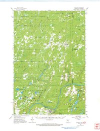
1962 Map of Danbury
USGS Topo · Published 1964About this map
Danbury serves as the focal point for this 1962 survey of the upper St Croix River region, where the state boundary between Minnesota and Wisconsin follows the river's winding path. The landscape is characterized by heavy timber and extensive wetlands, preserved within the Nemadji State Forest, St Croix State Forest, and St Croix State Park. These public lands suggest a mid-century shift toward recreation and conservation in a territory once dominated by the timber industry and the Soo Line railroad, which connects the small settlements of Kingsdale and Cloverton.
Find a feature on this map
64 named features on this map. Tap any name to fly to it.
Don’t see what you’re looking for? This feature index may not catch every label — zoom into the map to look around manually.
Map Details
Editions of this 1962 Danbury Map
2 editions found
Other maps of this area

1949 · Danbury
USGS Topo · 1:48,000

1949 · Hertel
USGS Topo · 1:48,000

1949 · Holyoke
USGS Topo · 1:48,000

1949 · Webb Lake
USGS Topo · 1:48,000

1949 · Patzau
USGS Topo · 1:48,000

1950 · Webster
USGS Topo · 1:48,000

1950 · Grantsburg
USGS Topo · 1:48,000

1953 · Duluth
USGS Topo · 1:250,000

1953 · Stillwater
USGS Topo · 1:250,000

1955 · Hertel
USGS Topo · 1:62,500