
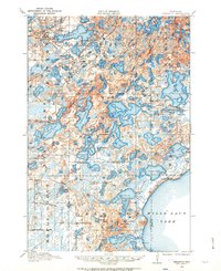
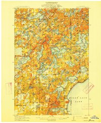
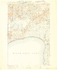
1958 Map of Duluth
USGS Topo · Published 1958About this map
The industrial and transportation hub of Duluth and Superior anchors this mid-century survey of the western tip of Lake Superior. The landscape reflects a complex network of rail and river routes, with the Great Northern and Soo Line railroads threading through the timberlands and wetlands of northern Minnesota and Wisconsin. To the west, the massive expanse of Mille Lacs Lake and the Mille Lacs Indian Reservation contrast with the rugged logging and iron ore country further north and east. The map captures an era when river-town economies like Sandstone and Hinckley were deeply integrated with the surrounding forests, preserved in large tracts such as the Savanna State Forest and the Rice Lake National Wildlife Refuge. The confluence of the Mississippi River and the St Louis River watersheds highlights the geographic significance of this region as a crossroads for continental trade and wildlife conservation.
Find a feature on this map
219 named features on this map. Tap any name to fly to it.
Don’t see what you’re looking for? This feature index may not catch every label — zoom into the map to look around manually.
Map Details
Editions of this 1958 Duluth Map
This is the sole edition of this map. No revisions or reprints were ever made.
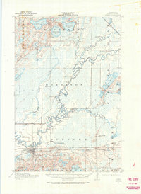
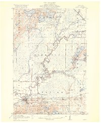
Other maps of this area

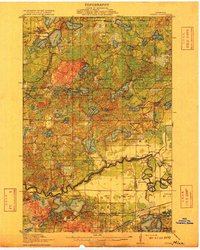
1895 · Duluth
USGS Topo · 1:62,500
1912 · Deerwood
USGS Topo · 1:62,500

1913 · Cuyuna
USGS Topo · 1:62,500
1914 · Deerwood
USGS Topo · 1:62,500
1914 · Aitkin
USGS Topo · 1:62,500

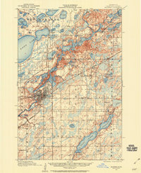
1915 · Superior
USGS Topo · 1:48,000
1915 · Aitkin
USGS Topo · 1:62,500
1915 · Cuyuna
USGS Topo · 1:62,500
1915 · Brainerd
USGS Topo · 1:62,500
1916 · Wealthwood
USGS Topo · 1:62,500