2020s Maps of Pipestone County, Minnesota
Explore 16 historic maps of Pipestone County from the 2020s. These maps offer a rare glimpse into what life looked like during the 2020s — showing old roads, neighborhoods, homes, and landmarks that have changed or disappeared over time.
Whether you're researching your family's past, planning a metal detecting trip, or studying how Pipestone County's landscape evolved across the 2020s, these high-resolution maps are a powerful tool for exploring the history of this region.
- Focus on a specific era: All maps on this page are from the 2020s, giving you a focused view of this time period.
- See what’s changed: Compare century-old streets, trails, and buildings to today's modern landscape using overlays and satellite layers.
- Research with precision: Use these maps for genealogy, historical research, land use analysis, or educational projects.
- View, download, or print: Maps are fully viewable online in high resolution, and can be downloaded or printed for your own records.
Start exploring Pipestone County's history through authentic maps from the 2020s. This is your window into the past.
Pipestone County, MN maps
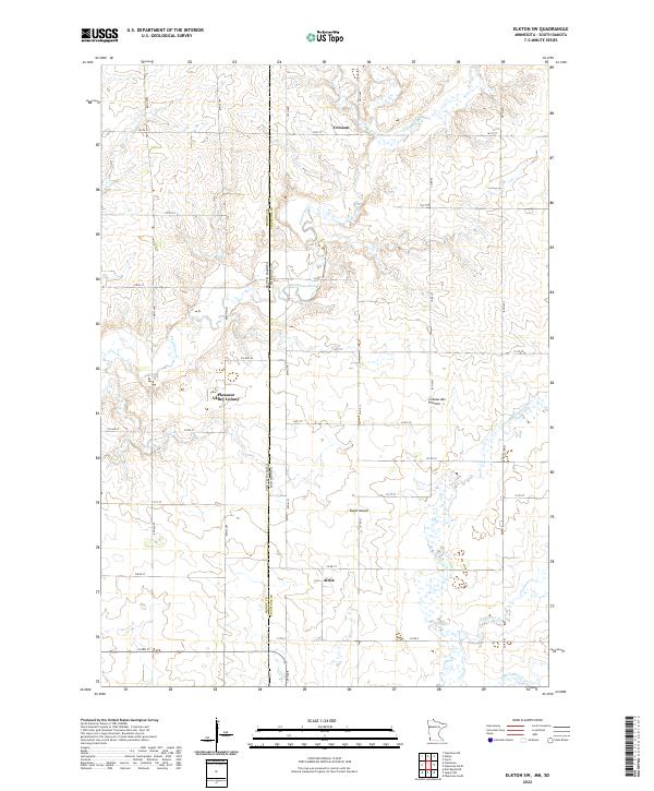
(16)- 2021 Map of Elkton, 2021 Print
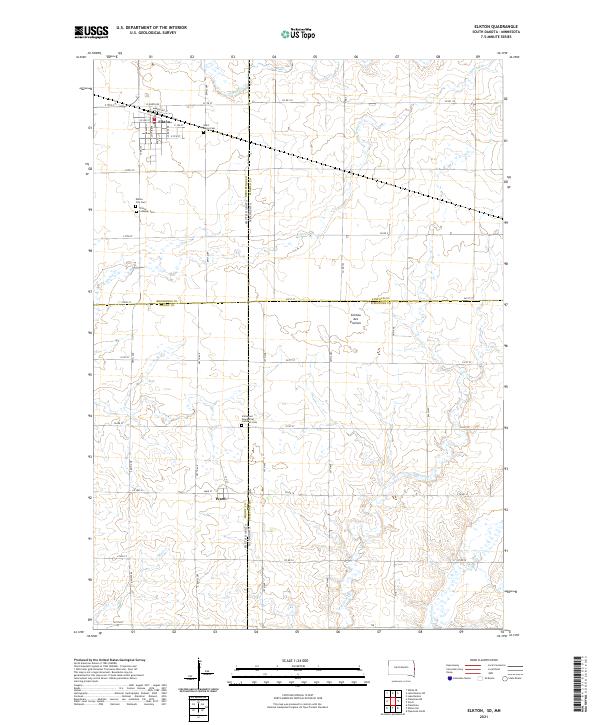 2021 Elkton2021 Print · USGSThe South Dakota and Minnesota border comes alive in this survey of the high plateau region. Genealogists and local historians can trace the foundations of Elkton and Ward while locating historic burial sites like Saint Marys Cem and Trinity Lutheran Cem.
 - 2022 Map of Kenneth, 2022 Print
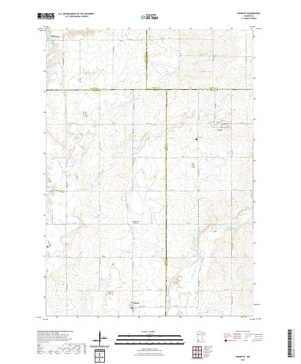 2022 Kenneth2022 Print · USGSSouthwestern Minnesota prairie life is captured here in the early 2020s, showing the intersection of four counties atop the Coteau des Prairies. Genealogists and local historians can trace the rural layouts of Kenneth and Leota, including the location of the Leota Cem.
 - 2022 Map of Edgerton South, 2022 Print
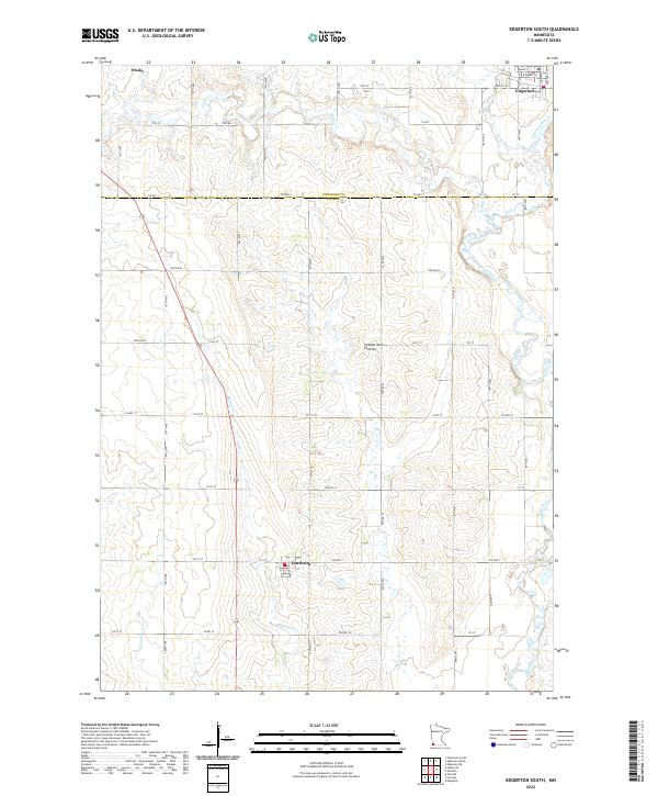 2022 Edgerton South2022 Print · USGSThe high prairie plateau of southwestern Minnesota is captured here in the early 2020s, showing a land defined by its agricultural grid. Trace local roots and farmsteads near Edgerton, Hardwick, or along the banks of the Rock River and Mound Cr.
 - 2022 Map of Edgerton NE, 2022 Print
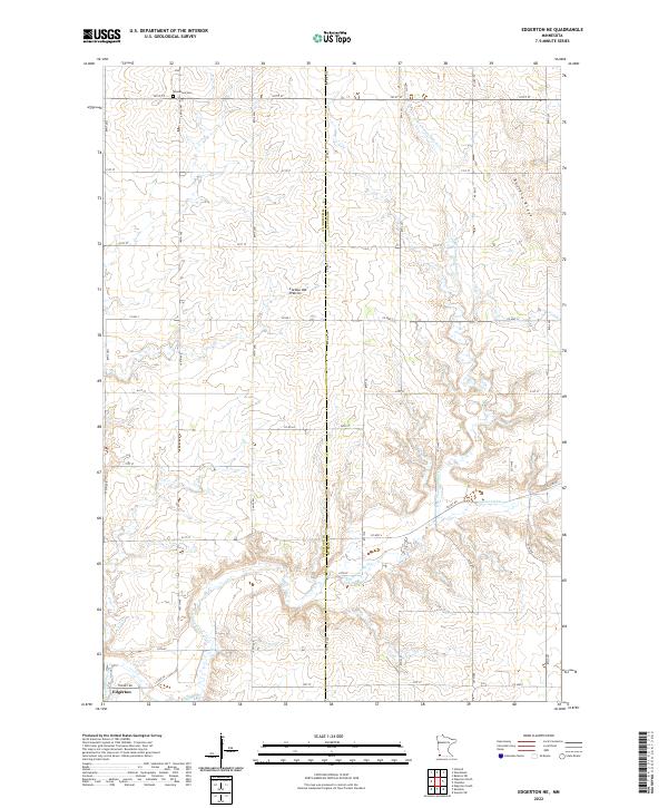 2022 Edgerton NE2022 Print · USGSMurray and Pipestone counties are captured here at the crest of the Buffalo Ridge during the early 2020s. Genealogists and local historians can trace family land near Woodstock Cem or follow the path of Chanarambie Cr toward Edgerton.
 - 2022 Map of Pipestone South, 2022 Print
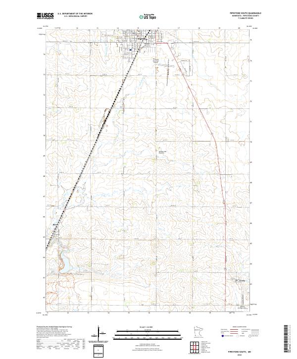 2022 Pipestone South2022 Print · USGSPipestone County, Minnesota, is captured in this recent survey, showcasing the established agricultural grid and small-town centers at the start of the 2020s. Researchers can locate the Pipestone County Courthouse and trace local waterways like Split Rock Cr and the Main Ditch.
 - 2022 Map of Woodstock, 2022 Print
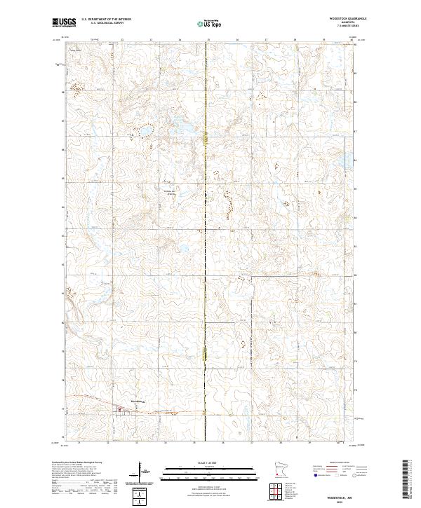 2022 Woodstock2022 Print · USGSWoodstock and the surrounding glacial uplands of Pipestone County are documented here in the early twenty-first century. Researchers can trace the local grid of range roads and find features like Engbarth Slough, Stony Point, and the Casey Jones State Trl.
 - 2022 Map of Verdi, 2022 Print
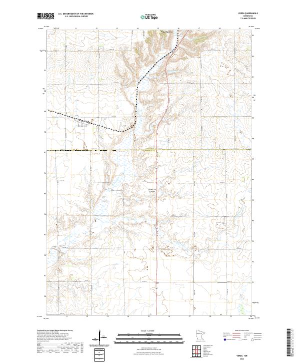 2022 Verdi2022 Print · USGSPipestone and Lincoln Counties are captured in this 2022 survey, showcasing the enduring rural character of the Coteau des Prairies. Researchers can trace the section lines and local roads surrounding Verdi and the winding course of Flandreau Cr.
 - 2022 Map of Pipestone North, 2022 Print
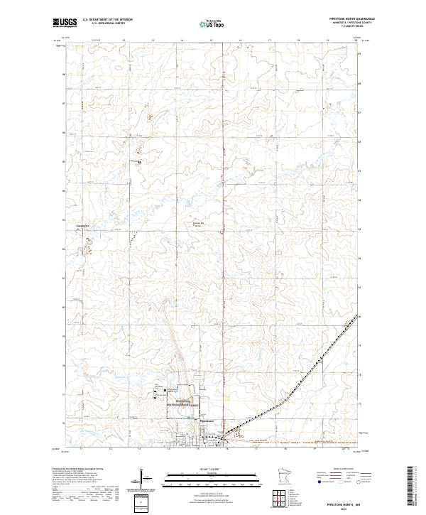 2022 Pipestone North2022 Print · USGSPipestone County at the start of the 2020s shows a landscape defined by prairie conservation and indigenous history. Trace local heritage at Troy Cem, the rural roads near Cazenovia, and the landmark Pipestone National Monument.
 - 2022 Map of Holland, 2022 Print
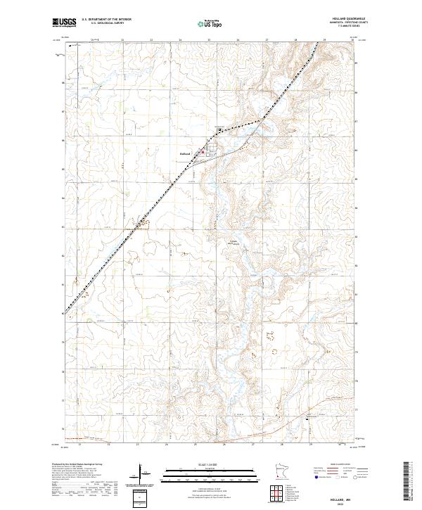 2022 Holland2022 Print · USGSPipestone County's agricultural highlands are showcased in this 2020s survey of Holland and the surrounding plateau. Trace local heritage at the Holland Cem or follow the recreational path of the Casey Jones State Trl along the old rail line.
 - 2022 Map of Ruthton NW, 2022 Print
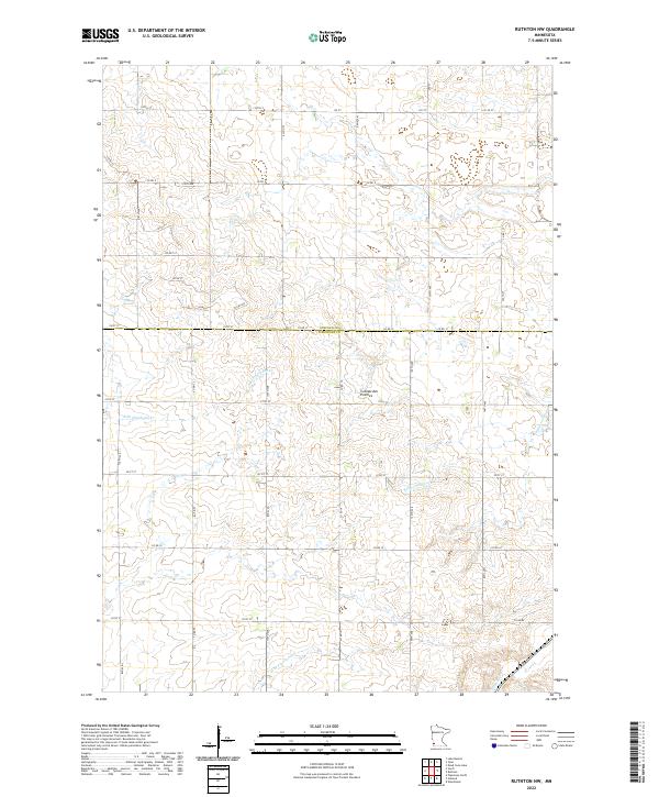 2022 Ruthton NW2022 Print · USGSSouthwest Minnesota's high plateau comes into focus in this contemporary survey of the rural divide between Lincoln and Pipestone Counties. Trace the headwaters of the Redwood River and Rock River as they flow across the Coteau des Prairies.
 - 2022 Map of Jasper SE, 2022 Print
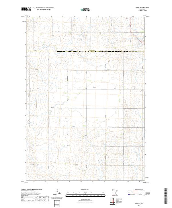 2022 Jasper SE2022 Print · USGSThe southwestern Minnesota uplands appear here in their modern agricultural form, centered on the high Coteau des Prairies. Genealogists and local historians can trace family locations near Rose Dell Cem and along the banks of Beaver Creek.
 - 2022 Map of Jasper NW, 2022 Print
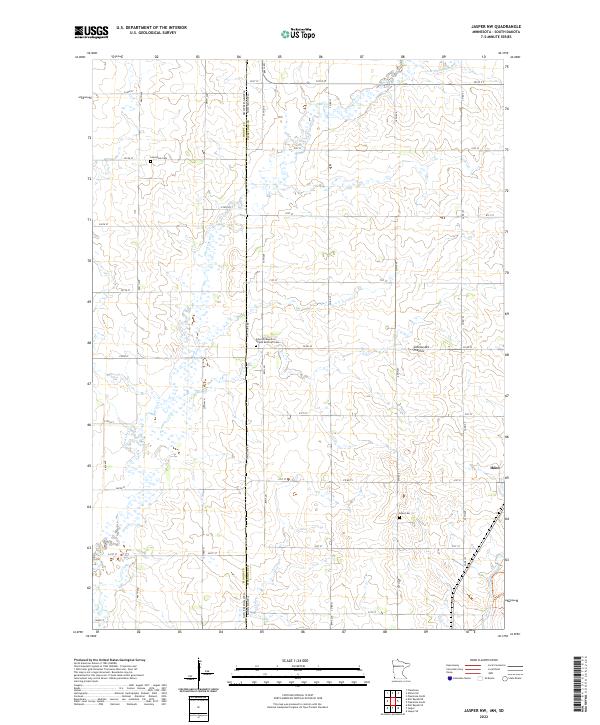 2022 Jasper NW2022 Print · USGSThe borderlands of Pipestone County and South Dakota are captured in this recent survey, showcasing a landscape of high prairie and established farmsteads. Researchers can trace family ties at Lone Rock Cem or explore the settlement at Ihlen and the Coteau des Prairies.
 - 2022 Map of Jasper, 2022 Print
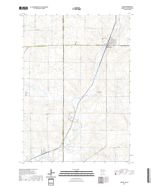 2022 Jasper2022 Print · USGSThe border between Minnesota and South Dakota comes alive on this survey of the northern prairie. Genealogists can locate family sites at Old Highland Cem or Rosendal Cem and trace the rail-aligned streets of Jasper and Sherman.
 - 2022 Map of Edgerton North, 2022 Print
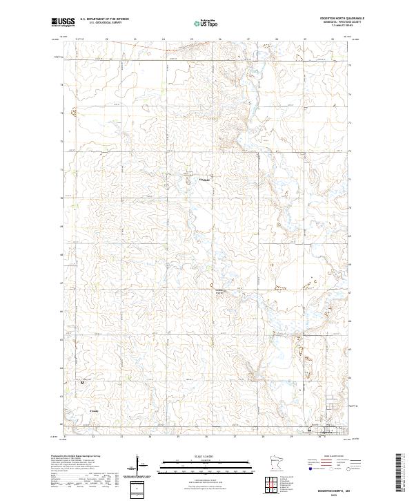 2022 Edgerton North2022 Print · USGSAgricultural life in Pipestone County is captured here in the early twenty-first century, showing the prairie landscape before it reaches the Iowa border. Researchers can trace family roots in Trosky, locate the Hillside Cem, and follow the path of the Rock River.
 - 2022 Map of Elkton SW, 2022 Print
 2022 Elkton SW2022 Print · USGSThe Minnesota and South Dakota border comes into focus in this recent survey of the Pipestone County farm country. Researchers can trace the rural layouts of Pleasant Valley Colony, Cresson, and Airlie along the high ground of the Coteau des Prairies.
 - 2022 Map of Ruthton, 2022 Print
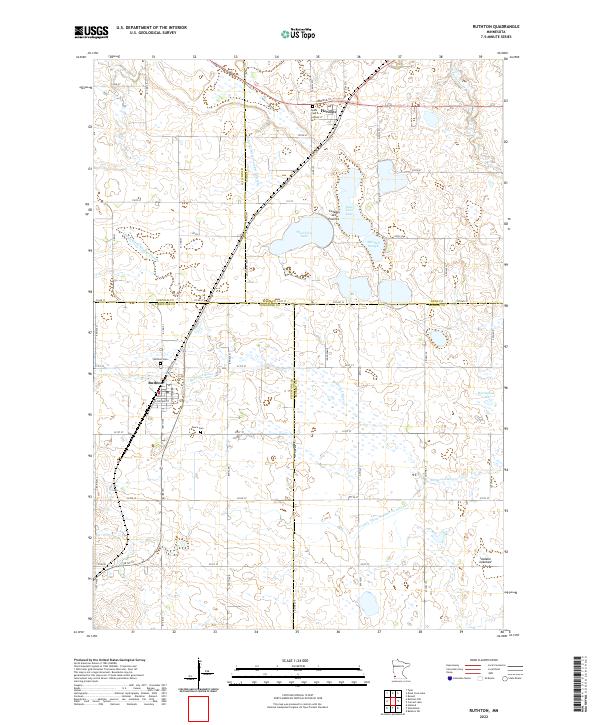 2022 Ruthton2022 Print · USGSThe upland prairie of southwestern Minnesota meets a complex network of glacial lakes and drainage ditches in the early twenty-first century. Genealogists and local researchers can trace the roads and landmarks of Ruthton and Florence, locating family sites at Opdal Cem or Peace Cem.
End of results
Showing maps 1-16 of 16
Top cities of Pipestone County
- Pipestone historical maps
- Edgerton historical maps
- Ruthton historical maps
- Holland historical maps
- Woodstock historical maps
- Ihlen historical maps
See more
Frequently asked questions
- What are the different types of historical maps available for Pipestone County?
- What is the oldest map of Pipestone County?
- Where can I purchase historical maps of Pipestone County for my home or office?
- Where can I download high-res historical maps of Pipestone County?
- Are there historical topographic maps available for Pipestone County?
- Is there historical aerial imagery available for Pipestone County?
- Where are historical maps of Pipestone County sourced from?