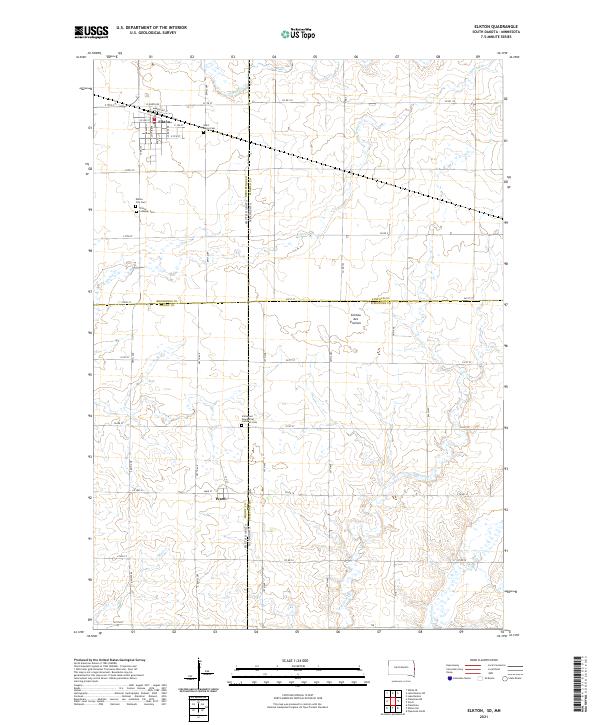
2021 Map of Elkton
USGS Topo · Published 2021About this map
The borderlands of South Dakota and Minnesota meet along the Coteau des Prairies, a vast plateau that defines the drainage patterns of this agricultural landscape. The city of Elkton serves as the primary hub, showing a grid of streets such as Beaver St and Buffalo St that reflect its early development. To the south, the smaller community of Ward sits near the headwaters of Mud Cr. The area is notably dense with early burial sites, providing a significant resource for genealogists researching families from Saint Marys Cem, Elkton City Cem, or the Immanuel Evangelical Lutheran Cem. Multiple waterways including Spring Cr and Flandreau Cr cut through the section lines, illustrating how the natural topography of the Coteau intersects with the rigid township and range system.
Find a feature on this map
48 named features on this map. Tap any name to fly to it.
Don’t see what you’re looking for? This feature index may not catch every label — zoom into the map to look around manually.
Map Details
Editions of this 2021 Elkton Map
This is the sole edition of this map. No revisions or reprints were ever made.
Other maps of this area

1953 · Watertown
USGS Topo · 1:250,000

1958 · Watertown
USGS Topo · 1:250,000

1967 · Pipestone North
USGS Topo · 1:24,000

1967 · Elkton SW
USGS Topo · 1:24,000

1967 · Verdi
USGS Topo · 1:24,000

1967 · Lake Benton
USGS Topo · 1:24,000

1967 · Lake Benton SW
USGS Topo · 1:24,000

1967 · Elkton
USGS Topo · 1:24,000

1972 · Flandreau NE
USGS Topo · 1:24,000
1972 · White SE
USGS Topo · 1:24,000