Old Maps of Pipestone County, Minnesota for Metal Detecting
Plan your next treasure hunt with 102 historic maps of Pipestone County. Find old homesites, ghost towns, trails, and gathering spots that may be lost to time — perfect for identifying promising metal detecting locations.
- Locate forgotten sites: Uncover places like long-lost settlements, abandoned rail lines, or gathering spots.
- Plan better hunts: Use map overlays combined with LiDAR or satellite views to narrow in on historically rich areas.
- Made for detectorists: Thousands of hobbyists use these maps to discover relics, coins, and hidden history.
Use these historic maps to boost your research and find new opportunities beneath the surface of Pipestone County.
Pipestone County, MN maps
(102)- 1953 Map of Watertown, 1968 Print
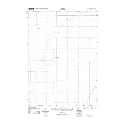
 1953 Watertown1968 Print · USGSEastern South Dakota and the Minnesota borderlands are captured here during the mid-twentieth century as the region's agricultural and rail-service centers thrived. Genealogists and local historians can trace family-named sites across the Coteau des Prairies and find landmarks in Watertown, De Smet, and Brookings.3 unique versions available
 - 1955 Map of Sioux Falls, 1967 Print
 1955 Sioux Falls1967 Print · USGSThe eastern South Dakota and western Minnesota borderlands come alive in the mid-fifties, showing the vital rail-to-river connections of the era. Genealogists can trace family footprints across townships like Madison and Pipestone, while following the paths of the Big Sioux River and the Chicago and North Western line.3 unique versions available
 - 1958 Map of Sioux Falls
 1958 Sioux Falls1958 Print · USGSThe tri-state borderlands of South Dakota, Minnesota, and Iowa are captured here during the mid-century peak of the regional rail network. Genealogists and historians can trace local landmarks like Augustana Academy, the St Marys Cem, and the path of the Illinois Central through Rock Rapids.
 - 1958 Map of Watertown
 1958 Watertown1958 Print · USGSThe eastern South Dakota prairie and the Minnesota borderlands are captured here in the late fifties, showcasing a landscape of terminal moraine lakes and burgeoning rail hubs. Genealogists and historians can trace the early paths of the Chicago and North Western railroad or locate family roots in Watertown, Clark, or the Sisseton Indian Reservation.2 unique versions available
 - 1967 Map of Edgerton South, 1968 Print
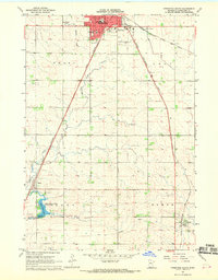
 1967 Edgerton South1968 Print · USGSPipestone and Rock Counties are captured in the late sixties, showing a landscape defined by the Chicago Rock Island and Pacific railroad. Genealogists and local historians can trace the town layouts of Edgerton and Hardwick, or locate family plots at Hillside Cem.
 - 1967 Map of Pipestone North, 1968 Print
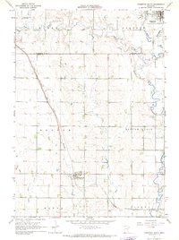
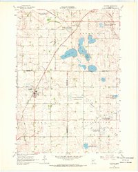
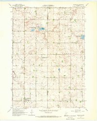
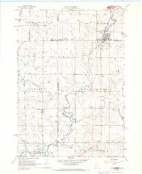
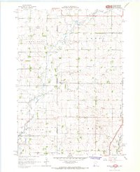
 1967 Pipestone North1968 Print · USGSPipestone, Minnesota and its surrounding prairies were a bustling railroad hub in the late sixties. Genealogists and local historians can trace the paths of three major rail lines and locate landmarks like Winnewissa Falls, St Leo Cem, and Cazenovia.2 unique versions available
 - 1967 Map of Edgerton North, 1968 Print
 1967 Edgerton North1968 Print · USGSPipestone County in the late sixties shows a landscape defined by the Milwaukee Road and steady agricultural life. Genealogists and historians can locate Trosky Cem, the small siding at Hatfield, and numerous Gravel Pits.
 - 1967 Map of Edgerton NE, 1968 Print
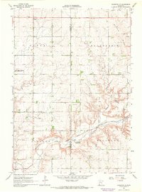 1967 Edgerton NE1968 Print · USGSSouthwestern Minnesota's prairie highlands come to life in the late sixties as agricultural townships and rail lines define the rural landscape. Researchers can locate the Woodstock Cemetery, trace the Milwaukee Road tracks, and find early landmarks like Diamond Corner.
 - 1967 Map of Ruthton, 1968 Print
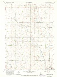
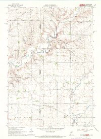
 1967 Ruthton1968 Print · USGSThe rail-and-river landscape of the Minnesota prairie comes into focus in the mid-1960s, centered on the settlements of Ruthton and Florence. Researchers can trace old family burial sites at Opdal Cem and Peace Cem or follow the path of the Great Northern railroad.
 - 1967 Map of Ruthton NW, 1968 Print
 1967 Ruthton NW1968 Print · USGSThe Pipestone and Lincoln county borderlands appear here in the late sixties as a thriving agricultural grid. Genealogists and historians can trace the Great Northern rail line, local landmarks like the Townhall, and the headwaters of the Redwood River.2 unique versions available
 - 1967 Map of Elkton SW, 1968 Print
 1967 Elkton SW1968 Print · USGSThe Minnesota and South Dakota borderlands come alive in this mid-sixties survey of Pipestone and Moody Counties. Researchers can trace the path of the Milwaukee Road through Airlie or locate the rural Fletcher Sch.2 unique versions available
 - 1967 Map of Kenneth, 1968 Print
 1967 Kenneth1968 Print · USGSAcross the prairie townships of southwest Minnesota in the 1960s, this survey shows the rail-and-road network connecting Kenneth and Leota. Genealogists and researchers can trace the Chicago Rock Island and Pacific rail line and locate the Leota Cem.
 - 1967 Map of Woodstock, 1968 Print
 1967 Woodstock1968 Print · USGSPipestone County's agricultural and conservation lands are captured here in the late sixties, centered on the village of Woodstock. Researchers can trace the path of the Old Railroad Grade and locate rural landmarks like School No 126 and the local Townhall.2 unique versions available
 - 1967 Map of Verdi, 1968 Print
 1967 Verdi1968 Print · USGSPipestone and Lincoln County farmland transitions from prairie to rail-side industry during the late sixties. Genealogists and local historians can trace the Chicago and North Western line through Verdi or locate the Altona State Wildlife Management Area.
 - 1967 Map of Jasper SE, 1968 Print
 1967 Jasper SE1968 Print · USGSRock County's rural townships are shown in detail during the late sixties, capturing the agricultural grid and rail infrastructure of the day. Genealogists can locate family landmarks such as Rose Dell Ch, the Townhall, and the Chicago Rock Island and Pacific railroad line.
 - 1967 Map of Pipestone South, 1968 Print
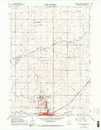
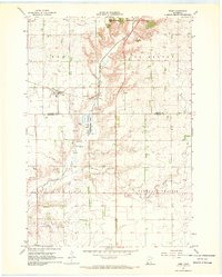
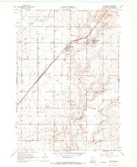
 1967 Pipestone South1968 Print · USGSPipestone and the surrounding prairie townships are captured here in the late sixties as a vital rail crossroads for three major lines. Genealogists and local historians can locate early schools like Dolson Hill Sch and the small settlements of Ihlen and Trosky.
 - 1967 Map of Jasper, 1968 Print
 1967 Jasper1968 Print · USGSThe tri-state border region of Minnesota and South Dakota was a busy rail and quarrying hub in the late sixties. Researchers can trace the Great Northern rail lines and locate family sites at Rosendal Cem or the village of Sherman.
 - 1967 Map of Jasper NW, 1968 Print
 1967 Jasper NW1968 Print · USGSThe borderlands of Minnesota and South Dakota are captured here in the late sixties, showing a landscape of family farms and rural townships. Researchers can trace local history at Lone Rock Ch, Eden Cem, and the old Townhall near Pipestone Creek.2 unique versions available
 - 1967 Map of Holland, 1969 Print
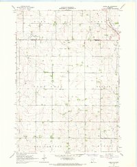
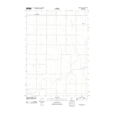
 1967 Holland1969 Print · USGSPipestone County's agricultural heartland is documented here in the late sixties, centered on the rail-aligned town of Holland. Researchers can locate several burial grounds like Luctor Cem and trace the path of the Great Northern railroad.
 - 1967 Map of Elkton, 1978 Print
 1967 Elkton1978 Print · USGSElkton sits at a bustling prairie rail junction on the South Dakota and Minnesota border during the late sixties. Genealogists and local researchers can locate St Marys Cem, trace the C & N W line, or follow the winding course of Medary Creek.
 - 1985 Map of Sioux Falls
 1985 Sioux Falls1985 Print · USGSIn the mid-1980s, the borderlands of South Dakota, Minnesota, and Iowa reveal a landscape shaped by the Big Sioux River and a growing urban hub. Researchers can trace the development of Sioux Falls and locate smaller communities like Dell Rapids, Garretson, and Valley Springs.2 unique versions available
 - 1985 Map of Brookings
 1985 Brookings1985 Print · USGSThe South Dakota and Minnesota borderlands in the mid-1980s are defined here by a network of prairie lakes and bustling rail corridors. Researchers can trace the path of the Chicago and North Western through Brookings or explore the numerous wetlands of Oakwood Lakes State Park.2 unique versions available
 - 2010 Map of Jasper NW, 2010 Print
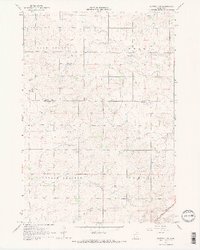
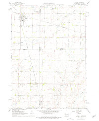
 2010 Jasper NW2010 Print · USGSCovers Pipestone County, including Ihlen, Alliance Township, and other nearby areas
 - 2010 Map of Edgerton North, 2010 Print
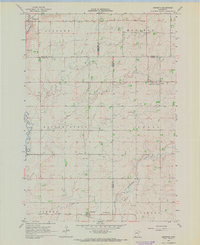
 2010 Edgerton North2010 Print · USGSCovers Pipestone County, including Edgerton, Trosky, and other nearby areas
 - 2010 Map of Edgerton NE, 2010 Print
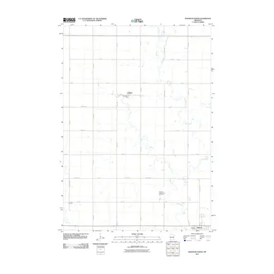
 2010 Edgerton NE2010 Print · USGSCovers Pipestone County, including Edgerton, Murray County, and other nearby areas
Showing maps 1-25 of 102
Top cities of Pipestone County
- Pipestone historical maps
- Edgerton historical maps
- Ruthton historical maps
- Holland historical maps
- Woodstock historical maps
- Ihlen historical maps
See more
Frequently asked questions
- What are the different types of historical maps available for Pipestone County?
- What is the oldest map of Pipestone County?
- Where can I purchase historical maps of Pipestone County for my home or office?
- Where can I download high-res historical maps of Pipestone County?
- Are there historical topographic maps available for Pipestone County?
- Is there historical aerial imagery available for Pipestone County?
- Where are historical maps of Pipestone County sourced from?