1960s Maps of Fosston, Minnesota
Explore 2 historic maps of Fosston from the 1960s. These maps offer a rare glimpse into what life looked like during the 1960s — showing old roads, neighborhoods, homes, and landmarks that have changed or disappeared over time.
Whether you're researching your family's past, planning a metal detecting trip, or studying how Fosston's landscape evolved across the 1960s, these high-resolution maps are a powerful tool for exploring the history of this region.
- Focus on a specific era: All maps on this page are from the 1960s, giving you a focused view of this time period.
- See what’s changed: Compare century-old streets, trails, and buildings to today's modern landscape using overlays and satellite layers.
- Research with precision: Use these maps for genealogy, historical research, land use analysis, or educational projects.
- View, download, or print: Maps are fully viewable online in high resolution, and can be downloaded or printed for your own records.
Start exploring Fosston's history through authentic maps from the 1960s. This is your window into the past.
Fosston, MN maps
(2)- 1969 Map of Fosston East, 1971 Print
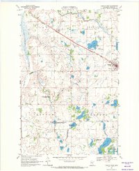
 1969 Fosston East1971 Print · USGSThe railroad towns of Fosston and Lengby anchor this late-sixties survey of Polk County's lake-rich landscape. Genealogists and historians can trace numerous rural landmarks, from Kingo Cem and Landstad Cem to the Poplar Lake Ch and the old Burlington Northern line.
 - 1969 Map of Fosston West, 1971 Print
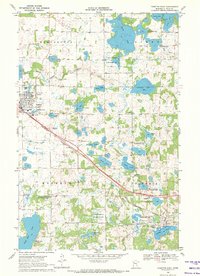
 1969 Fosston West1971 Print · USGSFosston and the surrounding prairie-pothole country of Polk County are shown in detail during the transition to the 1970s. Genealogists and local historians can trace rural landmarks like the Hansville Cemetery or follow the Burlington Northern tracks past the Drive-in Theater.2 unique versions available
End of results
Showing maps 1-2 of 2
Top cities near Fosston
- McIntosh historical maps
- Winger historical maps
- Gully historical maps
- Bejou historical maps
- Lengby historical maps
- Trail historical maps
Top neighborhoods of Fosston
Frequently asked questions
- What are the different types of historical maps available for Fosston?
- What is the oldest map of Fosston?
- Where can I purchase historical maps of Fosston for my home or office?
- Where can I download high-res historical maps of Fosston?
- Are there historical topographic maps available for Fosston?
- Is there historical aerial imagery available for Fosston?
- Where are historical maps of Fosston sourced from?