1980s Maps of Sherburne County, Minnesota
Explore 5 historic maps of Sherburne County from the 1980s. These maps offer a rare glimpse into what life looked like during the 1980s — showing old roads, neighborhoods, homes, and landmarks that have changed or disappeared over time.
Whether you're researching your family's past, planning a metal detecting trip, or studying how Sherburne County's landscape evolved across the 1980s, these high-resolution maps are a powerful tool for exploring the history of this region.
- Focus on a specific era: All maps on this page are from the 1980s, giving you a focused view of this time period.
- See what’s changed: Compare century-old streets, trails, and buildings to today's modern landscape using overlays and satellite layers.
- Research with precision: Use these maps for genealogy, historical research, land use analysis, or educational projects.
- View, download, or print: Maps are fully viewable online in high resolution, and can be downloaded or printed for your own records.
Start exploring Sherburne County's history through authentic maps from the 1980s. This is your window into the past.
Sherburne County, MN maps
(5)- 1981 Map of Rogers
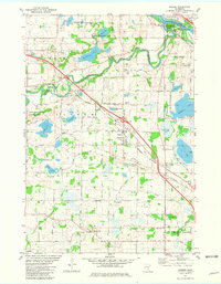 1981 Rogers1981 Print · USGSNorth of Minneapolis in the early eighties, this area shows the transition from rural farming to industrial and suburban growth. Genealogists can trace family names at St Walburga Cem, St John the Baptist Cem, and the historic St John Ch.2 unique versions available
 - 1985 Map of Mora
 1985 Mora1985 Print · USGSCentral Minnesota's river valleys and farming hubs are captured here in the mid-eighties, showing the region before significant modern expansion. Researchers can trace historic rail lines like the Burlington Northern and locate community landmarks in Mora, Milaca, and Princeton.
 - 1985 Map of Anoka
 1985 Anoka1985 Print · USGSThe northern Twin Cities suburbs and the Mississippi River valley are captured here in the mid-eighties as suburban growth began to meet rural conservation lands. Trace the expansion of Anoka and Blaine, or locate family landmarks near the Rum River and Buffalo Lake.
 - 1986 Map of St. Cloud
 1986 St. Cloud1986 Print · USGSCentral Minnesota in the mid-1980s reveals a landscape where river industry and growing highway corridors meet traditional farming communities. Researchers can trace the layout of small-town landmarks like St Wendel Ch and St Anna Cem or follow the path of the Sauk River as it winds toward the Mississippi.2 unique versions available
 - 1986 Map of Litchfield
 1986 Litchfield1986 Print · USGSCentral Minnesota in the mid-eighties was a landscape of conservation and transport, where the Burlington Northern rail line connected thriving lake towns. Genealogists and historians can trace old townships and landmarks like St Nicholas, Forest City, and School House Lake.2 unique versions available
End of results
Showing maps 1-5 of 5
Top cities of Sherburne County
Frequently asked questions
- What are the different types of historical maps available for Sherburne County?
- What is the oldest map of Sherburne County?
- Where can I purchase historical maps of Sherburne County for my home or office?
- Where can I download high-res historical maps of Sherburne County?
- Are there historical topographic maps available for Sherburne County?
- Is there historical aerial imagery available for Sherburne County?
- Where are historical maps of Sherburne County sourced from?