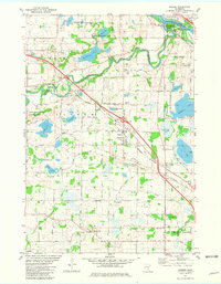
1981 Map of Rogers
USGS Topo · Published 1981About this map
The Mississippi River and Crow River converge in this northern Hennepin County landscape, creating a watery geography defined by Goodin Island and numerous glacial basins. The town of Rogers serves as a central hub, where the Burlington Northern railroad and Industrial Boulevard cut through a mix of developing residential blocks and traditional agricultural land. Significant local history is preserved at the St Walburga Sch and St Walburga Cem near the settlement of Fletcher, alongside several other parish cemeteries that mark the area's early community roots.
Find a feature on this map
54 named features on this map. Tap any name to fly to it.
Don’t see what you’re looking for? This feature index may not catch every label — zoom into the map to look around manually.
Map Details
Editions of this 1981 Rogers Map
2 editions found
Other maps of this area

1902 · Anoka
USGS Topo · 1:62,500

1909 · Rockford
USGS Topo · 1:62,500

1916 · St. Francis
USGS Topo · 1:62,500

1919 · St. Francis
USGS Topo · 1:62,500

1953 · Stillwater
USGS Topo · 1:250,000

1955 · Osseo
USGS Topo · 1:24,000

1955 · Anoka
USGS Topo · 1:24,000

1955 · Anoka
USGS Topo · 1:62,500

1955 · Stillwater
USGS Topo · 1:250,000

1958 · Stillwater
USGS Topo · 1:250,000