2020s Maps of Maine Prairie Township, Minnesota
Explore 6 historic maps of Maine Prairie Township from the 2020s. These maps offer a rare glimpse into what life looked like during the 2020s — showing old roads, neighborhoods, homes, and landmarks that have changed or disappeared over time.
Whether you're researching your family's past, planning a metal detecting trip, or studying how Maine Prairie Township's landscape evolved across the 2020s, these high-resolution maps are a powerful tool for exploring the history of this region.
- Focus on a specific era: All maps on this page are from the 2020s, giving you a focused view of this time period.
- See what’s changed: Compare century-old streets, trails, and buildings to today's modern landscape using overlays and satellite layers.
- Research with precision: Use these maps for genealogy, historical research, land use analysis, or educational projects.
- View, download, or print: Maps are fully viewable online in high resolution, and can be downloaded or printed for your own records.
Start exploring Maine Prairie Township's history through authentic maps from the 2020s. This is your window into the past.
Maine Prairie Township, MN maps
(6)- 2022 Map of Saint Augusta, 2022 Print
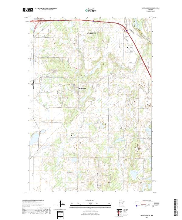 2022 Saint Augusta2022 Print · USGSThe rural lake country south of St. Cloud is captured here in the early 2020s as modern growth meets traditional farmsteads. Researchers can locate family sites and parish history at Saint Wendelin Cemetery, Gethsemane Cem, and the village of Luxemburg.
 - 2022 Map of Kimball, 2022 Print
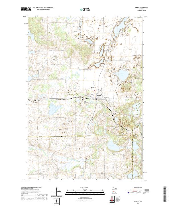 2022 Kimball2022 Print · USGSKimball and the surrounding lake country are captured in this recent survey of the Stearns and Meeker county borderlands. Researchers can trace local heritage at Saint Annes Cem or follow the winding Clearwater River as it passes near Lake Betsy and Scott Lake.
 - 2022 Map of Cold Spring, 2022 Print
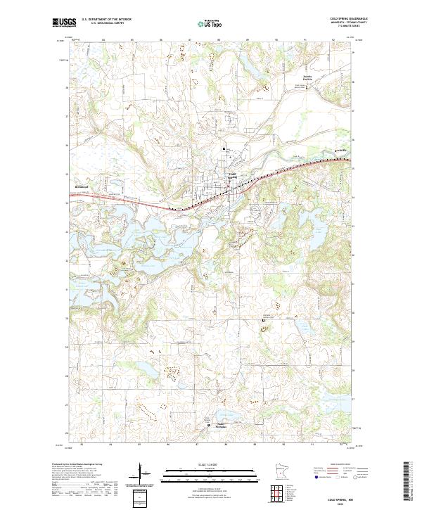 2022 Cold Spring2022 Print · USGSStearns County's lakelands and the Sauk River valley are shown here in the 2020s, highlighting the area's enduring religious and agricultural roots. Trace family history at Saint Boniface Cemetery or locate old homesteads near Saint Nicholas and Jacobs Prairie.
 - 2022 Map of South Haven, 2022 Print
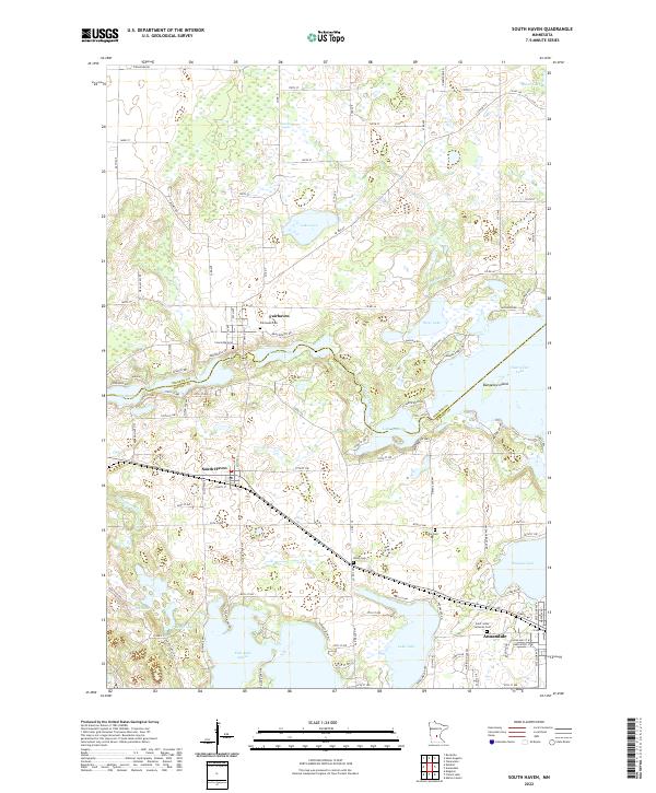 2022 South Haven2022 Print · USGSThe Stearns and Wright County borderlands in the early 2020s reveal a landscape defined by the Clearwater River and its glacial lakes. Genealogists and local historians can trace family roots through Fairhaven Cem, Union Cem, and Grace Cem.
 - 2022 Map of Watkins, 2022 Print
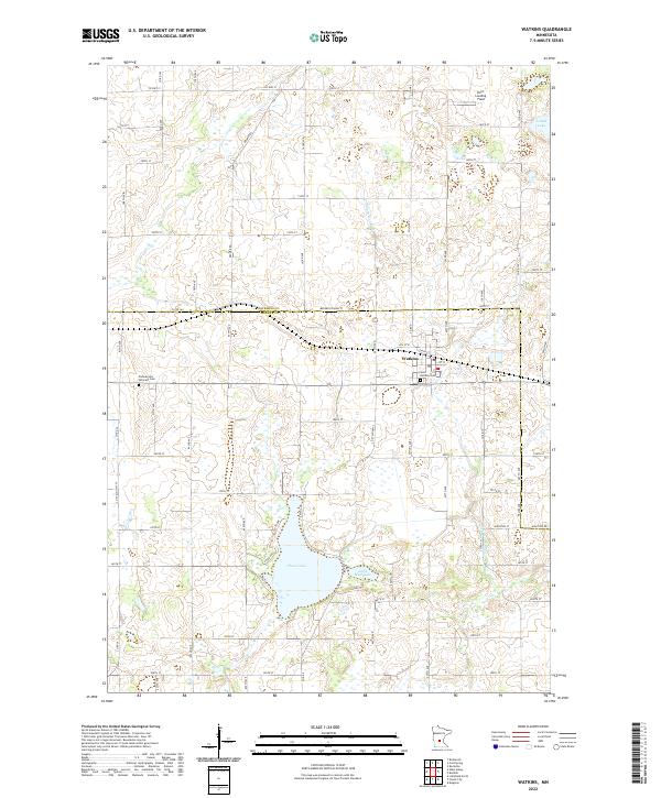 2022 Watkins2022 Print · USGSWatkins and the surrounding farm country on the Stearns and Meeker county line are documented in this recent survey. Researchers can locate local burial sites at Saint Anthony Cem or Pioneer and Veterans Cem and trace the shores of Clear Lake.
 - 2022 Map of Rockville, 2022 Print
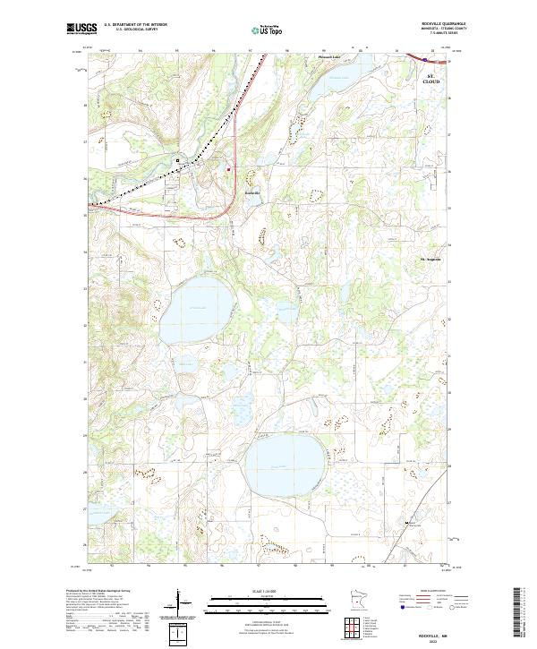 2022 Rockville2022 Print · USGSStearns County's glacial landscape and river valleys are captured here in the early twenty-first century. Researchers can trace family history at Maine Prairie Cem or study the shorelines of Pearl Lake and Grand Lake.
End of results
Showing maps 1-6 of 6
Top cities near Maine Prairie Township
- St. Cloud historical maps
- Saint Cloud historical maps
- Sauk Rapids historical maps
- Waite Park historical maps
- Litchfield historical maps
- Saint Joseph historical maps
See more
Top neighborhoods of Maine Prairie Township
Frequently asked questions
- What are the different types of historical maps available for Maine Prairie Township?
- What is the oldest map of Maine Prairie Township?
- Where can I purchase historical maps of Maine Prairie Township for my home or office?
- Where can I download high-res historical maps of Maine Prairie Township?
- Are there historical topographic maps available for Maine Prairie Township?
- Is there historical aerial imagery available for Maine Prairie Township?
- Where are historical maps of Maine Prairie Township sourced from?