2020s Maps of Steele County, Minnesota
Explore 16 historic maps of Steele County from the 2020s. These maps offer a rare glimpse into what life looked like during the 2020s — showing old roads, neighborhoods, homes, and landmarks that have changed or disappeared over time.
Whether you're researching your family's past, planning a metal detecting trip, or studying how Steele County's landscape evolved across the 2020s, these high-resolution maps are a powerful tool for exploring the history of this region.
- Focus on a specific era: All maps on this page are from the 2020s, giving you a focused view of this time period.
- See what’s changed: Compare century-old streets, trails, and buildings to today's modern landscape using overlays and satellite layers.
- Research with precision: Use these maps for genealogy, historical research, land use analysis, or educational projects.
- View, download, or print: Maps are fully viewable online in high resolution, and can be downloaded or printed for your own records.
Start exploring Steele County's history through authentic maps from the 2020s. This is your window into the past.
Steele County, MN maps
(16)- 2022 Map of Steele Center, 2022 Print
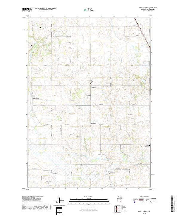 2022 Steele Center2022 Print · USGSSteele County's rural heartland is meticulously mapped in this recent survey of its historic crossroads and immigrant cemeteries. Genealogists and local historians can trace family roots through the Steele Center Lutheran Cem, Bohemian Cem, and the community of Litomysl.
 - 2022 Map of Hartland, 2022 Print
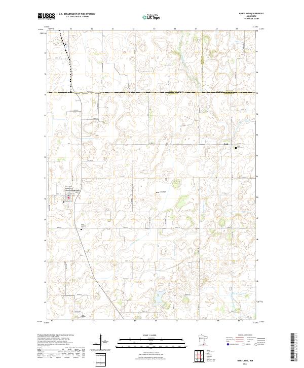 2022 Hartland2022 Print · USGSFreeborn County farming and water management are the focus of this recent survey of the Minnesota prairie. Researchers can locate family plots at Saint Aldens Cem or West Freeborn Cem and trace the drainage of the Mule Lakebed.
 - 2022 Map of Bixby, 2022 Print
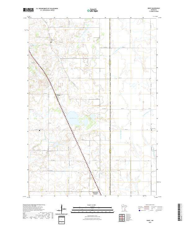 2022 Bixby2022 Print · USGSSouthern Minnesota farmland is mapped here just as the modern agricultural landscape was documented in 2022. Genealogists and local historians can trace family locations near Aurora Township Cem, Union Cem, and the rural settlement of Bixby.
 - 2022 Map of Hollandale, 2022 Print
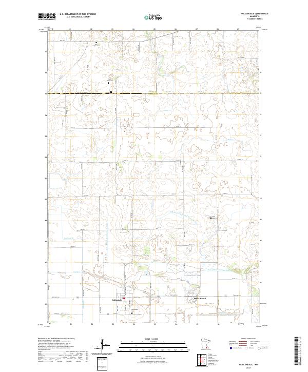 2022 Hollandale2022 Print · USGSFreeborn County farming communities and complex drainage networks are showcased here in the early 2020s. Genealogists can locate family landmarks such as Clark Family Cem and Summit Cem while tracing waterways like Knotvold Br and Mud Cr.
 - 2022 Map of Hope, 2022 Print
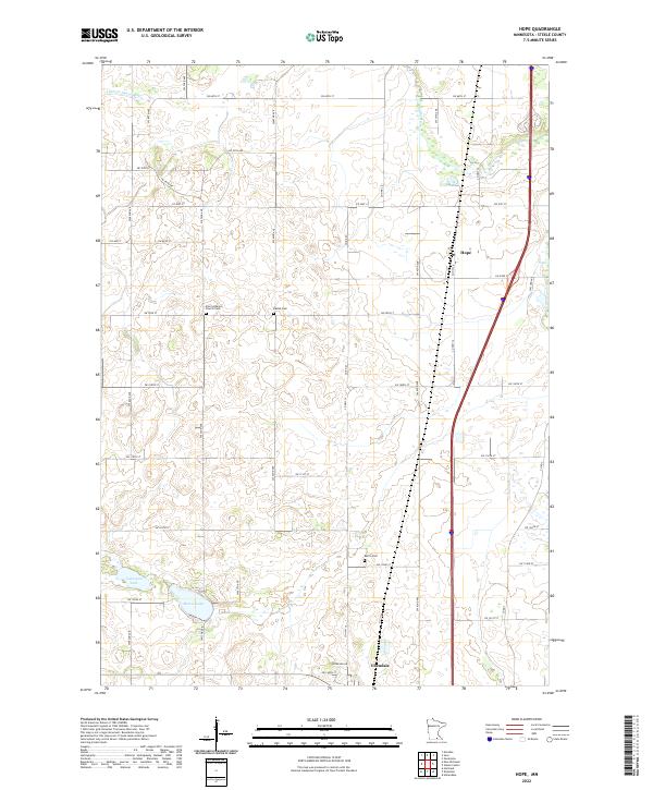 2022 Hope2022 Print · USGSSteele County at the start of the 2020s shows a classic Minnesota prairie landscape of small towns and well-preserved section lines. Researchers can trace family history at the Zion Lutheran Church Cem or explore the geography of Beaver Lake and Hope.
 - 2022 Map of Ellendale, 2022 Print
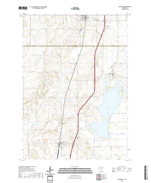 2022 Ellendale2022 Print · USGSSouthern Minnesota prairie life is centered on the waters of Geneva Lake in this 2022 survey. Genealogists can locate family sites near Clarks Grove Cem, Geneva Cem, and the settlements of Ellendale and Geneva.
 - 2022 Map of New Richland, 2022 Print
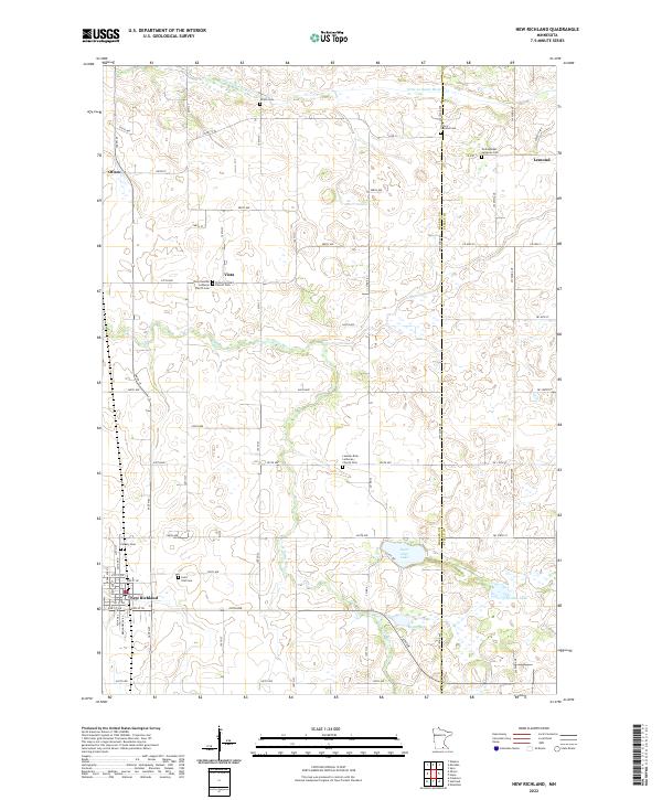 2022 New Richland2022 Print · USGSSouthern Minnesota farmland is captured in this modern survey of the Waseca and Steele county border. Genealogists can locate several historic burial grounds including Pontoppidan Lutheran Cem and Otisco Lemond Cem near the banks of the Le Sueur River.
 - 2022 Map of Blooming Prairie, 2022 Print
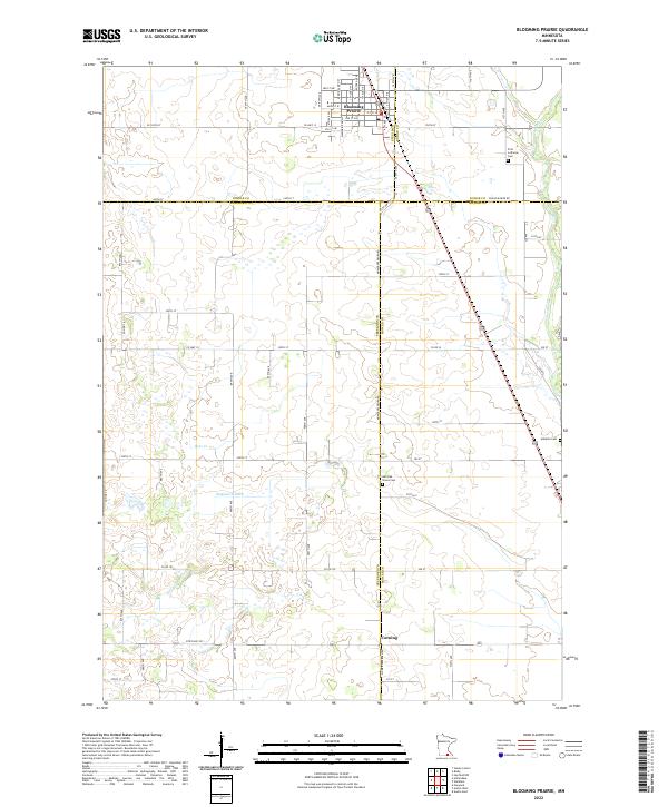 2022 Blooming Prairie2022 Print · USGSSouthern Minnesota's agricultural heartland is documented here in the early 2020s, centered on the border of four counties. Genealogists can trace family footprints at First Lutheran Cem, Red Oak Grove Cem, and the quiet crossroads of Corning.
 - 2022 Map of Saco, 2022 Print
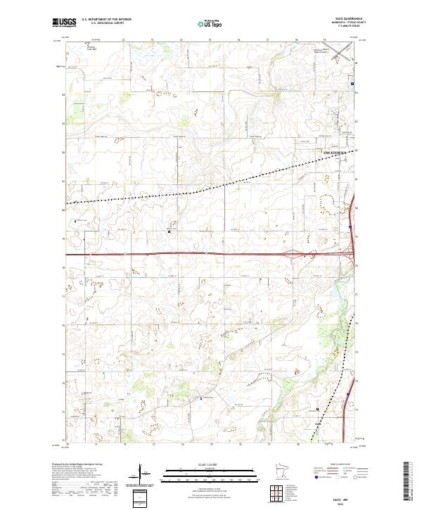 2022 Saco2022 Print · USGSSteele County's agricultural heartland and the outskirts of Owatonna are captured here in the early twenty-first century. Genealogists can locate several rural burial sites like Bohemian Cem and Lincoln Cem, or trace the path of the Straight River.
 - 2022 Map of Medford West, 2022 Print
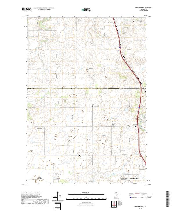 2022 Medford West2022 Print · USGSSteele County's prairie landscape is documented here in the early twenty-first century, showing the transition from rural townships to the northern edge of Owatonna. Researchers can locate family heritage sites like the Norwegian Lutheran Meraker Cem and Trinity Cem or trace the Pelican Lake Bed.
 - 2022 Map of Meriden, 2022 Print
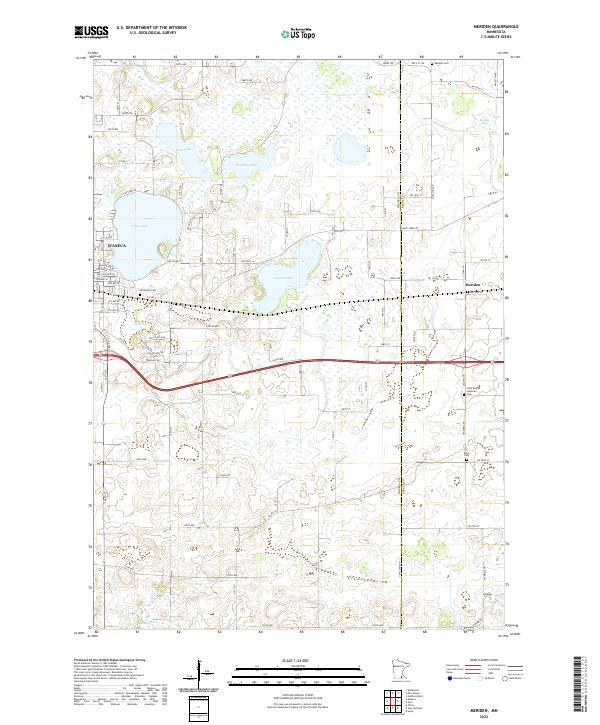 2022 Meriden2022 Print · USGSThe borderlands of Waseca and Steele Counties are shown here during the early twenty-first century, centered on the community of Meriden. Researchers can trace old road alignments like Old Hwy 14 and locate family burial sites at Saint Pauls Lutheran Cem or Karsten Cem.
 - 2022 Map of Medford East, 2022 Print
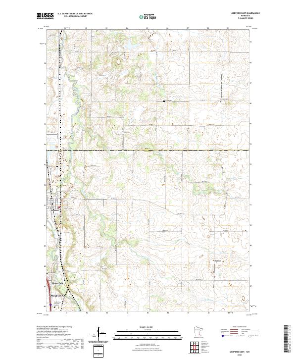 2022 Medford East2022 Print · USGSSteele County at the start of the 2020s shows a landscape of river-valley settlements and long-established rural cemeteries. Genealogists can locate specific plots at Richland Cem or Union Cem, while historians can trace the paths of Medford Cr and the Straight River through Medford.
 - 2022 Map of Owatonna SE, 2022 Print
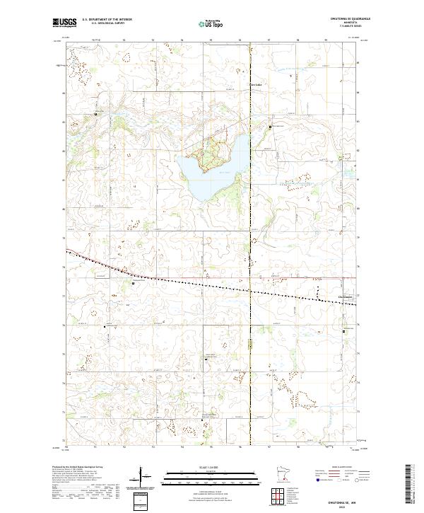 2022 Owatonna SE2022 Print · USGSSouthern Minnesota's agricultural heartland and the marshy headwaters of the Zumbro River are captured in the early 2020s. Genealogists can trace burial sites like Aurora Lutheran Cem and Thompson Cem near the town of Claremont.
 - 2022 Map of Morristown, 2022 Print
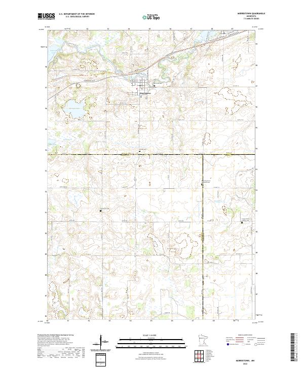 2022 Morristown2022 Print · USGSMorristown sits at the meeting point of three counties in the early 2020s, where the river and lake define the town's edge. Genealogists can trace family plots at Riverside Cem and Blooming Grove Methodist Cem or follow the Sakatah Singing Hills State Trl.
 - 2022 Map of Moland, 2022 Print
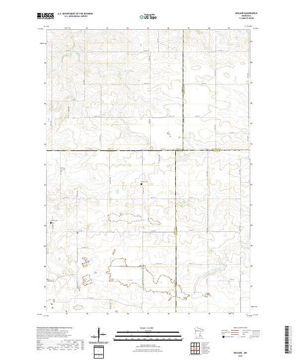 2022 Moland2022 Print · USGSSoutheastern Minnesota's rural landscape is captured here at the four-way intersection of Rice, Steele, Goodhue, and Dodge counties. Researchers can locate local burial sites at Moland Cem and Merton Cem or trace the early course of the Middle Fork Zumbro River.
 - 2022 Map of Owatonna, 2022 Print
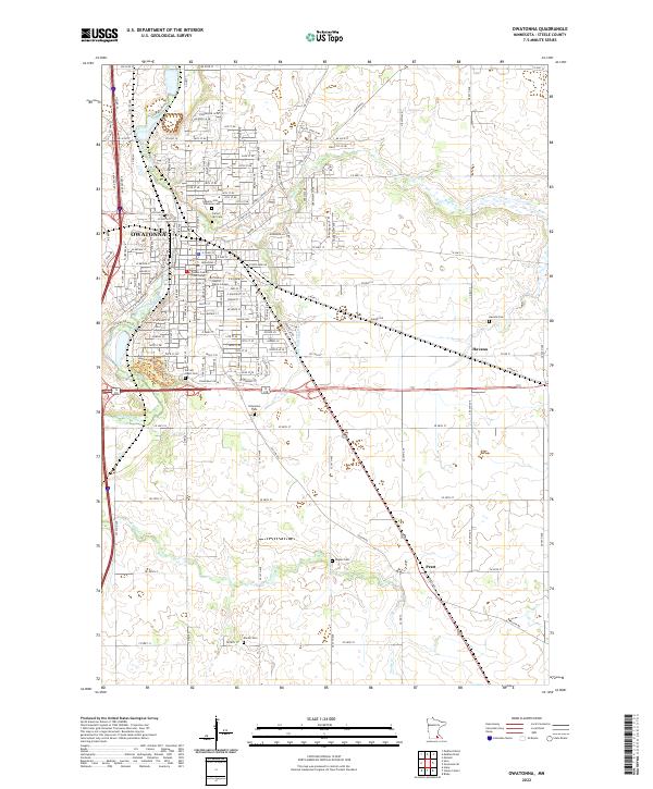 2022 Owatonna2022 Print · USGSOwatonna and its surrounding townships show a refined balance of civic development and deep-rooted agricultural tradition in this 2022 survey. Researchers can locate several heritage burial sites, including the Danish Cem and Bohemian Cem, alongside the Steele County Courthouse.
End of results
Showing maps 1-16 of 16
Top cities of Steele County
- Owatonna historical maps
- Blooming Prairie historical maps
- Medford historical maps
- Deerfield historical maps
- Ellendale historical maps
- Meriden historical maps
See more
Frequently asked questions
- What are the different types of historical maps available for Steele County?
- What is the oldest map of Steele County?
- Where can I purchase historical maps of Steele County for my home or office?
- Where can I download high-res historical maps of Steele County?
- Are there historical topographic maps available for Steele County?
- Is there historical aerial imagery available for Steele County?
- Where are historical maps of Steele County sourced from?