Old Maps of Traverse County, Minnesota for Genealogy
Trace your family roots with 142 historic maps of Traverse County. These high-res maps reveal old neighborhoods, homesites, landmarks, and streets — helping you uncover where your ancestors lived and how the area evolved over time.
- Explore historic neighborhoods: Identify where your relatives may have lived in the 1800s or 1900s.
- Compare maps over time: Trace the changes in streets, buildings, and landmarks for multi-generational research.
- Perfect for genealogy & ancestry research: Used by family historians and researchers to map out lineage and migration.
These maps are an incredible resource for exploring your personal connection to Traverse County's past.
Traverse County, MN maps
(142)- 1904 Map of Wahpeton
 1904 Wahpeton1904 Print · USGSThe Red River Valley at the start of the century was a landscape of burgeoning rail towns and river commerce along the Minnesota border. Genealogists can trace early homesteads and transport hubs between Wahpeton and Breckenridge, or follow the rail lines through Hankinson and Abercrombie.2 unique versions available
 - 1915 Map of White Rock, 1954 Print
 1915 White Rock1954 Print · USGSThe tri-state border region of the Dakotas and Minnesota comes alive in the early twentieth century as a hub of rail lines and prairie schools. Trace early settlements like White Rock and Rosholt or locate family landmarks such as Knutson School and Teare School.2 unique versions available
 - 1916 Map of Peever, 1954 Print
 1916 Peever1954 Print · USGSThe borderlands of South Dakota and Minnesota come alive in this survey of the early twentieth century. Genealogists and local historians can trace the paths of the Great Northern railroad and locate rural landmarks like Windom School, Peever, and the Erdman School.
 - 1916 Map of Beardsley, 1968 Print
 1916 Beardsley1968 Print · USGSWestern Minnesota and the South Dakota border are captured here during the height of the steam-rail era. Genealogists and researchers can trace dozens of early rural schoolhouses, including Hilo School and Twingrove School, alongside the Great Northern line.2 unique versions available
 - 1918 Map of Peever
 1918 Peever1918 Print · USGSThe borderlands of South Dakota and Minnesota are captured here during the First World War, centered on the strategic divide at Browns Valley. Genealogists and local historians can trace rural school locations like Morehead School and Becker School alongside the tracks of the Great Northern railroad.4 unique versions available
 - 1918 Map of White Rock
 1918 White Rock1918 Print · USGSThe tri-state borderlands of South Dakota, Minnesota, and North Dakota are frozen in time just before the end of the Great War. Researchers can trace the Sisseton and Wahpeton Indian Reservation boundary or locate early schools like Teare School and Knutson School.4 unique versions available
 - 1918 Map of Beardsley
 1918 Beardsley1918 Print · USGSWestern Minnesota and the South Dakota borderlands appear here during the height of the steam rail era. Genealogists can trace family footprints across dozens of local districts, from Round Mound School to the village streets of Beardsley.3 unique versions available
 - 1950 Map of Graceville
 1950 Graceville1950 Print · USGSBig Stone and Traverse counties come alive in this mid-century survey of the Minnesota prairie at the peak of its rail-and-farm economy. Local historians can trace the foundations of Graceville and identify vanished rural landmarks like Golden Rule Sch and the Trinity Sch.
 - 1951 Map of Wheaton
 1951 Wheaton1951 Print · USGSTraverse County farming communities and the rail hub of Wheaton are captured here in the early fifties. Genealogists can trace family footprints across dozens of country schools like School No 46 and sacred sites including St Johns Cem.2 unique versions available
 - 1951 Map of Campbell, 1953 Print
 1951 Campbell1953 Print · USGSWilkin County's prairie townships are captured here in the early fifties as the rail-driven economy shaped the Red River Valley borderlands. Genealogists and researchers can trace local landmarks like Sticklestad Ch, Vukku Ch Cem, and the community of Campbell.
 - 1953 Map of Milbank, 1958 Print
 1953 Milbank1958 Print · USGSThe tri-state border region of South Dakota, North Dakota, and Minnesota is shown here during the early fifties, a landscape defined by glacial lakes and the Sisseton Indian Reservation. Researchers can trace the legacy of the western railroads, locating old stops along the Great Northern and settlements like Milbank, Webster, and Sisseton.3 unique versions available
 - 1953 Map of Fargo, 1965 Print
 1953 Fargo1965 Print · USGSThe Red River Valley in the mid-fifties was a bustling rail and agricultural corridor during a period of steady prairie growth. Genealogists and historians can trace the intricate rail networks of the Great Northern and Soo Line connecting local hubs like Casselton and Wahpeton.2 unique versions available
 - 1956 Map of Fargo
 1956 Fargo1956 Print · USGSThe Red River Valley's agricultural heartland is documented here in the mid-fifties as the rail-and-road network expanded across the plains. Genealogists can trace family roots through numerous small railroad towns and local landmarks like Casselton, Sheyenne Valley Church, and Sisseton Indian Res.
 - 1958 Map of Milbank
 1958 Milbank1958 Print · USGSThe northern Great Plains in the late fifties show a landscape of glacial lakes and reservation lands shaped by the Great Northern railroad. Genealogists and local historians can trace the grid of settlements from Britton to Milbank and locate landmarks like Enemy Swim Lake and the Sisseton Indian Reservation.
 - 1971 Map of Browns Valley, 1974 Print
 1971 Browns Valley1974 Print · USGSBrowns Valley occupied this critical continental divide in the early seventies, positioned between two major reservoirs at the Minnesota-South Dakota border. Researchers can trace the rail-and-water geography of the era, locating the Burlington Northern line, the Valley View Cem, and the Townhall.
 - 1971 Map of Peever NE, 1974 Print
 1971 Peever NE1974 Print · USGSThe borderlands of South Dakota and Minnesota come into focus in the early 1970s, defined by the winding waters of Lake Traverse. Genealogists and local historians can trace rural landmarks like Trinity Church, the township Townhall, and family-named features like Jensen Island.
 - 1972 Map of Rosholt, 1974 Print
 1972 Rosholt1974 Print · USGSPrairie life in Roberts County during the early seventies is defined by the rail lines and reservation lands surrounding the town of Rosholt. Researchers can trace local genealogy through sites like Hillside Cem and St Peter Cem or explore the water management history of Reservation Dam.
 - 1972 Map of Boisberg, 1974 Print
 1972 Boisberg1974 Print · USGSThe tri-state borderlands of Minnesota and the Dakotas come alive in the early seventies, centered on the Bois De Sioux River. Researchers can trace old rail siding communities like White Rock and Boisberg or locate family plots at Lake View Cem.
 - 1972 Map of Wheaton West, 1974 Print
 1972 Wheaton West1974 Print · USGSThe Minnesota-South Dakota borderlands appear in the 1970s as a landscape of managed waterways and rail-side commerce. Researchers can trace the Chicago Milwaukee St Paul and Pacific line through Wheaton or locate landmarks like Nelson Cem and Larsens Camp.
 - 1972 Map of Beardsley NW, 1974 Print
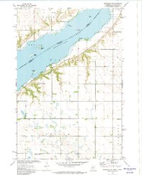 1972 Beardsley NW1974 Print · USGSThe Minnesota-South Dakota borderlands come into focus in the early seventies, centered on the broad waters of Lake Traverse. Genealogists and historians can locate the Lake View Cem and small rural hubs like Dakomin and Layden.
 - 1973 Map of Fairmount, 1975 Print
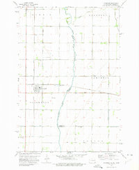 1973 Fairmount1975 Print · USGSFairmount and the surrounding prairie of the Red River Valley are seen here in the early seventies as a vital rail hub on the North Dakota-Minnesota border. Researchers can trace the paths of the Soo Line, locate the Fairmount Cem, and explore old rural sites like Childs.
 - 1974 Map of Beardsley, 1976 Print
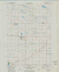 1974 Beardsley1976 Print · USGSBeardsley and the surrounding prairie wetlands are captured here in the mid-1970s as a hub of rail transit and wildlife conservation. Researchers can locate Beardsley Cem, trace the Burlington Northern railroad, and explore the sprawling National Waterfowl Production Area.
 - 1974 Map of Graceville NE, 1976 Print
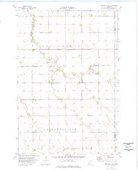 1974 Graceville NE1976 Print · USGSTraverse and Stevens counties are captured here in the mid-1970s, showing a prairie landscape defined by massive townships and managed water. Trace local history through a Townhall and family farmsteads in Dollymount and Leonardsville.
 - 1974 Map of Barry, 1976 Print
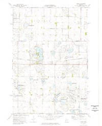 1974 Barry1976 Print · USGSBig Stone County is characterized by its prairie wetlands and rail-line settlements in the mid-1970s. Local researchers can trace the footprint of Barry along the Burlington Northern tracks and explore the numerous conservation sites like Taffe State Wildlife Management Area.
 - 1974 Map of Beardsley NE, 1976 Print
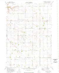 1974 Beardsley NE1976 Print · USGSTraverse County townships near the Dakota border show a landscape of drainage engineering and prairie conservation in the mid-seventies. Genealogists can locate family landmarks like Siloah Ch and Zion Cem among the agricultural Walls and Parnell townships.
Showing maps 1-25 of 142
Top cities of Traverse County
Frequently asked questions
- What are the different types of historical maps available for Traverse County?
- What is the oldest map of Traverse County?
- Where can I purchase historical maps of Traverse County for my home or office?
- Where can I download high-res historical maps of Traverse County?
- Are there historical topographic maps available for Traverse County?
- Is there historical aerial imagery available for Traverse County?
- Where are historical maps of Traverse County sourced from?