Old Maps of Alcorn County, Mississippi for Hiking & Exploration
Hike through history with 76 historic maps of Alcorn County. Explore old trails, ghost towns, and forgotten backroads — perfect for outdoor adventurers and local explorers.
- Rediscover forgotten places: Map out old mining camps, roads, and footpaths that no longer exist on modern maps.
- Layer with modern tools: Combine with LiDAR or satellite views to plan hikes through historical terrain.
- Made for exploration: Popular among hikers, overlanders, and local history lovers.
Use these maps to find adventure and explore the hidden past of Alcorn County.
Alcorn County, MS maps
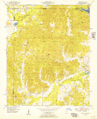
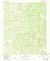
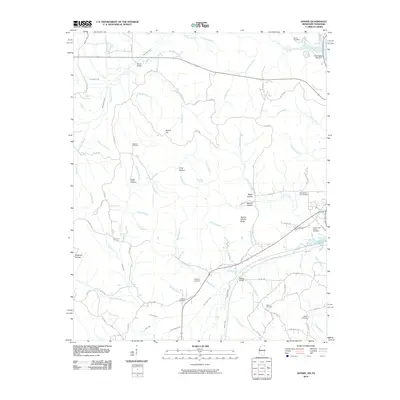
(76)- 1935 Map of Doskie
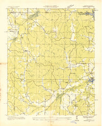 1935 Doskie1935 Print · USGSTishomingo County and the Tennessee borderlands are captured here in the mid-1930s just as the Tennessee Valley Authority began reshaping the local geography. Researchers can trace the rural communities of Doskie and Cross Roads or find family history at Pleasant Hill Ch and Mulberry Sch.
 - 1935 Map of Leedy
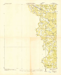
 1935 Leedy1935 Print · USGSIn the mid-1930s, the Tishomingo County countryside was a landscape of small rail spurs and country churches centered around Burnsville. Researchers can locate vanished rural landmarks such as Rolands Mill Sch, Opossum Trot Cem, and the Illinois Central rail line.
 - 1935 Map of Glens
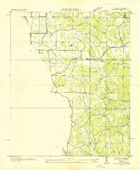
 1935 Glens1935 Print · USGSNortheastern Mississippi at the height of the mid-1930s reveals a landscape defined by crossing rail lines and rural church communities. Genealogists can trace family roots through sites like Cooks Chapel, the Glen PO, and the Zion Sch near the Alcorn Co Prentiss Co line.
 - 1936 Map of Kendrick
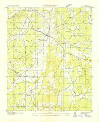
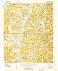
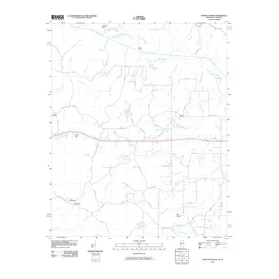
 1936 Kendrick1936 Print · USGSAlcorn County and the Tennessee borderlands are captured here in the mid-1930s as the TVA began modernizing the region. Local historians can trace family roots through sites like Barnes Chapel, Field Sch, and the community of Kendrick.
 - 1950 Map of Corinth, 1952 Print
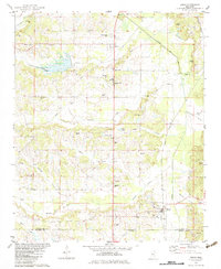
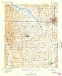 1950 Corinth1952 Print · USGSAlcorn County's rail-and-river landscape comes alive in the early fifties as Corinth expands at the junction of three major railroads. Genealogists can trace family roots through dozens of rural landmarks like Wesley Chapel, Kossuth, and the National Cemetery.3 unique versions available
 - 1950 Map of Kendrick, 1953 Print
 1950 Kendrick1953 Print · USGSThe Mississippi-Tennessee borderlands in the mid-twentieth century show a landscape of rural schools and rail intersections. Genealogists can trace family names at Marvin Cem and Wyly Cem, or locate lost landmarks like McGlathery Sch and Fraley Chapel.3 unique versions available
 - 1950 Map of Burnsville, 1954 Print
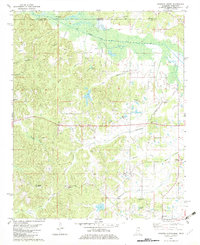
 1950 Burnsville1954 Print · USGSTishomingo County at mid-century reveals a landscape of rural schools, family cemeteries, and critical rail junctions during the post-war era. Researchers can trace ancestral roots at Opossum Trot Cem or locate the old Gravel Hill School and Hazard Switch.3 unique versions available
 - 1950 Map of Glens, 1954 Print
 1950 Glens1954 Print · USGSThe crossroads at Jacinto and the rail stop at Glens anchor this mid-century survey of the Alcorn and Prentiss county border. Genealogists can locate family landmarks like Piney Grove Cem and Macedonia Sch.3 unique versions available
 - 1950 Map of Doskie, 1954 Print
 1950 Doskie1954 Print · USGSNortheast Mississippi and southern Tennessee appear here just after the war, showing the area near Doskie and the Tishomingo County Game Refuge. Researchers can trace rural life at Lambs Chapel School, Shady Grove Ch, and the Beaver Pond gaging station.3 unique versions available
 - 1951 Map of Walnut, 1953 Print
 1951 Walnut1953 Print · USGSThe Mississippi-Tennessee borderlands in the early 1950s show a landscape defined by the Gulf Mobile and Ohio railroad and winding creek valleys. Genealogists can trace family roots through numerous sites like Old Mt Zion Cem, Providence Sch, and Chalybeate.4 unique versions available
 - 1956 Map of Tupelo, 1967 Print
 1956 Tupelo1967 Print · USGSNortheast Mississippi and parts of Tennessee and Alabama are shown here during the mid-fifties, a time of major reservoir construction and forestry management. Researchers can trace the St Louis-San Francisco RR through Tupelo or locate historic sites like Tishomingo State Park and the University.2 unique versions available
 - 1958 Map of Tupelo
 1958 Tupelo1958 Print · USGSNortheast Mississippi and neighboring Alabama and Tennessee appear here during the late fifties as a region defined by new reservoirs and historic rail lines. Genealogists can trace family locations near Sardis Lake, Woodall Mountain, and the St Louis-San Francisco Ry.
 - 1982 Map of Kossuth South, 1983 Print
 1982 Kossuth South1983 Print · USGSAlcorn County in the early eighties remains a landscape of small rural settlements and family-named ridges. Researchers can locate community anchors like Kossuth, trace the Hatchie River crossings, and find genealogy-rich sites like Antioch Ch No 1 and Pleasant Grove Cem.
 - 1982 Map of Chalybeate, 1983 Print
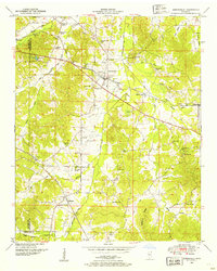
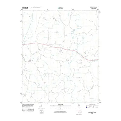
 1982 Chalybeate1983 Print · USGSStraddling the Tennessee-Mississippi border in the early eighties, this area shows a landscape defined by its creek-bottom farms and rural family settlements. Researchers can trace local roots through Union Cem, Union Center Sch, and crossroads like Jonesboro or Mathis.
 - 1982 Map of Peoples, 1983 Print
 1982 Peoples1983 Print · USGSTippah and Alcorn counties in the early eighties were defined by the winding Hatchie River and its rural settlements. Genealogists can trace family roots through numerous sites like Pleasant Ridge Cem, Golden Hill Ch, and the hamlet of Peoples.
 - 1982 Map of Kossuth North, 1983 Print
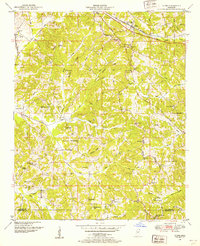
 1982 Kossuth North1983 Print · USGSAlcorn County in the early eighties shows a landscape of border-straddling watercourses and rural family settlements. Genealogists can trace deep roots through sites like Tishomingo Chapel, the Pine Mountain Lookout Tower, and Bethlehem Cemetery.
 - 1982 Map of Rienzi, 1983 Print
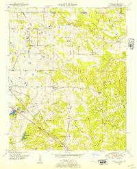
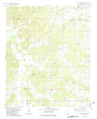
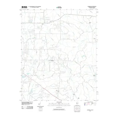
 1982 Rienzi1983 Print · USGSNortheast Mississippi’s rural landscape comes into focus during the late seventies, showing the rail-and-creek networks of the Alcorn and Prentiss county line. Genealogists can locate family burial sites at Stockade Cem and Rienzi Cem or trace the early settlement of Biggersville.
 - 1982 Map of Corinth, 1983 Print
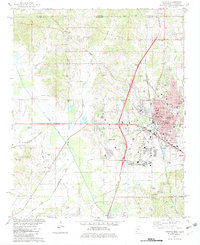 1982 Corinth1983 Print · USGSCorinth in the early eighties is captured as a bustling rail and county hub on the Tennessee-Mississippi line. Genealogists and local historians can trace family roots through the National Cem, Forest Hill Cem, and rural sites like Pleasant Hill Ch.2 unique versions available
 - 1984 Map of Corinth
 1984 Corinth1984 Print · USGSNortheast Mississippi and its borders with Alabama and Tennessee are captured here in the mid-1980s, showcasing a landscape of rail-connected towns and ridge-top settlements. Researchers can trace the path of the Natchez Trace Parkway or locate family-named landmarks near Biggersville, Kossuth, and the historic Tennessee Divide.
 - 1984 Map of Tupelo
 1984 Tupelo1984 Print · USGSNorth Mississippi in the 1980s is defined by its massive river basin reservoirs and the growing regional hubs of Tupelo and Oxford. Researchers can trace the legacy of the Pontotoc Ridge, find the University of Mississippi, and map early Interstate corridors near Sardis Lake.3 unique versions available
 - 1994 Map of Corinth
 1994 Corinth1994 Print · USGSNortheast Mississippi and the Tennessee borderlands are captured in the mid-1990s as the region's modern industrial and recreational landscape took shape. Genealogists and historians can trace rail-to-river connections through Corinth, the old courthouse at Jacinto, and the route of the Natchez Trace Parkway.
 - 2010 Map of Doskie, 2010 Print
 2010 Doskie2010 Print · USGSCovers Alcorn County, including Pine Flat, Cross Roads, and other nearby areas
 - 2010 Map of Kossuth North, 2010 Print
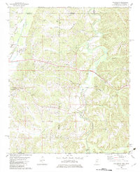
 2010 Kossuth North2010 Print · USGSCovers Alcorn County, including Kossuth, Gift, and other nearby areas
 - 2010 Map of Chalybeate, 2010 Print
 2010 Chalybeate2010 Print · USGSCovers Alcorn County, including Chalybeate, McNairy County, and other nearby areas
 - 2010 Map of Kendrick, 2010 Print
 2010 Kendrick2010 Print · USGSCovers Alcorn County, including Corinth, Farmington, and other nearby areas
Showing maps 1-25 of 76
Top cities of Alcorn County
Frequently asked questions
- What are the different types of historical maps available for Alcorn County?
- What is the oldest map of Alcorn County?
- Where can I purchase historical maps of Alcorn County for my home or office?
- Where can I download high-res historical maps of Alcorn County?
- Are there historical topographic maps available for Alcorn County?
- Is there historical aerial imagery available for Alcorn County?
- Where are historical maps of Alcorn County sourced from?