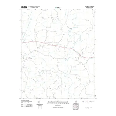
2010 Map of Chalybeate
USGS Topo · Published 2010About this map
Chalybeate Cemetery and Union Cemetery sit at the heart of this North Mississippi landscape, where the headwaters of the Hatchie River weave through a network of rural roads and family-named landmarks. The terrain is defined by a dense drainage system including Muddy Creek, Bearman Creek, and Jonesboro Creek, which together shape the local settlement patterns. Genealogists will find a high concentration of burial grounds, from the State Line Cemetery at the northern border to Ebenezer Cemetery and Providence Cemetery further south. The map documents two notable crossing points over the Hatchie, Lookout Bridge and Crum Bridge, which serve as key navigational nodes for the surrounding area. The presence of Old Hwy 72 and a grid of county roads provides a detailed layout of the community’s infrastructure at the end of the decade.
Find a feature on this map
79 named features on this map. Tap any name to fly to it.
Don’t see what you’re looking for? This feature index may not catch every label — zoom into the map to look around manually.
Map Details
Editions of this 2010 Chalybeate Map
This is the sole edition of this map. No revisions or reprints were ever made.
Other maps of this area

1950 · Corinth
USGS Topo · 1:62,500

1950 · Pocahontas
USGS Topo · 1:24,000

1950 · Middleton
USGS Topo · 1:24,000

1951 · Middleton
USGS Topo · 1:24,000

1951 · Chewalla
USGS Topo · 1:24,000

1951 · Walnut
USGS Topo · 1:62,500

1952 · Pocahontas
USGS Topo · 1:24,000

1956 · Blytheville
USGS Topo · 1:250,000

1956 · Tupelo
USGS Topo · 1:250,000

1958 · Tupelo
USGS Topo · 1:250,000