
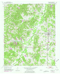
1950 Map of Middleton
USGS Topo · Published 1975About this map
Middleton serves as the primary rail hub on this mid-century survey, situated at the junction of the Southern and Gulf Mobile and Ohio railroads. The town's grid is surrounded by a rural landscape of ridges and creek bottoms, where small communities like Stewart and Lisbon were established along the drainage of Porters Creek. The map documents a high density of rural institutions, including the Chestnut Bluff School near Chestnut Bluff and multiple country churches such as New Hope Church and Gentrys Chapel. To the west, Rogers Springs is located along the Southern line near the Rogers Springs Creek. This 1950 field check captures the area's agricultural and industrial character, evidenced by the numerous cemeteries like Sandy Springs Cemetery and a Gas Pumping Station that mark the evolving Hardeman County countryside.
Find a feature on this map
35 named features on this map. Tap any name to fly to it.
Don’t see what you’re looking for? This feature index may not catch every label — zoom into the map to look around manually.
Map Details
Editions of this 1950 Middleton Map
2 editions found
Other maps of this area

1950 · Ashland
USGS Topo · 1:62,500

1950 · Pocahontas
USGS Topo · 1:24,000

1950 · Hebron
USGS Topo · 1:24,000

1950 · Hornsby
USGS Topo · 1:24,000

1950 · Middleburg
USGS Topo · 1:24,000

1951 · Middleton
USGS Topo · 1:24,000

1951 · Middleburg
USGS Topo · 1:24,000

1951 · Hebron
USGS Topo · 1:24,000

1951 · Hornsby
USGS Topo · 1:24,000

1951 · Walnut
USGS Topo · 1:62,500