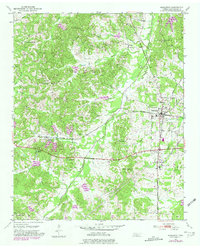
1950 Map of Middleton
USGS Topo · Published 1981About this map
The railroad junction at Middleton serves as the focal point for this Hardeman County landscape, where the Southern and Illinois Central Gulf lines intersect. The 1950s terrain is defined by the winding course of Porters Creek and the heights of Porters Mountain, punctuated by numerous rural congregations and burial sites that anchored the local community. Genealogists will find many landmarks such as Old Bethelhem Ch, New Bethel Ch, and Gentrys Chapel, along with the Old Bethelhem Cem and Sandy Springs Cem.
Find a feature on this map
34 named features on this map. Tap any name to fly to it.
Don’t see what you’re looking for? This feature index may not catch every label — zoom into the map to look around manually.
Map Details
Editions of this 1950 Middleton Map
2 editions found
Other maps of this area

1950 · Ashland
USGS Topo · 1:62,500

1950 · Pocahontas
USGS Topo · 1:24,000

1950 · Hebron
USGS Topo · 1:24,000

1950 · Hornsby
USGS Topo · 1:24,000

1950 · Middleburg
USGS Topo · 1:24,000

1950 · Middleton
USGS Topo · 1:24,000

1951 · Middleton
USGS Topo · 1:24,000

1951 · Middleburg
USGS Topo · 1:24,000

1951 · Hebron
USGS Topo · 1:24,000

1951 · Hornsby
USGS Topo · 1:24,000