Old Maps of Brody, Mississippi
Explore 12 old maps of Brody, spanning from 1950 to today. These high-resolution historic maps reveal how streets, neighborhoods, landmarks, and natural features evolved over time — perfect for genealogy, metal detecting, research, and local history exploration.
What you can do with these maps:
- See how Brody changed over time: Compare historical maps to modern-day views to trace roads, homesites, rail lines & more.
- View detailed metadata: Each map includes creators, publishers, year, scale, and archive source.
- Overlay maps with satellite & LiDAR: Visualize the past alongside modern tools to explore terrain & human change.
- Trusted historical sources: Maps sourced from the USGS, Library of Congress, and other archives.
- Access maps your way: View online, download high-res files, or order prints for personal or research use.
Start exploring old maps of Brody to uncover forgotten places, hidden landmarks, and the deep history beneath your feet.
Brody, MS maps
(12)- 1950 Map of Ashland, 1952 Print
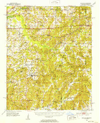 1950 Ashland1952 Print · USGSBenton County at the mid-century is captured here as a landscape of small timber towns and forest clearings before modern development. You can trace early school sites like Holloway Sch and family-centered landmarks such as Whitten Town and Hunters Chapel.3 unique versions available
 - 1956 Map of Tupelo, 1967 Print
 1956 Tupelo1967 Print · USGSNortheast Mississippi and parts of Tennessee and Alabama are shown here during the mid-fifties, a time of major reservoir construction and forestry management. Researchers can trace the St Louis-San Francisco RR through Tupelo or locate historic sites like Tishomingo State Park and the University.2 unique versions available
 - 1958 Map of Tupelo
 1958 Tupelo1958 Print · USGSNortheast Mississippi and neighboring Alabama and Tennessee appear here during the late fifties as a region defined by new reservoirs and historic rail lines. Genealogists can trace family locations near Sardis Lake, Woodall Mountain, and the St Louis-San Francisco Ry.
 - 1982 Map of Camp Hill, 1983 Print
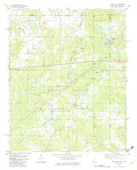 1982 Camp Hill1983 Print · USGSThe rural borderlands of Mississippi and Tennessee are captured here in the early eighties, centered on the Holly Springs National Forest. Researchers can trace genealogical roots through numerous sites like Zion Chapel Cem, Wesley Cem, and the small settlement at New Canaan.
 - 1984 Map of Tupelo
 1984 Tupelo1984 Print · USGSNorth Mississippi in the 1980s is defined by its massive river basin reservoirs and the growing regional hubs of Tupelo and Oxford. Researchers can trace the legacy of the Pontotoc Ridge, find the University of Mississippi, and map early Interstate corridors near Sardis Lake.3 unique versions available
 - 2000 Map of Camp Hill, 2003 Print
 2000 Camp Hill2003 Print · USGSThe northern border of Benton County is mapped here around the turn of the century as the Holly Springs National Forest surrounds small timberlands. Researchers can trace rural landmarks like New Canaan, Zion Chapel, and the Medlock Ch.
 - 2010 Map of Camp Hill, 2010 Print
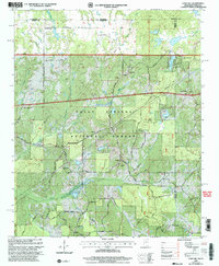
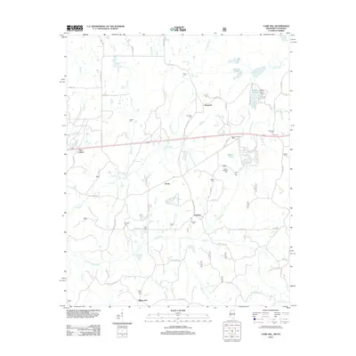
 2010 Camp Hill2010 Print · USGSCovers Brody, including Black Jack, Hamilton, and other nearby areas
 - 2012 Map of Camp Hill, 2012 Print
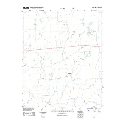
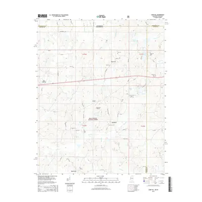
 2012 Camp Hill2012 Print · USGSCovers Brody, including Black Jack, Hamilton, and other nearby areas
 - 2015 Map of Camp Hill, 2015 Print
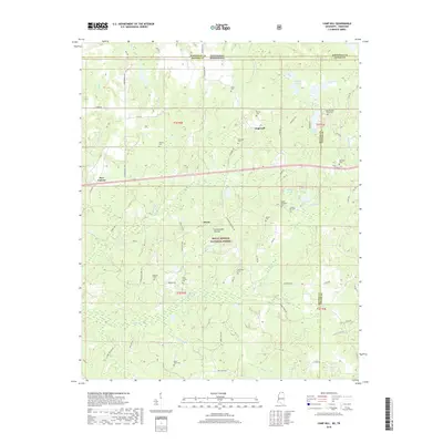
 2015 Camp Hill2015 Print · USGSCovers Brody, including Black Jack, Hamilton, and other nearby areas
 - 2018 Map of Camp Hill, 2018 Print
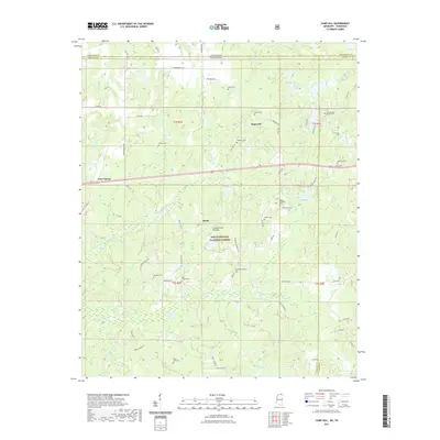
 2018 Camp Hill2018 Print · USGSCovers Brody, including Black Jack, Hamilton, and other nearby areas
 - 2021 Map of Camp Hill, 2021 Print
 2021 Camp Hill2021 Print · USGSCovers Brody, including Black Jack, Hamilton, and other nearby areas
 - 2024 Map of Camp Hill, 2024 Print
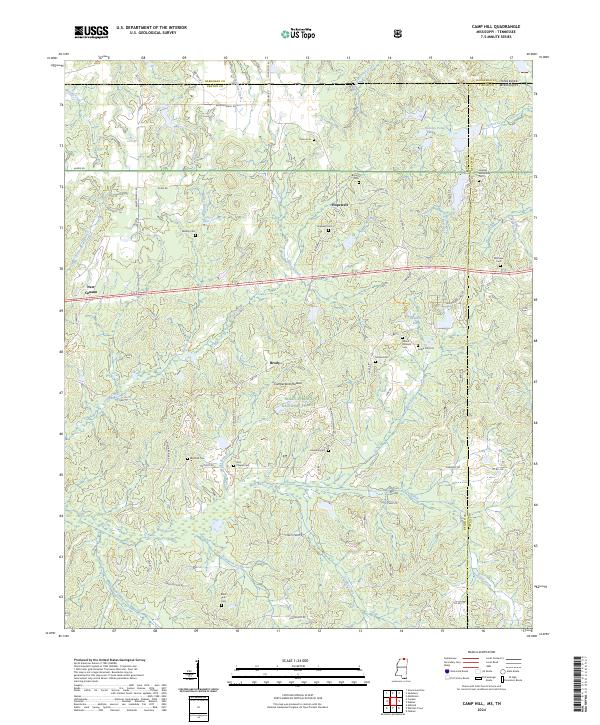 2024 Camp Hill2024 Print · USGSBenton and Tippah counties meet at the Tennessee state line in this modern study of the northern Mississippi borderlands. Researchers can locate numerous family burial grounds and rural landmarks such as Zion Chapel Cem, Medlock Cem, and the settlement of Brody.
End of results
Showing maps 1-12 of 12
Top cities near Brody
- Ripley historical maps
- Walnut historical maps
- Middleton historical maps
- Ashland historical maps
- Snow Lake Shores historical maps
- Falkner historical maps
See more
Frequently asked questions
- What are the different types of historical maps available for Brody?
- What is the oldest map of Brody?
- Where can I purchase historical maps of Brody for my home or office?
- Where can I download high-res historical maps of Brody?
- Are there historical topographic maps available for Brody?
- Is there historical aerial imagery available for Brody?
- Where are historical maps of Brody sourced from?