Old Maps of Clarke County, Mississippi
Explore 125 old maps of Clarke County, spanning from 1953 to today. These high-resolution historic maps reveal how streets, neighborhoods, landmarks, and natural features evolved over time — perfect for genealogy, metal detecting, research, and local history exploration.
What you can do with these maps:
- See how Clarke County changed over time: Compare historical maps to modern-day views to trace roads, homesites, rail lines & more.
- View detailed metadata: Each map includes creators, publishers, year, scale, and archive source.
- Overlay maps with satellite & LiDAR: Visualize the past alongside modern tools to explore terrain & human change.
- Trusted historical sources: Maps sourced from the USGS, Library of Congress, and other archives.
- Access maps your way: View online, download high-res files, or order prints for personal or research use.
Start exploring old maps of Clarke County to uncover forgotten places, hidden landmarks, and the deep history beneath your feet.
Clarke County, MS maps
(125)- 1953 Map of Hattiesburg, 1965 Print
 1953 Hattiesburg1965 Print · USGSSouth Mississippi and western Alabama are shown here during the mid-twentieth century as the timber and rail industries shaped the region. Genealogists and historians can trace rail lines like the Mississippi Central and locate rural centers such as Magee, Richton, and Mount Vernon.4 unique versions available
 - 1953 Map of Meridian, 1966 Print
 1953 Meridian1966 Print · USGSEast Central Mississippi and the Alabama borderlands are captured here during a period of steady growth and infrastructure expansion. Genealogists and historians can trace rail-town development along the Gulf Mobile & Ohio Railroad and find early settlements like Scooba, Pelahatchie, and De Kalb.2 unique versions available
 - 1957 Map of Meridian
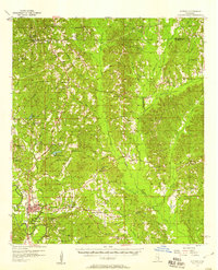
 1957 Meridian1957 Print · USGSEast Central Mississippi and parts of Western Alabama come alive in the mid-1950s, centered on the transit hub of Meridian. Researchers can trace old rail lines like the Illinois Central and find historic sites such as the Choctaw Indian Reservation and Roosevelt State Park.
 - 1957 Map of Quitman, 1958 Print
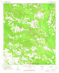
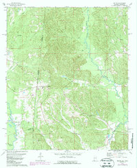
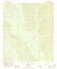
 1957 Quitman1958 Print · USGSClarke County in the late fifties is captured here through its network of riverfront settlements and rural parishes. Genealogists can trace family landmarks like Archusa Springs, Sullers Cem, and Coopers Chapel across the hill country.2 unique versions available
 - 1957 Map of Enterprise, 1958 Print
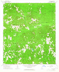
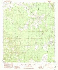
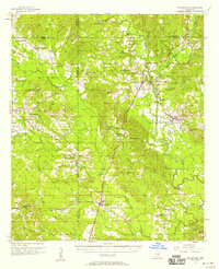 1957 Enterprise1958 Print · USGSEast-central Mississippi is shown here in the late fifties, defined by the rail corridors of the Southern and GM&O lines. Researchers can trace family history through dozens of rural sites like Orange Twistwood Sch, Basic City, and Zion Hill Ch.
 - 1958 Map of Hattiesburg
 1958 Hattiesburg1958 Print · USGSSoutheastern Mississippi's timber and rail networks are at their peak during the late fifties, centered on the growing hubs of Hattiesburg and Laurel. Researchers can trace old family landmarks like Sims Chapel, the Busbey Game Refuge, and the vanished stops along the Mississippi Central railroad.2 unique versions available
 - 1963 Map of Heidelberg, 1965 Print
 1963 Heidelberg1965 Print · USGSHeidelberg and the surrounding timberlands of Jasper and Clarke Counties are seen here in the early sixties as the rail-and-river economy matured. Trace family roots at Vossburg, Stafford Springs, and numerous local sites like Eddins Memorial Cem.2 unique versions available
 - 1964 Map of Heidelberg SW, 1965 Print
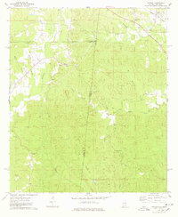
 1964 Heidelberg SW1965 Print · USGSFour Mississippi counties meet among the creek bottoms and timberlands south of Heidelberg in the mid-sixties. Genealogists can trace rural family sites like Blackledge Cem, Bogue Homo Sch, and the Old Indian Treaty Boundary.3 unique versions available
 - 1964 Map of Carmichael, 1965 Print
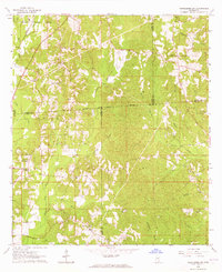
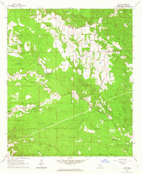
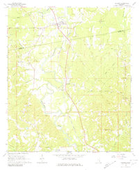
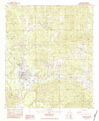
 1964 Carmichael1965 Print · USGSIn the mid-1960s, Clarke County saw a landscape shaped by petroleum discovery and old transit routes. Genealogists and historians can trace family roots at Carmichael and Langsdale or locate landmarks like the Indian Mound and the Old Indian Treaty Boundary.2 unique versions available
 - 1964 Map of Eucutta, 1965 Print
 1964 Eucutta1965 Print · USGSWayne and Clarke counties in the 1960s were defined by rural church congregations and the historical Indian Treaty Boundary. Genealogists can trace local family landmarks at Beaverdam Cem, Jeans Name Ch, and Eucutta.2 unique versions available
 - 1964 Map of Hale, 1965 Print
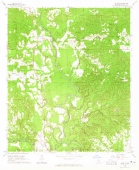
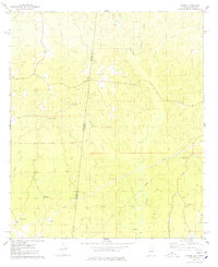
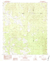
 1964 Hale1965 Print · USGSClarke County's rural interior is captured here in the mid-sixties, showing a landscape of family farms and creek-side settlements. Researchers can trace ancestral locations near New Oak Grove Ch, Goodwater Cem, and the hamlet of Nancy.2 unique versions available
 - 1964 Map of De Soto, 1965 Print
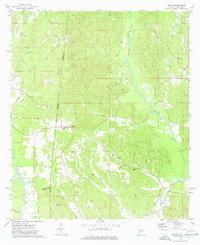
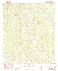
 1964 De Soto1965 Print · USGSClarke County's river-bottom lands and railroad towns are captured here in the mid-1960s, showing a landscape defined by the winding Chickasawhay River. Genealogists and historians can trace family-named sites like Covington Cem and Brown Chapel alongside the tracks of the Gulf Mobile and Ohio.2 unique versions available
 - 1964 Map of Shubuta, 1965 Print
 1964 Shubuta1965 Print · USGSClarke and Wayne Counties at the height of the mid-century oil boom show a landscape defined by the Chickasawhay River and the Gulf Mobile and Ohio rail line. Researchers can trace family roots through sites like Atkinson Cem, New Pilgrim Ch, and the Shubuta Sch.2 unique versions available
 - 1964 Map of Matherville, 1965 Print
 1964 Matherville1965 Print · USGSWayne and Clarke Counties in the early sixties reveal a landscape shaped by historical land divisions and rural community life. Researchers can trace the Shiloh Treaty Boundary, locate family names at the Gandy Cem, and find old country congregations like St Paul Ch.2 unique versions available
 - 1965 Map of Meridian
 1965 Meridian1965 Print · USGSEast Mississippi and West Alabama are mapped here in the mid-sixties as the region's modern highway and reservoir systems began to take shape. Researchers can trace rural lineages through local landmarks like Prince Chapel and Tuscahoma Landing, or follow the historic Gulf Mobile & Ohio rail lines.
 - 1974 Map of Melvin, 1977 Print
 1974 Melvin1977 Print · USGSThe Alabama and Mississippi borderlands come to life in the mid-1970s, showing a landscape defined by old treaty lines and early oil exploration. Genealogists can trace family names at Zion Chapel Cem, Stroud Cem, and rural settlements like Melvin and Eiler.
 - 1974 Map of Yantley, 1978 Print
 1974 Yantley1978 Print · USGSChoctaw County at the Alabama-Mississippi border in the mid-1970s reveals a quiet landscape of rural settlements and winding creek bottoms. Researchers can trace family roots at McLendon Cem or explore old community hubs like Cyril and Yantley.
 - 1974 Map of Hinton, 1978 Print
 1974 Hinton1978 Print · USGSThe Alabama and Mississippi borderlands are captured here in the mid-seventies, showing the rural communities of Choctaw and Clarke counties. Researchers can trace family roots at Antioch Cemetery or locate landmarks like Shiloh and Camp Pine Crest.
 - 1978 Map of Melvin, 1987 Print
 1978 Melvin1987 Print · USGSThe Alabama-Mississippi borderlands come to life in the 1970s, showcasing a landscape defined by traditional rural settlements and early oil exploration. Genealogists can trace family landmarks like Zion Chapel Cem and Donald Ch near the historic Old Indian Treaty Boundary.
 - 1983 Map of Quitman
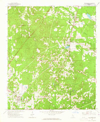
 1983 Quitman1983 Print · USGSClarke County in the early 1980s reveals a community deeply rooted in its riverfront and rail history. Researchers can trace family sites from Confederate Cem to Bethany Ch, or locate local landmarks like Ivy Lake and the Clarke Co Airport.
 - 1983 Map of Rose Hill
 1983 Rose Hill1983 Print · USGSIn the early eighties, this eastern Mississippi boundary region maintained its character as a landscape of rural congregations and winding waterways. Trace the community ties between Rose Hill and Twistwood through landmarks like Rose Hill Cem and East Galilee Ch.
 - 1983 Map of Sable
 1983 Sable1983 Print · USGSCrossing the border between Lauderdale and Clarke counties in the early 1980s, this survey documents a landscape of rural settlements and family-named landmarks. Genealogists can trace local roots at Devoe Cem or locate community hubs like Union Hill Ch and Sable.
 - 1983 Map of Sykes
 1983 Sykes1983 Print · USGSEastern Mississippi’s rural landscape is shown in the early eighties as a network of creek-fed hollows and scattered settlements. Researchers can trace local heritage through sites like New Home Cem, Sykes, and the Elim Ch near Linton.
 - 1983 Map of Pachuta
 1983 Pachuta1983 Print · USGSThe rural borderlands of Jasper and Clarke Counties come into focus in the early eighties as the SOUTHERN rail line passes through Pachuta. Genealogists and local historians can locate Clark Academy, the Herrington Cem, and several area churches like Mt Pleasant Ch.
 - 1983 Map of Snell
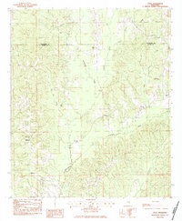 1983 Snell1983 Print · USGSEastern Mississippi's rural timberland comes to life in this early 1980s survey of the borderlands between Clarke and Lauderdale Counties. Researchers can locate several family landmarks and remote congregations, including Hays Cem, Energy, and the Open Door Ch.
Showing maps 1-25 of 125
Top cities of Clarke County
- Quitman historical maps
- Stonewall historical maps
- Shubuta historical maps
- Enterprise historical maps
- Pachuta historical maps
Frequently asked questions
- What are the different types of historical maps available for Clarke County?
- What is the oldest map of Clarke County?
- Where can I purchase historical maps of Clarke County for my home or office?
- Where can I download high-res historical maps of Clarke County?
- Are there historical topographic maps available for Clarke County?
- Is there historical aerial imagery available for Clarke County?
- Where are historical maps of Clarke County sourced from?