
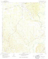
1964 Map of Matherville
USGS Topo · Published 1965About this map
The Shiloh Treaty Boundary cuts across the northern landscape, serving as a historic marker of land division within Wayne and Clarke Counties. The terrain is defined by the winding course of Bucatunna Creek and its many tributaries, including Cypress Creek and Shiloh Creek. In the southern reaches, the Diamond Oil Field indicates the mid-century industrial activity of the region, interspersed with numerous country churches that anchored the local community. Small settlements like Matherville and Gretna are visible alongside essential social landmarks such as Mt Levy Sch and several family or community burial grounds, including Scotch Chapel Cem and the Gandy Cem. This survey illustrates a rural Mississippi landscape where traditional church-centered communities and historic treaty lines remained central to the geography even as resource extraction began to leave its mark on the land.
Find a feature on this map
35 named features on this map. Tap any name to fly to it.
Don’t see what you’re looking for? This feature index may not catch every label — zoom into the map to look around manually.
Map Details
Editions of this 1964 Matherville Map
2 editions found
Other maps of this area

1953 · Hattiesburg
USGS Topo · 1:250,000

1958 · Hattiesburg
USGS Topo · 1:250,000

1964 · Carmichael
USGS Topo · 1:24,000

1964 · Denham
USGS Topo · 1:24,000

1964 · De Soto
USGS Topo · 1:24,000

1964 · Waynesboro
USGS Topo · 1:24,000

1964 · Shubuta
USGS Topo · 1:24,000

1974 · Melvin
USGS Topo · 1:24,000

1974 · Isney
USGS Topo · 1:24,000
1974 · Aquilla
USGS Topo · 1:24,000