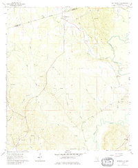
1964 Map of Matherville
USGS Topo · Published 1980About this map
The Old Indian Treaty Boundary cuts across the northern reaches of this landscape, marking a significant historical line through the woods of the Mississippi-Alabama borderlands. Centered around Matherville, the area shows a mid-century rural economy shifting from timber and small-scale farming toward mineral extraction. The southwest corner is dominated by the Diamond Oil Field, where numerous drill holes and an Oil Well are recorded alongside family-named landmarks like Gandy Cem.
Find a feature on this map
36 named features on this map. Tap any name to fly to it.
Don’t see what you’re looking for? This feature index may not catch every label — zoom into the map to look around manually.
Map Details
Editions of this 1964 Matherville Map
2 editions found
Other maps of this area

1953 · Hattiesburg
USGS Topo · 1:250,000

1958 · Hattiesburg
USGS Topo · 1:250,000

1964 · Carmichael
USGS Topo · 1:24,000

1964 · Denham
USGS Topo · 1:24,000

1964 · De Soto
USGS Topo · 1:24,000

1964 · Waynesboro
USGS Topo · 1:24,000

1964 · Shubuta
USGS Topo · 1:24,000

1964 · Matherville
USGS Topo · 1:24,000

1974 · Melvin
USGS Topo · 1:24,000

1974 · Isney
USGS Topo · 1:24,000