1960s Maps of Clarke County, Mississippi
Explore 9 historic maps of Clarke County from the 1960s. These maps offer a rare glimpse into what life looked like during the 1960s — showing old roads, neighborhoods, homes, and landmarks that have changed or disappeared over time.
Whether you're researching your family's past, planning a metal detecting trip, or studying how Clarke County's landscape evolved across the 1960s, these high-resolution maps are a powerful tool for exploring the history of this region.
- Focus on a specific era: All maps on this page are from the 1960s, giving you a focused view of this time period.
- See what’s changed: Compare century-old streets, trails, and buildings to today's modern landscape using overlays and satellite layers.
- Research with precision: Use these maps for genealogy, historical research, land use analysis, or educational projects.
- View, download, or print: Maps are fully viewable online in high resolution, and can be downloaded or printed for your own records.
Start exploring Clarke County's history through authentic maps from the 1960s. This is your window into the past.
Clarke County, MS maps
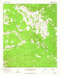
(9)- 1963 Map of Heidelberg, 1965 Print
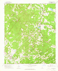 1963 Heidelberg1965 Print · USGSHeidelberg and the surrounding timberlands of Jasper and Clarke Counties are seen here in the early sixties as the rail-and-river economy matured. Trace family roots at Vossburg, Stafford Springs, and numerous local sites like Eddins Memorial Cem.2 unique versions available
 - 1964 Map of Heidelberg SW, 1965 Print
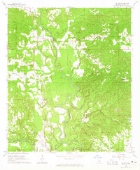
 1964 Heidelberg SW1965 Print · USGSFour Mississippi counties meet among the creek bottoms and timberlands south of Heidelberg in the mid-sixties. Genealogists can trace rural family sites like Blackledge Cem, Bogue Homo Sch, and the Old Indian Treaty Boundary.3 unique versions available
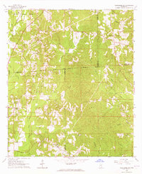
 - 1964 Map of Carmichael, 1965 Print
 1964 Carmichael1965 Print · USGSIn the mid-1960s, Clarke County saw a landscape shaped by petroleum discovery and old transit routes. Genealogists and historians can trace family roots at Carmichael and Langsdale or locate landmarks like the Indian Mound and the Old Indian Treaty Boundary.2 unique versions available
 - 1964 Map of Eucutta, 1965 Print
 1964 Eucutta1965 Print · USGSWayne and Clarke counties in the 1960s were defined by rural church congregations and the historical Indian Treaty Boundary. Genealogists can trace local family landmarks at Beaverdam Cem, Jeans Name Ch, and Eucutta.2 unique versions available
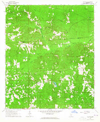
 - 1964 Map of Hale, 1965 Print
 1964 Hale1965 Print · USGSClarke County's rural interior is captured here in the mid-sixties, showing a landscape of family farms and creek-side settlements. Researchers can trace ancestral locations near New Oak Grove Ch, Goodwater Cem, and the hamlet of Nancy.2 unique versions available
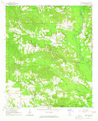
 - 1964 Map of De Soto, 1965 Print
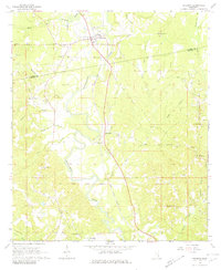
 1964 De Soto1965 Print · USGSClarke County's river-bottom lands and railroad towns are captured here in the mid-1960s, showing a landscape defined by the winding Chickasawhay River. Genealogists and historians can trace family-named sites like Covington Cem and Brown Chapel alongside the tracks of the Gulf Mobile and Ohio.2 unique versions available
 - 1964 Map of Shubuta, 1965 Print
 1964 Shubuta1965 Print · USGSClarke and Wayne Counties at the height of the mid-century oil boom show a landscape defined by the Chickasawhay River and the Gulf Mobile and Ohio rail line. Researchers can trace family roots through sites like Atkinson Cem, New Pilgrim Ch, and the Shubuta Sch.2 unique versions available
 - 1964 Map of Matherville, 1965 Print
 1964 Matherville1965 Print · USGSWayne and Clarke Counties in the early sixties reveal a landscape shaped by historical land divisions and rural community life. Researchers can trace the Shiloh Treaty Boundary, locate family names at the Gandy Cem, and find old country congregations like St Paul Ch.2 unique versions available
 - 1965 Map of Meridian
 1965 Meridian1965 Print · USGSEast Mississippi and West Alabama are mapped here in the mid-sixties as the region's modern highway and reservoir systems began to take shape. Researchers can trace rural lineages through local landmarks like Prince Chapel and Tuscahoma Landing, or follow the historic Gulf Mobile & Ohio rail lines.
End of results
Showing maps 1-9 of 9
Top cities of Clarke County
- Quitman historical maps
- Stonewall historical maps
- Shubuta historical maps
- Enterprise historical maps
- Pachuta historical maps
Frequently asked questions
- What are the different types of historical maps available for Clarke County?
- What is the oldest map of Clarke County?
- Where can I purchase historical maps of Clarke County for my home or office?
- Where can I download high-res historical maps of Clarke County?
- Are there historical topographic maps available for Clarke County?
- Is there historical aerial imagery available for Clarke County?
- Where are historical maps of Clarke County sourced from?