Old Maps of George County, Mississippi
Explore 114 old maps of George County, spanning from 1941 to today. These high-resolution historic maps reveal how streets, neighborhoods, landmarks, and natural features evolved over time — perfect for genealogy, metal detecting, research, and local history exploration.
What you can do with these maps:
- See how George County changed over time: Compare historical maps to modern-day views to trace roads, homesites, rail lines & more.
- View detailed metadata: Each map includes creators, publishers, year, scale, and archive source.
- Overlay maps with satellite & LiDAR: Visualize the past alongside modern tools to explore terrain & human change.
- Trusted historical sources: Maps sourced from the USGS, Library of Congress, and other archives.
- Access maps your way: View online, download high-res files, or order prints for personal or research use.
Start exploring old maps of George County to uncover forgotten places, hidden landmarks, and the deep history beneath your feet.
George County, MS maps
(114)- 1941 Map of Hurley, 1953 Print
 1941 Hurley1953 Print · USGSThe borderlands between Mississippi and Alabama are captured here in the early 1940s as rural life centered on the river and rail. Local researchers can trace family landmarks and forgotten road networks from Hurley to St Elmo, including Tanners Cem, Baker Sch, and Slaughter Flat Landing.3 unique versions available
 - 1941 Map of Vancleave, 1959 Print
 1941 Vancleave1959 Print · USGSThe Pascagoula River bottomlands in the early 1940s reveal a landscape of oxbow lakes and timber-reliant settlements. Trace family roots at Wolf Ridge Cem, Graham Ferry, or the historic crossroads of Vancleave and Old Americus.4 unique versions available
 - 1941 Map of Lucedale, 1961 Print
 1941 Lucedale1961 Print · USGSGeorge County's timber and rail landscape is meticulously captured here in the early 1940s as the rail lines intersect at Lucedale. Genealogists can trace family roots through numerous sites like Agricola High Sch, Woodard Cem, and the Mengel Lumber Camp.2 unique versions available
 - 1942 Map of Wilmer, 1968 Print
 1942 Wilmer1968 Print · USGSMobile County and the Mississippi borderlands are captured here in the early 1940s, showing a landscape of timber ridges and river bottoms. Family historians can trace rural roots through Moffet Cem, Fellowship Ch, and the settlement at Wilmer.
 - 1943 Map of Lucedale
 1943 Lucedale1943 Print · USGSSoutheastern Mississippi at the start of the 1940s reveals a landscape of river confluences and timber-driven rail hubs. Genealogists can trace family landmarks like Ball Cem and Gibson Cem or old schools including Agricola High Sch.2 unique versions available
 - 1943 Map of Hurley
 1943 Hurley1943 Print · USGSCoastal Mississippi and Alabama are surveyed here during the early war years, showing the rural communities between the rivers and the growing Gulf coast. Genealogists can locate family landmarks like Tanners Cem, Roberts Chapel, and the settlement of Nut Bank along the river bluffs.2 unique versions available
 - 1943 Map of Vancleave
 1943 Vancleave1943 Print · USGSCoastal Mississippi river life in the early 1940s centers on the sprawling basin of the Pascagoula River. Researchers can trace family history through numerous rural landmarks like Wolf Ridge Cem, Old Americus, and the Campmeeting Ground.
 - 1944 Map of Wilmer
 1944 Wilmer1944 Print · USGSMobile County and the Mississippi borderlands are captured here during the early years of the war. Genealogists and local historians can trace family roots through markers like Moffet, Semmes Cem, and the old Howell Sch along the Escatappa River.2 unique versions available
 - 1944 Map of Vancleave
 1944 Vancleave1944 Print · USGSThe Pascagoula River valley during the early 1940s reveals a landscape of river landings, ferries, and scattered timber-country settlements. Genealogists can trace family locations near Graham Ferry, Old Americus, and Sins Mill Pond.2 unique versions available
 - 1947 Map of Benndale, 1966 Print
 1947 Benndale1966 Print · USGSSoutheast Mississippi's piney woods and river bottoms are documented here just after the war. Researchers can locate family landmarks like Alexander Bridge, Indian Cem, and the community of Benndale amidst the Pascagoula River wetlands.2 unique versions available
 - 1949 Map of Benndale
 1949 Benndale1949 Print · USGSSoutheast Mississippi's piney woods and river bottoms come into focus in the late 1940s as the De Soto National Forest reaches across four counties. Researchers can trace the heritage of local settlements through Benndale, St Luke Ch, and several family cemeteries.2 unique versions available
 - 1953 Map of Mobile, 1968 Print
 1953 Mobile1968 Print · USGSThe Gulf Coast comes alive in this mid-century survey, from the streets of Mobile to the marshes of New Orleans. Trace family roots in coastal towns like Pass Christian and Bayou La Batre or locate military landmarks including Keesler AFB.3 unique versions available
 - 1954 Map of Vestry, 1955 Print
 1954 Vestry1955 Print · USGSCoastal Mississippi's pine forests and small rural communities are captured here in the mid-1950s. Genealogists can trace family roots through sites like Ramsey Cemetery, Bonnie Chapel, and the settlement of White Plains along the Tchoutacabouffa River.4 unique versions available
 - 1957 Map of Mobile
 1957 Mobile1957 Print · USGSThe Gulf Coast in the mid-1950s reveals a bustling corridor of rail-and-river commerce connecting Alabama to Louisiana. Genealogists and historians can trace old settlements and military hubs from Keesler Afb to the coastal reaches of Ship Island and Bogalusa.3 unique versions available
 - 1960 Map of Mobile
 1960 Mobile1960 Print · USGSThe Gulf Coast at the dawn of the sixties shows a landscape of busy ports, military airbases, and barrier islands. Trace the rail lines of the Louisville & Nashville through BILOXI and Pascagoula or find family history in towns like Bayou La Batre and Poplarville.
 - 1963 Map of Mobile
 1963 Mobile1963 Print · USGSThe Gulf Coast at the dawn of the sixties shows a thriving maritime and military corridor from Louisiana to Alabama. Genealogists and historians can trace rail lines like the Louisville & Nashville RR and find landmarks from Brookley AFB to Fort Morgan.
 - 1965 Map of Mobile
 1965 Mobile1965 Print · USGSThe Gulf Coast at mid-century reveals a landscape of expanding ports and vital military installations from Louisiana to Alabama. Genealogists and historians can trace the growth of Biloxi, Pascagoula, and Mobile, alongside the sprawling De Soto National Forest.
 - 1982 Map of Basin
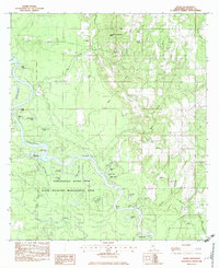 1982 Basin1982 Print · USGSThe Pascagoula River floodplain in the early eighties is captured here in intricate detail, showing a landscape shaped by oxbow lakes and timber. Genealogists and local historians can locate the Byrd-Helveston Cem, trace the dismantled railroad, and find the site of Wilkerson Ferry.
 - 1982 Map of Barbara
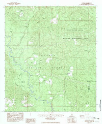 1982 Barbara1982 Print · USGSPerry and Stone Counties are shown in the early eighties as a region of managed timberland and river bottoms. Family historians can locate several rural burials including Fairley Cem and Cooper Cem, or trace the path of Black Creek past Fairley Bridge Landing.
 - 1982 Map of Hurley
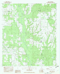 1982 Hurley1982 Print · USGSCrossing the Mississippi-Alabama border in the early eighties, this survey captures the rural landscape of Jackson and George Counties. You can trace family roots through Tanners Chapel, locate the Coleman Cem, and follow the winding Es Catawpa River past Red Bluff.2 unique versions available
 - 1982 Map of Agricola
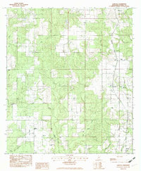 1982 Agricola1982 Print · USGSSoutheast Mississippi's rural character is on full display in the early 1980s as timber and small-scale farming shaped George County. Genealogists can trace local family landmarks and burial sites like Finch Cem and Union Cem near the historic settlements of Agricola and Barton.
 - 1982 Map of Benndale
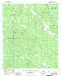 1982 Benndale1982 Print · USGSGeorge County in the early eighties was a landscape of dense timber and winding watercourses within the University of Mississippi Forest. Genealogists and local historians can trace family ties through Byrd-Cowart Cem and community hubs like Sweet Pilgrim Ch.
 - 1982 Map of Ramsey Springs
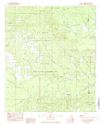 1982 Ramsey Springs1982 Print · USGSSoutheastern Mississippi's piney woods and creek bottoms are documented here in the early eighties. Genealogists can locate family landmarks like Whittington Cem and Moore Cem or trace the Old RR Grade through Ramsey Springs.
 - 1982 Map of Beatrice
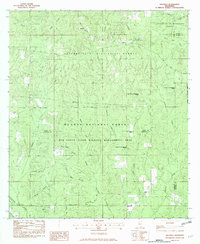 1982 Beatrice1982 Print · USGSStone County and the neighboring pine forests are captured here in the early 1980s as centers of timber and wildlife management. Researchers can trace rural genealogy at Walker Cem and Ramsey Chapel, or locate the old University Lookout Tower and the settlement of Beatrice.
 - 1982 Map of Lucedale
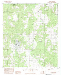 1982 Lucedale1982 Print · USGSGeorge County in the early eighties shows a landscape of timberlands and rural communities centered on the growth of Lucedale. Genealogists and local historians can trace family locations through numerous sites like Magnolia Garden Cem, Rocky Creek Sch, and the Antioch Missionary Ch.
Showing maps 1-25 of 114
Top cities of George County
Frequently asked questions
- What are the different types of historical maps available for George County?
- What is the oldest map of George County?
- Where can I purchase historical maps of George County for my home or office?
- Where can I download high-res historical maps of George County?
- Are there historical topographic maps available for George County?
- Is there historical aerial imagery available for George County?
- Where are historical maps of George County sourced from?