Old Maps of Old Americus, Mississippi for Academic Research
Study the evolution of Old Americus with 17 high-resolution historic maps. Whether you're teaching, researching, or modeling changes in land use, these maps provide essential visual documentation of urban, environmental, and geographic change.
- Analyze long-term change: Track patterns in development, transportation, and natural features.
- Ideal for environmental or urban studies: Support academic projects with primary historical map data.
- Use in the classroom or lab: Educators and researchers rely on these maps to bring historical context to life.
These maps are a powerful tool for teaching, research, and visualizing how Old Americus has changed over the decades.
Old Americus, MS maps
(17)- 1941 Map of Vancleave, 1959 Print
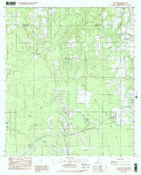
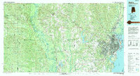
 1941 Vancleave1959 Print · USGSThe Pascagoula River bottomlands in the early 1940s reveal a landscape of oxbow lakes and timber-reliant settlements. Trace family roots at Wolf Ridge Cem, Graham Ferry, or the historic crossroads of Vancleave and Old Americus.4 unique versions available
 - 1943 Map of Vancleave
 1943 Vancleave1943 Print · USGSCoastal Mississippi river life in the early 1940s centers on the sprawling basin of the Pascagoula River. Researchers can trace family history through numerous rural landmarks like Wolf Ridge Cem, Old Americus, and the Campmeeting Ground.
 - 1944 Map of Vancleave
 1944 Vancleave1944 Print · USGSThe Pascagoula River valley during the early 1940s reveals a landscape of river landings, ferries, and scattered timber-country settlements. Genealogists can trace family locations near Graham Ferry, Old Americus, and Sins Mill Pond.2 unique versions available
 - 1953 Map of Mobile, 1968 Print
 1953 Mobile1968 Print · USGSThe Gulf Coast comes alive in this mid-century survey, from the streets of Mobile to the marshes of New Orleans. Trace family roots in coastal towns like Pass Christian and Bayou La Batre or locate military landmarks including Keesler AFB.3 unique versions available
 - 1957 Map of Mobile
 1957 Mobile1957 Print · USGSThe Gulf Coast in the mid-1950s reveals a bustling corridor of rail-and-river commerce connecting Alabama to Louisiana. Genealogists and historians can trace old settlements and military hubs from Keesler Afb to the coastal reaches of Ship Island and Bogalusa.3 unique versions available
 - 1960 Map of Mobile
 1960 Mobile1960 Print · USGSThe Gulf Coast at the dawn of the sixties shows a landscape of busy ports, military airbases, and barrier islands. Trace the rail lines of the Louisville & Nashville through BILOXI and Pascagoula or find family history in towns like Bayou La Batre and Poplarville.
 - 1963 Map of Mobile
 1963 Mobile1963 Print · USGSThe Gulf Coast at the dawn of the sixties shows a thriving maritime and military corridor from Louisiana to Alabama. Genealogists and historians can trace rail lines like the Louisville & Nashville RR and find landmarks from Brookley AFB to Fort Morgan.
 - 1965 Map of Mobile
 1965 Mobile1965 Print · USGSThe Gulf Coast at mid-century reveals a landscape of expanding ports and vital military installations from Louisiana to Alabama. Genealogists and historians can trace the growth of Biloxi, Pascagoula, and Mobile, alongside the sprawling De Soto National Forest.
 - 1982 Map of Harleston
 1982 Harleston1982 Print · USGSJackson County at the start of the 1980s reveals a landscape defined by the Pascagoula river bottomlands and rural crossroads. Trace family history through Old Americus Steede Cem, Johnson Chapel, and the community at Hurley.2 unique versions available
 - 1984 Map of Mobile
 1984 Mobile1984 Print · USGSMobile and its surrounding Gulf Coast backcountry appear in the mid-eighties as a hub of maritime industry and timber management. Genealogists and historians can trace the development of the riverfront near McDuffie Island or explore rural settlements like Lucedale and Chunchula.
 - 1984 Map of Mobile
 1984 Mobile1984 Print · USGSThe Gulf Coast at the height of the mid-eighties shows a landscape of rapid industrial growth and military significance. Researchers can trace the sprawling rail lines of the Illinois Central Gulf RR, locate the NASA Test Facility, or study the barrier island chain from Cat Island to Petit Bois Island.3 unique versions available
 - 1994 Map of Mobile
 1994 Mobile1994 Print · USGSMobile and its sprawling bay are captured in the mid-nineties as the industrial port and coastal wilderness found a modern balance. Genealogists and historians can trace rail lines like the Illinois Central Gulf RR and find landmarks such as Bonnie Chapel and Hollingers Island.
 - 2012 Map of Harleston, 2012 Print
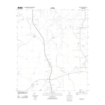 2012 Harleston2012 Print · USGSCovers Old Americus, including Popetown, Wade, and other nearby areas
 - 2015 Map of Harleston, 2015 Print
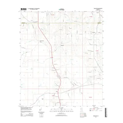 2015 Harleston2015 Print · USGSCovers Old Americus, including Popetown, Wade, and other nearby areas
 - 2018 Map of Harleston, 2018 Print
 2018 Harleston2018 Print · USGSCovers Old Americus, including Popetown, Wade, and other nearby areas
 - 2020 Map of Harleston, 2020 Print
 2020 Harleston2020 Print · USGSCovers Old Americus, including Popetown, Wade, and other nearby areas
 - 2024 Map of Harleston, 2024 Print
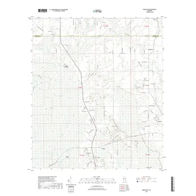
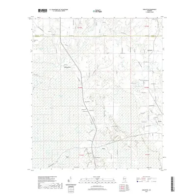
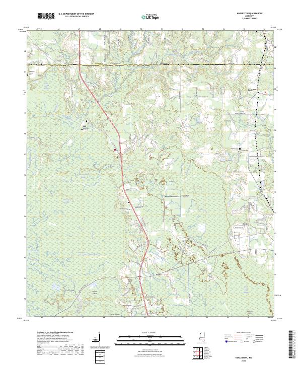 2024 Harleston2024 Print · USGSSpanning the border of George and Jackson Counties in the 2020s, this area shows a landscape defined by the winding waters of Black Creek and rural Mississippi life. Researchers can locate numerous family burial sites including Old Carter Historic Cem 1, Steede Cem, and the historic settlement site of Old Americus.
End of results
Showing maps 1-17 of 17
Top cities near Old Americus
Frequently asked questions
- What are the different types of historical maps available for Old Americus?
- What is the oldest map of Old Americus?
- Where can I purchase historical maps of Old Americus for my home or office?
- Where can I download high-res historical maps of Old Americus?
- Are there historical topographic maps available for Old Americus?
- Is there historical aerial imagery available for Old Americus?
- Where are historical maps of Old Americus sourced from?