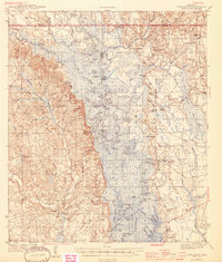
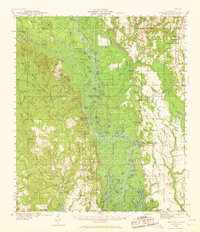
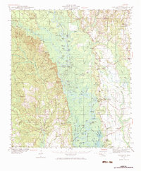
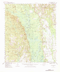
1941 Map of Vancleave
USGS Topo · Published 1959About this map
The Pascagoula River meanders through the heart of this 1940s survey, creating a complex network of cutoffs and oxbows including Ferrell Dead River, David Dead River, and Stead Dead River. The landscape is defined by the transition from these dense bottomlands to the higher ground of Red Bluff and Wolf Ridge. In Vancleave and surrounding settlements like Harleston and Old Americus, the map documents a community deeply tied to the river and its timber resources, evidenced by landmarks like Sims Mill Pond and several historic river access points such as Graham Ferry and Holly Landing. Numerous country churches, including Magnolia Ch and New Light Ch, alongside Wade Sch, anchor the rural social geography of the era. The presence of an Airway Beacon near Coll Town highlights the early mid-century infrastructure beginning to intersect with these traditional river-bound settlements.
Find a feature on this map
118 named features on this map. Tap any name to fly to it.
Don’t see what you’re looking for? This feature index may not catch every label — zoom into the map to look around manually.
Map Details
Editions of this 1941 Vancleave Map
4 editions found
Historical Maps of Coll Town Through Time
9 maps found