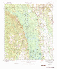
1941 Map of Vancleave
USGS Topo · Published 1984About this map
Pascagoula River oxbows and bottomlands dominate this 1940s landscape, illustrating the intricate hydrology of the George and Jackson county line. The map records a rural network of small communities and faith centers such as Evergreen Ch, Magnolia Ch, and New Light Ch near Vancleave. Along the river’s winding course, numerous named water bodies like Dogged Dead River and Ferrell Dead River reveal the shifting nature of the waterway before modern alterations.
Find a feature on this map
141 named features on this map. Tap any name to fly to it.
Don’t see what you’re looking for? This feature index may not catch every label — zoom into the map to look around manually.
Map Details
Editions of this 1941 Vancleave Map
4 editions found
Other maps of this area

1921 · Grand Bay
USGS Topo · 1:62,500

1941 · Hurley
USGS Topo · 1:62,500

1941 · Vancleave
USGS Topo · 1:62,500

1941 · Lucedale
USGS Topo · 1:62,500

1942 · Wilmer
USGS Topo · 1:62,500

1943 · Pascagoula
USGS Topo · 1:62,500

1943 · Lucedale
USGS Topo · 1:62,500

1943 · Grand Bay
USGS Topo · 1:62,500

1943 · Hurley
USGS Topo · 1:62,500

1943 · Vancleave
USGS Topo · 1:62,500