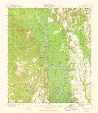
1941 Map of Vancleave
USGS Topo · Published 1968About this map
Pascagoula River serves as the central artery of this early 1940s landscape, winding through a complex network of bayous and swampy lowlands in Jackson and George Counties. The settlement at Vancleave sits west of the river, while the community of Wade and the historic site of Old Americus occupy the eastern banks. This survey captures a moment when river access remained vital for local industry and transport, evidenced by several named river landings such as Dees Landing and Mc Call Landing. Genealogists and local historians will find numerous rural landmarks, including Wolf Ridge Cem and the Campmeeting Ground. The map also preserves the locations of country congregations like New Light Ch and Magnolia Ch, alongside industry-related features such as Sims Mill Pond Br, which reflect the region's reliance on its abundant water resources and timber.
Find a feature on this map
128 named features on this map. Tap any name to fly to it.
Don’t see what you’re looking for? This feature index may not catch every label — zoom into the map to look around manually.
Map Details
Editions of this 1941 Vancleave Map
4 editions found
Other maps of this area

1921 · Grand Bay
USGS Topo · 1:62,500

1941 · Hurley
USGS Topo · 1:62,500

1941 · Vancleave
USGS Topo · 1:62,500

1941 · Lucedale
USGS Topo · 1:62,500

1942 · Wilmer
USGS Topo · 1:62,500

1943 · Pascagoula
USGS Topo · 1:62,500

1943 · Lucedale
USGS Topo · 1:62,500

1943 · Grand Bay
USGS Topo · 1:62,500

1943 · Hurley
USGS Topo · 1:62,500

1943 · Vancleave
USGS Topo · 1:62,500