Old Maps of Jefferson County, Mississippi
Explore 124 old maps of Jefferson County, spanning from 1921 to today. These high-resolution historic maps reveal how streets, neighborhoods, landmarks, and natural features evolved over time — perfect for genealogy, metal detecting, research, and local history exploration.
What you can do with these maps:
- See how Jefferson County changed over time: Compare historical maps to modern-day views to trace roads, homesites, rail lines & more.
- View detailed metadata: Each map includes creators, publishers, year, scale, and archive source.
- Overlay maps with satellite & LiDAR: Visualize the past alongside modern tools to explore terrain & human change.
- Trusted historical sources: Maps sourced from the USGS, Library of Congress, and other archives.
- Access maps your way: View online, download high-res files, or order prints for personal or research use.
Start exploring old maps of Jefferson County to uncover forgotten places, hidden landmarks, and the deep history beneath your feet.
Jefferson County, MS maps
(124)- 1921 Map of Natchez
 1921 Natchez1921 Print · USGSThe Mississippi River bluffs and floodplain come alive in this early 1920s survey of the Natchez region and its Louisiana neighbors. Genealogists can trace family roots through numerous sites like Taconey Plantation, the Adams County Poor Farm, and Quitman School.
 - 1922 Map of Natchez, 1938 Print
 1922 Natchez1938 Print · USGSThe Mississippi River's shifting path at Natchez in the early twentieth century reveals a landscape of working plantations and thriving river ports. Researchers can trace land holdings at Windemere, locate rural sites like the Poor Farm, or follow the Yazoo and Mississippi Valley rail line.2 unique versions available
 - 1939 Map of Lorman, 1942 Print
 1939 Lorman1942 Print · USGSThe Mississippi River borderlands thrive with plantation life and early educational institutions during the late nineteen-thirties. You can trace family roots through numerous cemetery-school-church complexes like Richland Sch Ch & Cem and the grounds of Alcorn A & M College.
 - 1939 Map of Natchez, 1943 Print
 1939 Natchez1943 Print · USGSThe Mississippi River corridor and Natchez area appear in the late thirties as a landscape of river-bottom plantations and bluff-top estates. Genealogists can locate family landmarks like Hole in the Wall Plantation, Briars Plantation, and Gilfield Ch & Sch.3 unique versions available
 - 1939 Map of Locust Ridge, 1965 Print
 1939 Locust Ridge1965 Print · USGSThe Mississippi Delta in the late 1930s reveals a land of sprawling plantations and bayou settlements along the Louisiana border. Genealogists can trace family landmarks like the Mayflower Cem, Maryland Plantation Cem, and New St Mark Ch among the meanders of the river.
 - 1953 Map of Natchez, 1966 Print
 1953 Natchez1966 Print · USGSSouthwest Mississippi and the Louisiana border country come alive in this mid-century survey of the river valley and forest lands. Researchers can trace the rail lines of the Illinois Central RR and locate rural hubs like Gloster and Ferriday.3 unique versions available
 - 1956 Map of Natchez
 1956 Natchez1956 Print · USGSThe Mississippi River borderlands and the Pine Hills come alive in this mid-fifties study of the Natchez region. Genealogists and historians can trace rail-era towns along the Illinois Central RR and explore the oxbows of Lake Bruin and Lake Concordia.
 - 1958 Map of St. Joseph, 1960 Print
 1958 St. Joseph1960 Print · USGSThe Mississippi River borderlands in the late fifties reveal a landscape of plantation ruins and rising hills between Tensas Parish and Claiborne County. Genealogists can trace family footprints at St Joseph, the Windsor Ruins, and rural landmarks like Alcorn Sch and Mt Zion Ch.4 unique versions available
 - 1959 Map of Natchez
 1959 Natchez1959 Print · USGSSouthwestern Mississippi and eastern Louisiana are captured in the late fifties, showing a landscape defined by the winding Mississippi River and the timbered Homochitto National Forest. Researchers can trace the sprawling Illinois Central RR and find rural landmarks like Union Church and Camp Van Dorn (Abandoned).
 - 1962 Map of Fayette, 1964 Print
 1962 Fayette1964 Print · USGSMississippi's river-country interior in the early sixties reveals a landscape of oil fields and ancient earthworks. Genealogists and historians can trace family-named sites like Emerald Mound, Hicks Cem, and the rural Daughters Temple.2 unique versions available
 - 1963 Map of Pine Ridge, 1964 Print
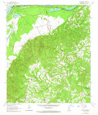 1963 Pine Ridge1964 Print · USGSThe Mississippi riverfront and the bluffs of Adams County are captured here in the early sixties as petroleum exploration expanded through the hills. Genealogists can locate numerous rural landmarks like Painters Cem, Linwood Ch, and Daughters of Zion Ch.3 unique versions available
 - 1963 Map of Red Lick, 1964 Print
 1963 Red Lick1964 Print · USGSThe rural communities of Jefferson County are captured in the early sixties as the Illinois Central railroad connected the countryside. Genealogists can trace family footprints at Homeless Cem, Mizpah Ch, and the crossroads at Tillman.2 unique versions available
 - 1963 Map of Chamblee, 1964 Print
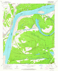 1963 Chamblee1964 Print · USGSThe Mississippi River's shifting bends and cutoffs in the early 1960s reveal a landscape of islands and oil fields along the Louisiana-Mississippi border. Genealogists and historians can trace the locations of Durango Plantation, Myrtle Grove Cem, and the village of Chamblee.2 unique versions available
 - 1963 Map of Union Church, 1964 Print
 1963 Union Church1964 Print · USGSSouthwest Mississippi in the early sixties was defined by the timbered stretches of the Homochitto National Forest and the Mississippi Central railroad. Researchers can trace rural lineages through numerous small settlements and family burial sites like Union Church, Perth, and the Singletary Cem.2 unique versions available
 - 1963 Map of McBride, 1964 Print
 1963 McBride1964 Print · USGSThe rural borderlands of Claiborne and Jefferson counties are captured here in the early sixties, showing a landscape of ridge-top churches and creek-bottom timber. Researchers can trace family history through landmarks like Sarepta Ch, Blue Hill, and the Antioch Cem.2 unique versions available
 - 1963 Map of Barlow, 1964 Print
 1963 Barlow1964 Print · USGSSouthwestern Mississippi's rural interior is captured in the early 1960s, showing a landscape defined by forest and frontier history. Researchers can find old family landmarks and the Old Indian Treaty Boundary alongside Barlow, Hawkins Cem, and Mt Zion Ch.
 - 1965 Map of Natchez, 1967 Print
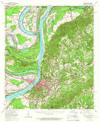 1965 Natchez1967 Print · USGSThe Mississippi River floodplain and the bluffs of Adams County are seen here in the mid-sixties, capturing a landscape of massive plantations and river engineering. Trace family sites at Hole in the Wall Plantation or Vidalia and locate landmarks like Jefferson Military College.2 unique versions available
 - 1965 Map of Locust Ridge, 1967 Print
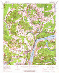 1965 Locust Ridge1967 Print · USGSThe Louisiana-Mississippi riverlands are captured here in the mid-1960s, showing the intricate oxbow lakes and rail-connected settlements along the river's edge. Researchers can locate family-named estates like Winona Plantation and rural landmarks like Choctaw Chapel and the Shiloh Ch.2 unique versions available
 - 1972 Map of McCall Creek, 1974 Print
 1972 McCall Creek1974 Print · USGSFranklin and Lincoln counties are shown here in the early seventies, where the massive Homochitto National Forest meets local rail towns. Genealogists can locate family burial sites like Wright Cem and rural centers such as McCall Creek or Shucktown.
 - 1972 Map of Caseyville, 1974 Print
 1972 Caseyville1974 Print · USGSSettled at the intersection of Lincoln and Copiah counties in the early seventies, this area features the dense woodlands of the Homochitto National Forest. Genealogists can locate family landmarks like Ben Salem Cem, Philadelphia Ch, and the community of Caseyville.
 - 1984 Map of Natchez
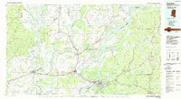 1984 Natchez1984 Print · USGSThe Mississippi-Louisiana borderlands in the mid-eighties show a landscape defined by the winding Mississippi River and its rail networks. Trace family history at the Natchez National Cemetery or explore the river towns of Vidalia and Ferriday.
 - 1984 Map of Brookhaven
 1984 Brookhaven1984 Print · USGSSouth-central Mississippi's rural character and rail-centered commerce are shown here in the mid-eighties, from the Homochitto woods to the Pearl River. Trace local roots through Union Church, Meadows Store, and the campus of Copiah-Lincoln Jr College.2 unique versions available
 - 1986 Map of Lorman
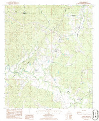 1986 Lorman1986 Print · USGSThe crossroads around Lorman and the historic Natchez Trace Parkway are captured in the mid-1980s. Genealogists and historians can trace the rail corridor of the Illinois Central Gulf Railroad through smaller settlements like Shankstown, Melton, and Coon Box.
 - 1986 Map of Rodney
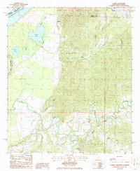 1986 Rodney1986 Print · USGSThe river bluffs of Jefferson County are captured here in the mid-1980s as the modern Natchez Trace Parkway meets the ancient river corridor. Genealogists and historians can locate the historic settlement of Rodney and the campus of Alcorn State University among the oxbows of Rodney Lake and Flatland Lake.
 - 1988 Map of Kirby
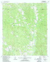 1988 Kirby1988 Print · USGSFranklin and Jefferson counties in the late 1980s show a landscape where timber and energy extraction define the rural economy. Local researchers can pinpoint family cemeteries like Sixteen Cem, or trace the development of the Middle Fork Oil Field near the village of Oldenburg.
Showing maps 1-25 of 124
Top cities of Jefferson County
Frequently asked questions
- What are the different types of historical maps available for Jefferson County?
- What is the oldest map of Jefferson County?
- Where can I purchase historical maps of Jefferson County for my home or office?
- Where can I download high-res historical maps of Jefferson County?
- Are there historical topographic maps available for Jefferson County?
- Is there historical aerial imagery available for Jefferson County?
- Where are historical maps of Jefferson County sourced from?